


vat tu...

LAHUPPEAndre
User

Length
40 km

Max alt
1377 m

Uphill gradient
1510 m
Km-Effort
57 km

Min alt
394 m

Downhill gradient
561 m
Boucle
No
Creation date :
2019-11-08 01:04:09.618
Updated on :
2019-11-08 16:24:55.903
1h53
Difficulty : Very easy

FREE GPS app for hiking
 SityTrail
IGN / Geographical institutes
SityTrail World
The world is yours!
About
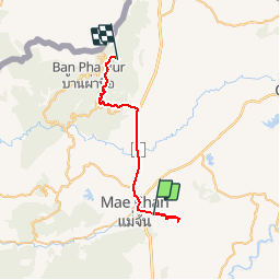
Trail 4x4 of 40 km to be discovered at Chiang Rai Province. This trail is proposed by LAHUPPEAndre.
Photos

Positioning
Country:
Thailand
Region :
Chiang Rai Province
Department/Province :
Unknown
Municipality :
Unknown
Location:
Unknown
Start:(Dec)
Start:(UTM)
591691 ; 2227455 (47Q) N.
Comments
Trails nearby