Trail Walking Die - Le Glandasse (Abbaye-Fauchard-Comptoir-à-Moutons) - Photo

Le Glandasse (Abbaye-Fauchard-Comptoir-à-Moutons)

© OpenStreetMap contributors
Length
Length
12.3 km
Max alt
Max alt
1683 m
Uphill gradient
Uphill gradient
1077 m
Km-Effort
Km-Effort  
27 km
Min alt
Min alt
599 m
Downhill gradient
Downhill gradient
1074 m
Boucle
Boucle
Yes
Creation date :
2019-12-28 09:03:18.667
Updated on :
2020-10-03 15:53:14.892

(0 Reviews)

Walking
Walking
4h30
Difficulty : Difficult

Scan this QR Code to open this trail in the SityTrail application

FREE GPS app for hiking

Logo SityTrail SityTrail

IGN / Geographical institutes

Download SityTrail from the App Store Download SityTrail from Google Play

Logo SityTrail SityTrail World

The world is yours!

Download SityTrail from the App Store Download SityTrail from Google Play Download SityTrail on Huawei AppGallery

About

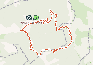
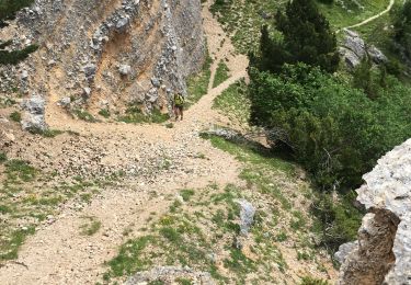
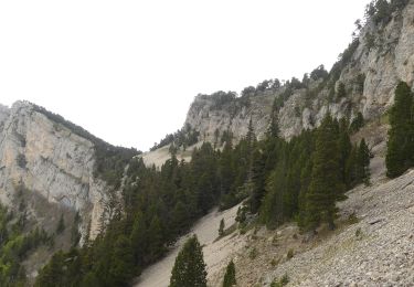
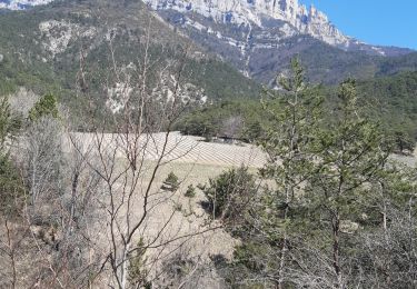
Trail Walking of 12.3 km to be discovered at Auvergne-Rhône-Alpes, Drôme, Die. This trail is proposed by Philindy26.

Description

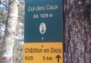
Départ du parking de l'Abbaye de Valcroissant à Die...
Géolocalisation (Google Maps) : https://goo.gl/maps/t38pzYLnE1uLgqq67 .

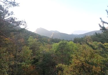
Prendre la direction du Pas de la Coche (594 m), puis le Col de l'Abbaye (848 m), le Col Fauchard (909 m), le Col de Cologne (1207 m) et le Comptoir à Moutons (1520 m).
Normalement, vous pourrez y observer des bouquetins...
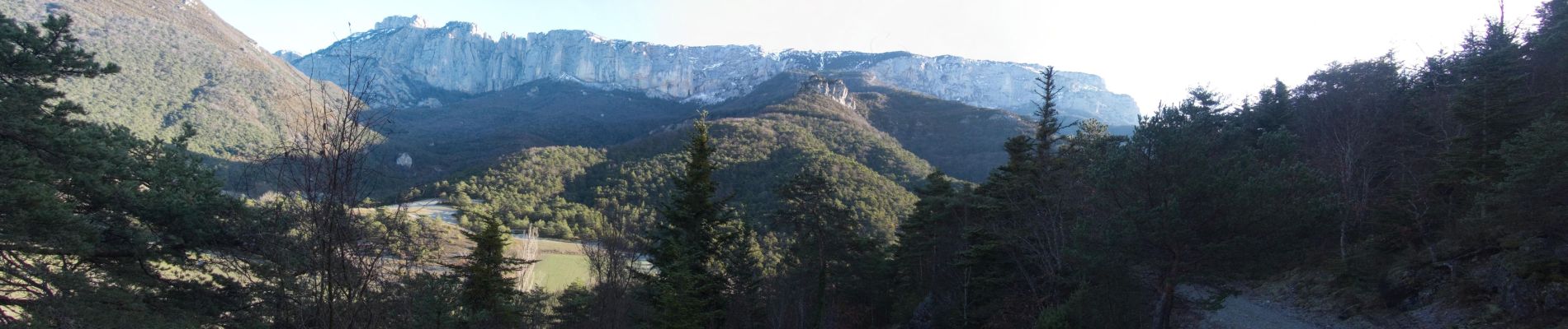
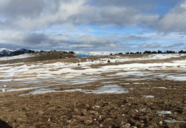
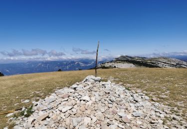
De là vous pourrez monter au Dôme ou Pié Ferré, point culminant du Glandasse avec 2041 mètres d'altitude (les 4h30 n'en tiens pas compte...).
Sinon, descente par la Fontaine de Juillet (1058 m) et les Quatres Chemins (1021 m).

Elevation profile

Photos

Positioning

Country:
France
Region :
Auvergne-Rhône-Alpes
Department/Province :
Drôme
Municipality :
Die
Location:
Unknown
Start:(UTM)
692583 ; 4957528 (31T) N.

Trails nearby

Trail Walking Die - Abbaye de Valcroissant - Photo
Walking
000151.528cee2ba5ea499bb7720e62b4a3eb52.0056

Walking

Medium
Die, Auvergne-Rhône-Alpes, Drôme, France
12.5 km | 22 km-effort
3h 10min
Yes
Trail sport Die - Croix de Justin , Ausson  - Photo
sport
alinetpierre

sport

Very easy
Die, Auvergne-Rhône-Alpes, Drôme, France
14.7 km | 24 km-effort
Unknown
Yes
Trail Walking Châtillon-en-Diois - Cabane de Chatillon  - Photo
Walking
Atchoum26

Walking

Medium
Châtillon-en-Diois, Auvergne-Rhône-Alpes, Drôme, France
17.6 km | 37 km-effort
6h 4min
No
Trail Walking Die - Tour Abbaye Val Croissant - Photo
Walking
Thierry0032

Walking

Difficult
Die, Auvergne-Rhône-Alpes, Drôme, France
11.5 km | 18.9 km-effort
1h 58min
No
Trail Walking Die - Abbaye Val croissant - Chatillon en diois - Photo
Walking
Atchoum26

Walking

Easy
Die, Auvergne-Rhône-Alpes, Drôme, France
13.5 km | 25 km-effort
6h 26min
No
Trail Walking Die - Le Dôme ou Pié Ferré de l'Abbaye Valcroissant - Photo
Walking
Philindy26

Walking

Very difficult
Die, Auvergne-Rhône-Alpes, Drôme, France
16.2 km | 35 km-effort
5h 45min
Yes
Trail Walking Die - Le Pestel  - Photo
Walking
ajd26

Walking

Very difficult
Die, Auvergne-Rhône-Alpes, Drôme, France
14.5 km | 33 km-effort
7h 41min
Yes
Trail Walking Romeyer - Col des Bachassons depuis Romeyer - Photo
Walking
Philindy26

Walking

Difficult
Romeyer, Auvergne-Rhône-Alpes, Drôme, France
17.2 km | 33 km-effort
5h 10min
Yes
Trail Walking Laval-d'Aix - Laval d'Aix col ayase col fauchare - Photo
Walking
Joel26400

Walking

Easy
Laval-d'Aix, Auvergne-Rhône-Alpes, Drôme, France
13.9 km | 24 km-effort
4h 15min
Yes


Close
My subscriptions