Trail Walking Romeyer - Col des Bachassons depuis Romeyer - Photo

Col des Bachassons depuis Romeyer

© OpenStreetMap contributors
Length
Length
17.2 km
Max alt
Max alt
1661 m
Uphill gradient
Uphill gradient
1204 m
Km-Effort
Km-Effort  
33 km
Min alt
Min alt
488 m
Downhill gradient
Downhill gradient
1205 m
Boucle
Boucle
Yes
Creation date :
2021-05-29 06:54:26.79
Updated on :
2021-05-31 17:55:22.274

(0 Reviews)

Walking
Walking
5h10
Difficulty : Difficult

Scan this QR Code to open this trail in the SityTrail application

FREE GPS app for hiking

Logo SityTrail SityTrail

IGN / Geographical institutes

Download SityTrail from the App Store Download SityTrail from Google Play

Logo SityTrail SityTrail World

The world is yours!

Download SityTrail from the App Store Download SityTrail from Google Play Download SityTrail on Huawei AppGallery

About

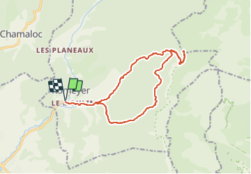
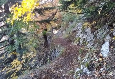
Trail Walking of 17.2 km to be discovered at Auvergne-Rhône-Alpes, Drôme, Romeyer. This trail is proposed by Philindy26.

Description

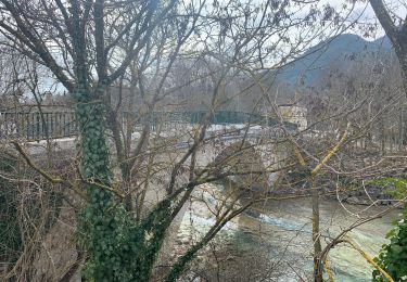
Départ du hameau des Liotards, commune de Romeyer dans le Diois…
Géolocalisation (Google Maps) : https://goo.gl/maps/hZ3PmVBTUqLUY4896

Monter au Col des Bachassons en suivant les marques Jaune/Vert et en prenant la direction du Brise Charge (529m), le Gué Déssableur (534m) puis le Ravin des Charoses pour arriver aux Charbonnières (1285m).
Au carrefour, tout droit montée finale au Col des Bachassons (1661m).
Descendre par le même chemin jusqu'aux Charbonnières.
Là prendre le sentier direction plein sud pour rejoindre Le Bichon (1118m).
Enfin descendre en direction du Gué Déssableur, Le Brise Charge et rejoindre le hameau des Liotards.

Elevation profile

Photos

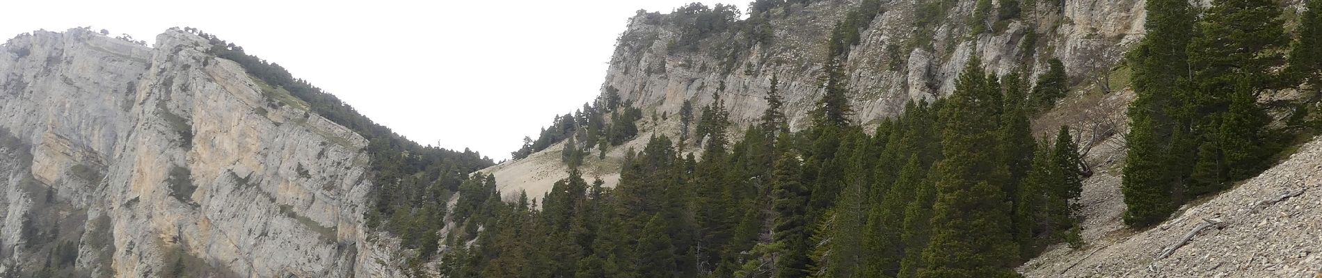
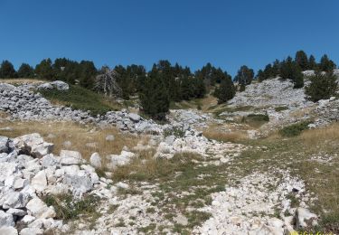
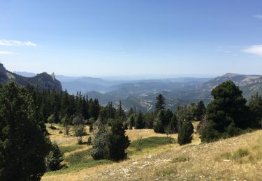
40 photos in total. Please click on a photo to see them all in the gallery.

Positioning

Country:
France
Region :
Auvergne-Rhône-Alpes
Department/Province :
Drôme
Municipality :
Romeyer
Location:
Unknown
Start:(UTM)
690387 ; 4960798 (31T) N.

Trails nearby

Trail Mountain bike Chamaloc - Chamaloc - Hauteurs de Die - Photo
Mountain bike
tracegps

Mountain bike

Difficult
(1)
Chamaloc, Auvergne-Rhône-Alpes, Drôme, France
36 km | 50 km-effort
3h 0min
Yes
Trail Walking Romeyer - les rochers de plautret - Photo
Walking
bymarc26

Walking

Difficult
(2)
Romeyer, Auvergne-Rhône-Alpes, Drôme, France
14.2 km | 27 km-effort
6h 40min
Yes
Trail Walking Romeyer - Romeyer - Col des Bachassons - Le Pison - Le Château - Photo
Walking
Philindy26

Walking

Difficult
Romeyer, Auvergne-Rhône-Alpes, Drôme, France
15.6 km | 28 km-effort
5h 30min
Yes
Trail Walking Romeyer - Tourte-Barreaux  - Photo
Walking
ajd26

Walking

Difficult
Romeyer, Auvergne-Rhône-Alpes, Drôme, France
18.2 km | 32 km-effort
7h 12min
Yes
Trail Walking Die - Autour de Die balade - Photo
Walking
jll7513

Walking

Easy
Die, Auvergne-Rhône-Alpes, Drôme, France
8.9 km | 11.7 km-effort
1h 56min
Yes
Trail Walking Die - Tour Abbaye Val Croissant - Photo
Walking
Thierry0032

Walking

Difficult
Die, Auvergne-Rhône-Alpes, Drôme, France
11.5 km | 18.9 km-effort
1h 58min
No
Trail Walking Romeyer - PAS DE PISON COL DES BACHASSON - Photo
Walking
TOULAUDIN

Walking

Difficult
Romeyer, Auvergne-Rhône-Alpes, Drôme, France
14.6 km | 26 km-effort
5h 51min
Yes
Trail Walking Die - Abbaye Val croissant - Chatillon en diois - Photo
Walking
Atchoum26

Walking

Easy
Die, Auvergne-Rhône-Alpes, Drôme, France
13.5 km | 25 km-effort
6h 26min
No
Trail Walking Romeyer - La rive du rocher des heures - Photo
Walking
nadd73

Walking

Difficult
Romeyer, Auvergne-Rhône-Alpes, Drôme, France
19.5 km | 34 km-effort
5h 31min
No


Close
My subscriptions