Trail Walking Saint-Sulpice-les-Bois - Saint Sulpice les bois - Photo
 viam19
viam19

User

© OpenStreetMap contributors
Length
Length
13.5 km
Max alt
Max alt
903 m
Uphill gradient
Uphill gradient
393 m
Km-Effort
Km-Effort  
18.8 km
Min alt
Min alt
684 m
Downhill gradient
Downhill gradient
396 m
Boucle
Boucle
Yes
Creation date :
2020-01-04 22:43:26.968
Updated on :
2021-05-01 17:18:21.218

(1 Reviews)

Walking
Walking
4h20
Difficulty : Very difficult

Scan this QR Code to open this trail in the SityTrail application

FREE GPS app for hiking

Logo SityTrail SityTrail

IGN / Geographical institutes

Download SityTrail from the App Store Download SityTrail from Google Play

Logo SityTrail SityTrail World

The world is yours!

Download SityTrail from the App Store Download SityTrail from Google Play Download SityTrail on Huawei AppGallery

About

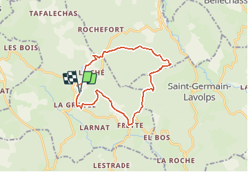
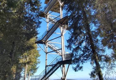
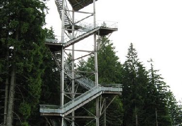
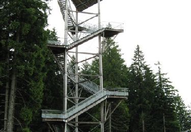
Trail Walking of 13.5 km to be discovered at New Aquitaine, Corrèze, Saint-Sulpice-les-Bois. This trail is proposed by viam19.

Description

Randonnée en boucle.

Elevation profile

Positioning

Country:
France
Region :
New Aquitaine
Department/Province :
Corrèze
Municipality :
Saint-Sulpice-les-Bois
Location:
Unknown
Start:(UTM)
433469 ; 5051324 (31T) N.

Comments

Please log in to post a review or rate the element


Trails nearby

Trail Walking Saint-Germain-Lavolps - Fred st Germain lavolps - Photo
Walking
arnoultjf

Walking

Difficult
Saint-Germain-Lavolps, New Aquitaine, Corrèze, France
9.4 km | 12.7 km-effort
3h 35min
Yes
Trail Walking Meymac - Lestrade-La Vialle-Le Colomby - Photo
Walking
viam19

Walking

Easy
Meymac, New Aquitaine, Corrèze, France
13.2 km | 18.3 km-effort
5h 8min
Yes
Trail Walking Chavanac - chavanac_les Oussines - Photo
Walking
viam19

Walking

Easy
Chavanac, New Aquitaine, Corrèze, France
11 km | 14.1 km-effort
3h 56min
No
Trail On foot Millevaches - Sentier du puy des Pouges - Photo
On foot
PRO

On foot

Easy
Millevaches, New Aquitaine, Corrèze, France
5 km | 6.1 km-effort
1h 23min
No
Trail Walking Meymac - Tour du Mont Bessou. - Photo
Walking
Indi34

Walking

Easy
Meymac, New Aquitaine, Corrèze, France
3.4 km | 4.9 km-effort
1h 0min
No
Trail Mountain bike Meymac - Le toit du Limousin 16 km - Meymac - Pays de Haute Corrèze  - Photo
Mountain bike
tracegps

Mountain bike

Difficult
(1)
Meymac, New Aquitaine, Corrèze, France
16.4 km | 23 km-effort
1h 30min
Yes
Trail Walking Meymac - Le toit du Limousin 16 km - Meymac - Pays de Haute Corrèze  - Photo
Walking
tracegps

Walking

Difficult
(1)
Meymac, New Aquitaine, Corrèze, France
16.4 km | 23 km-effort
4h 0min
Yes
Trail Mountain bike Meymac - Le toit du Limousin 19 km - Meymac - Pays de Haute Corrèze  - Photo
Mountain bike
tracegps

Mountain bike

Difficult
Meymac, New Aquitaine, Corrèze, France
19 km | 26 km-effort
1h 45min
Yes
Trail Walking Meymac - Le toit du Limousin 19 km - Meymac - Pays de Haute Corrèze  - Photo
Walking
tracegps

Walking

Difficult
(2)
Meymac, New Aquitaine, Corrèze, France
19 km | 26 km-effort
4h 30min
Yes


Close
My subscriptions