Trail Walking Boult - Boult - Photo
© OpenStreetMap contributors
Length
Length
14.5 km
Max alt
Max alt
374 m
Uphill gradient
Uphill gradient
285 m
Km-Effort
Km-Effort  
18.3 km
Min alt
Min alt
232 m
Downhill gradient
Downhill gradient
289 m
Boucle
Boucle
Yes
Creation date :
2020-01-09 13:48:06.698
Updated on :
2020-01-12 13:57:29.793

(0 Reviews)

Walking
Walking
2h12
Difficulty : Medium

Scan this QR Code to open this trail in the SityTrail application

FREE GPS app for hiking

Logo SityTrail SityTrail

IGN / Geographical institutes

Download SityTrail from the App Store Download SityTrail from Google Play

Logo SityTrail SityTrail World

The world is yours!

Download SityTrail from the App Store Download SityTrail from Google Play Download SityTrail on Huawei AppGallery

About

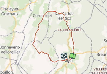
Trail Walking of 14.5 km to be discovered at Bourgogne-Franche-Comté, Haute-Saône, Boult. This trail is proposed by eltonnermou.

Description

Parking devant l'église. 14,4km
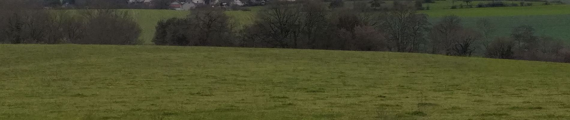
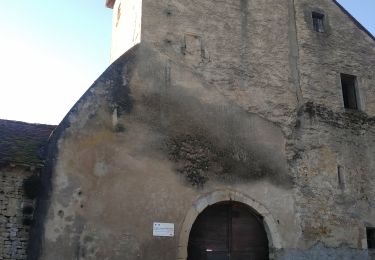
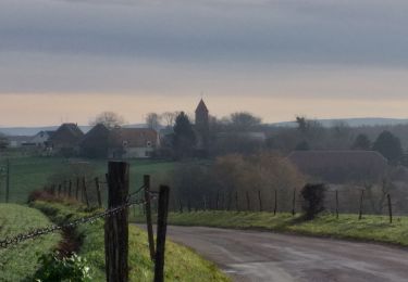
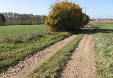
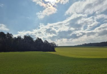
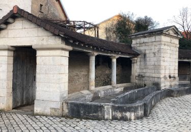
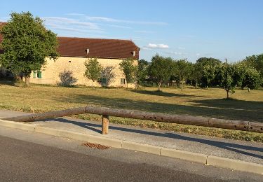
randonnée à travers prairie et beaucoup de sous bois. De belles bâtisses dans les villages traversés. 2 points de vue sur les paysages haut-saonois.

Elevation profile

Photos

Positioning

Country:
France
Region :
Bourgogne-Franche-Comté
Department/Province :
Haute-Saône
Municipality :
Boult
Location:
Unknown
Start:(UTM)
273614 ; 5251788 (32T) N.

Trails nearby

Trail Walking Neuvelle-lès-Cromary - Rioz Bois des Vaudots 16 janv 2020 CAF - Photo
Walking
TRIMAILLE

Walking

Difficult
Neuvelle-lès-Cromary, Bourgogne-Franche-Comté, Haute-Saône, France
37 km | 46 km-effort
7h 2min
No
Trail Walking Perrouse - Perrouse  - Photo
Walking
eltonnermou

Walking

Easy
Perrouse, Bourgogne-Franche-Comté, Haute-Saône, France
12.5 km | 15.1 km-effort
2h 0min
Yes
Trail Walking Boulot - Circuit des hauts du Mont - Boulot - Photo
Walking
tracegps

Walking

Medium
Boulot, Bourgogne-Franche-Comté, Haute-Saône, France
7.9 km | 9.9 km-effort
2h 30min
Yes
Trail Mountain bike Cussey-sur-l'Ognon - De Breurey lès Faverney à Vignieu en VTT- Étape 2/6 - Photo
Mountain bike
tracegps

Mountain bike

Difficult
Cussey-sur-l'Ognon, Bourgogne-Franche-Comté, Doubs, France
81 km | 91 km-effort
7h 30min
No
Trail Walking Boult - Champis avec Cam - Photo
Walking
GUIDE
David25400

Walking

Very easy
Boult, Bourgogne-Franche-Comté, Haute-Saône, France
8.9 km | 10.6 km-effort
1h 21min
No
Trail Walking Bonnay - Au pied des falaises de la Dame Blanche - Doubs - Photo
Walking
tracegps

Walking

Medium
Bonnay, Bourgogne-Franche-Comté, Doubs, France
9 km | 11 km-effort
2h 30min
Yes
Trail Walking Étuz - étuz  - Photo
Walking
MartinBraudThierry

Walking

Difficult
Étuz, Bourgogne-Franche-Comté, Haute-Saône, France
11.7 km | 14.1 km-effort
2h 59min
Yes
Trail Walking Boult - Boult petite randonnée  - Photo
Walking
nicolasdresse

Walking

Boult, Bourgogne-Franche-Comté, Haute-Saône, France
7.4 km | 8.9 km-effort
2h 0min
Yes
Trail Walking Boulot - de boulot a boulot - Photo
Walking
nicolasdresse

Walking

Very easy
Boulot, Bourgogne-Franche-Comté, Haute-Saône, France
11.2 km | 13.6 km-effort
2h 57min
Yes


Close
My subscriptions