Trail On foot Gavarnie-Gèdre - Granges de Coumely le 1 08 2012 - Photo

Granges de Coumely le 1 08 2012

 marmotte65
marmotte65

User GUIDE

© OpenStreetMap contributors
Length
Length
7.8 km
Max alt
Max alt
1787 m
Uphill gradient
Uphill gradient
270 m
Km-Effort
Km-Effort  
11.4 km
Min alt
Min alt
1638 m
Downhill gradient
Downhill gradient
267 m
Boucle
Boucle
Yes
Creation date :
2020-01-10 09:33:10.998
Updated on :
2022-08-09 09:11:30.666

(0 Reviews)

On foot
On foot
--
Difficulty : Medium

Scan this QR Code to open this trail in the SityTrail application

FREE GPS app for hiking

Logo SityTrail SityTrail

IGN / Geographical institutes

Download SityTrail from the App Store Download SityTrail from Google Play

Logo SityTrail SityTrail World

The world is yours!

Download SityTrail from the App Store Download SityTrail from Google Play Download SityTrail on Huawei AppGallery

About

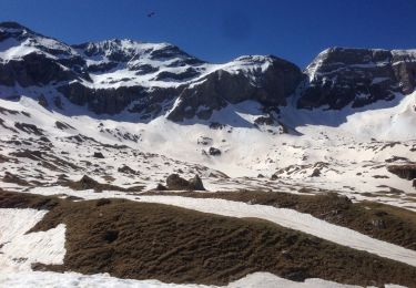
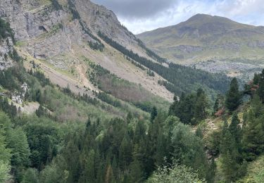
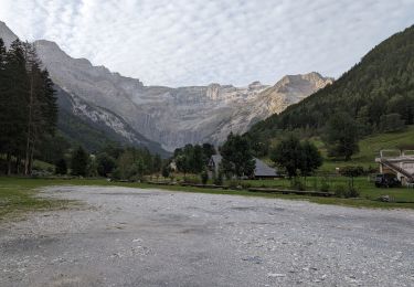
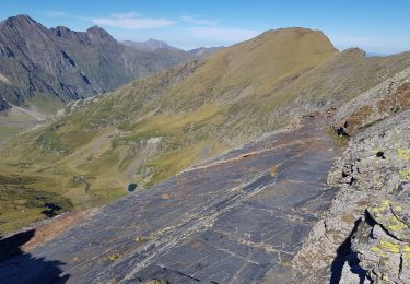
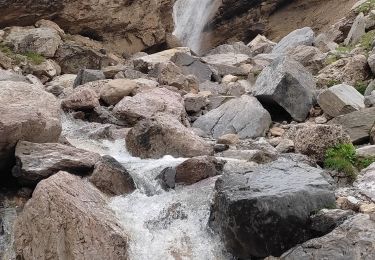
Trail On foot of 7.8 km to be discovered at Occitania, Hautespyrenees, Gavarnie-Gèdre. This trail is proposed by marmotte65.

Description

Départ maison 8h pour arriver avant les touristes (10h) apres il ni a plus de place pour se garer.
4h30 de rando pauses comprises.
un pot au bar de la grotte à Gédre retour maison vers 17h

Elevation profile

Positioning

Country:
France
Region :
Occitania
Department/Province :
Hautespyrenees
Municipality :
Gavarnie-Gèdre
Location:
Gèdre
Start:(UTM)
258694 ; 4737463 (31T) N.

Trails nearby

Trail Walking Gavarnie-Gèdre - Le Pimené par la vallée d'Estaubé  - Gèbre - Photo
Walking
tracegps

Walking

Difficult
(1)
Gavarnie-Gèdre, Occitania, Hautespyrenees, France
19.8 km | 35 km-effort
9h 0min
Yes
Trail Walking Gavarnie-Gèdre - Le Cirque de Gavarnie autrement - Photo
Walking
tracegps

Walking

Medium
(2)
Gavarnie-Gèdre, Occitania, Hautespyrenees, France
9.1 km | 15.6 km-effort
3h 0min
Yes
Trail Walking Gavarnie-Gèdre - jc.pambrun@yahoo.fr - Photo
Walking
sebastienPBN

Walking

Easy
(1)
Gavarnie-Gèdre, Occitania, Hautespyrenees, France
28 km | 48 km-effort
6h 19min
No
Trail Walking Gavarnie-Gèdre - PYRENNES  cirque d'Estaube   - Photo
Walking
ego

Walking

Medium
(1)
Gavarnie-Gèdre, Occitania, Hautespyrenees, France
6.1 km | 8.6 km-effort
1h 56min
No
Trail Walking Gavarnie-Gèdre - Gèdre - barrage des gloriettes - Photo
Walking
marcel.F

Walking

Easy
(1)
Gavarnie-Gèdre, Occitania, Hautespyrenees, France
6.2 km | 8.3 km-effort
1h 57min
Yes
Trail Walking Gavarnie-Gèdre - Le cirque de gavarnie - Photo
Walking
ombrabella

Walking

Difficult
Gavarnie-Gèdre, Occitania, Hautespyrenees, France
10.3 km | 16.3 km-effort
3h 21min
No
Trail Walking Gavarnie-Gèdre - 2023-09-06 Gavarnie - Photo
Walking
Mich&Agnès

Walking

Very difficult
Gavarnie-Gèdre, Occitania, Hautespyrenees, France
12.4 km | 23 km-effort
5h 14min
Yes
Trail Walking Gavarnie-Gèdre - Héas- Hourquette d'Héas - Photo
Walking
pffrench

Walking

Difficult
Gavarnie-Gèdre, Occitania, Hautespyrenees, France
15.8 km | 31 km-effort
7h 7min
Yes
Trail Walking Gavarnie-Gèdre - Les Gloriettes et Cascades .  - Photo
Walking
sereton

Walking

Medium
Gavarnie-Gèdre, Occitania, Hautespyrenees, France
12.3 km | 15.5 km-effort
3h 56min
Yes


Close
My subscriptions