Trail Walking Ingwiller - 67 Ingwiller - Photo
 LUTZMarc
LUTZMarc

User

© OpenStreetMap contributors
Length
Length
55 km
Max alt
Max alt
374 m
Uphill gradient
Uphill gradient
1182 m
Km-Effort
Km-Effort  
70 km
Min alt
Min alt
153 m
Downhill gradient
Downhill gradient
1190 m
Boucle
Boucle
No
Creation date :
2019-12-12 08:22:31.011
Updated on :
2020-01-15 15:02:30.448

(0 Reviews)

Walking
Walking
5h06
Difficulty : Medium

Scan this QR Code to open this trail in the SityTrail application

FREE GPS app for hiking

Logo SityTrail SityTrail

IGN / Geographical institutes

Download SityTrail from the App Store Download SityTrail from Google Play

Logo SityTrail SityTrail World

The world is yours!

Download SityTrail from the App Store Download SityTrail from Google Play Download SityTrail on Huawei AppGallery

About

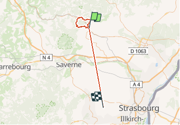
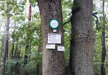
Trail Walking of 55 km to be discovered at Grand Est, Bas-Rhin, Ingwiller. This trail is proposed by LUTZMarc.
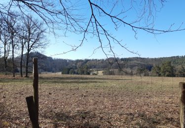
Description

Boucle forestière.
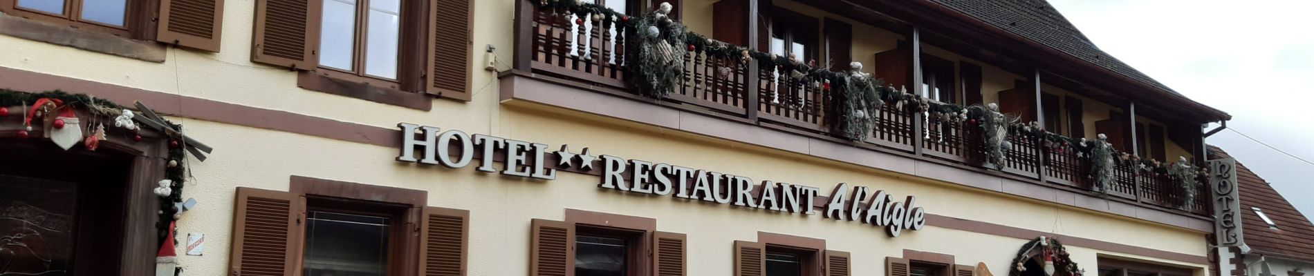
pas très difficile. Très bon resto à Wimenau.

Elevation profile

Photos

Positioning

Country:
France
Region :
Grand Est
Department/Province :
Bas-Rhin
Municipality :
Ingwiller
Location:
Unknown
Start:(UTM)
388304 ; 5414449 (32U) N.

Trails nearby

Trail On foot Wimmenau - Rectangle jaune barré de blanc - Photo
On foot
PRO

On foot

Easy
Wimmenau, Grand Est, Bas-Rhin, France
4.7 km | 6.2 km-effort
1h 24min
No
Trail On foot Weiterswiller - Triangle bleu - Photo
On foot
PRO

On foot

Easy
Weiterswiller, Grand Est, Bas-Rhin, France
11.6 km | 17.3 km-effort
3h 56min
No
Trail On foot Weiterswiller - Triangle jaune - Photo
On foot
PRO

On foot

Easy
Weiterswiller, Grand Est, Bas-Rhin, France
14.6 km | 19.2 km-effort
4h 22min
No
Trail On foot Sparsbach - Chevalet rouge - Photo
On foot
PRO

On foot

Easy
Sparsbach, Grand Est, Bas-Rhin, France
3.2 km | 5.1 km-effort
1h 9min
No
Trail On foot Wimmenau - Green triangle - Photo
On foot
PRO

On foot

Easy
Wimmenau, Grand Est, Bas-Rhin, France
10.4 km | 15.6 km-effort
3h 33min
No
Trail Walking Ingwiller - boucle Ingwiller /Lichtemberg - Photo
Walking
LUTZMarc

Walking

Medium
Ingwiller, Grand Est, Bas-Rhin, France
20 km | 27 km-effort
5h 9min
Yes
Trail Walking Offwiller - Offwiller - Photo
Walking
oscar1

Walking

Easy
Offwiller, Grand Est, Bas-Rhin, France
14.7 km | 20 km-effort
3h 41min
Yes
Trail Horseback riding Rothbach - BOUCLE ROTHBACH VERS COL DE STEIGE - RIVIERE VERS ROTHBACH - Photo
Horseback riding
depoucquesElisabeth

Horseback riding

Medium
(2)
Rothbach, Grand Est, Bas-Rhin, France
16.8 km | 24 km-effort
2h 56min
Yes
Trail Walking Sparsbach - Boucle Sparsbach Englishberg - Photo
Walking
zazie

Walking

Easy
Sparsbach, Grand Est, Bas-Rhin, France
6 km | 8.4 km-effort
1h 10min
Yes


Close
My subscriptions