Trail Walking Grospierres - Grospierres - col de la Cize - Photo

Grospierres - col de la Cize

 pb07
pb07

User

© OpenStreetMap contributors
Length
Length
12.2 km
Max alt
Max alt
477 m
Uphill gradient
Uphill gradient
394 m
Km-Effort
Km-Effort  
17.5 km
Min alt
Min alt
129 m
Downhill gradient
Downhill gradient
389 m
Boucle
Boucle
Yes
Creation date :
2014-12-10 00:00:00.0
Updated on :
2014-12-10 00:00:00.0

(1 Reviews)

Walking
Walking
3h35
Difficulty : Medium

Scan this QR Code to open this trail in the SityTrail application

FREE GPS app for hiking

Logo SityTrail SityTrail

IGN / Geographical institutes

Download SityTrail from the App Store Download SityTrail from Google Play

Logo SityTrail SityTrail World

The world is yours!

Download SityTrail from the App Store Download SityTrail from Google Play Download SityTrail on Huawei AppGallery

About

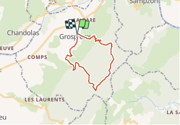
Trail Walking of 12.2 km to be discovered at Auvergne-Rhône-Alpes, Ardèche, Grospierres. This trail is proposed by pb07.

Description

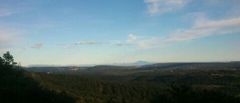
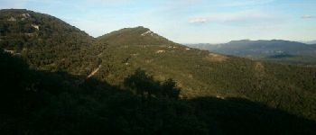
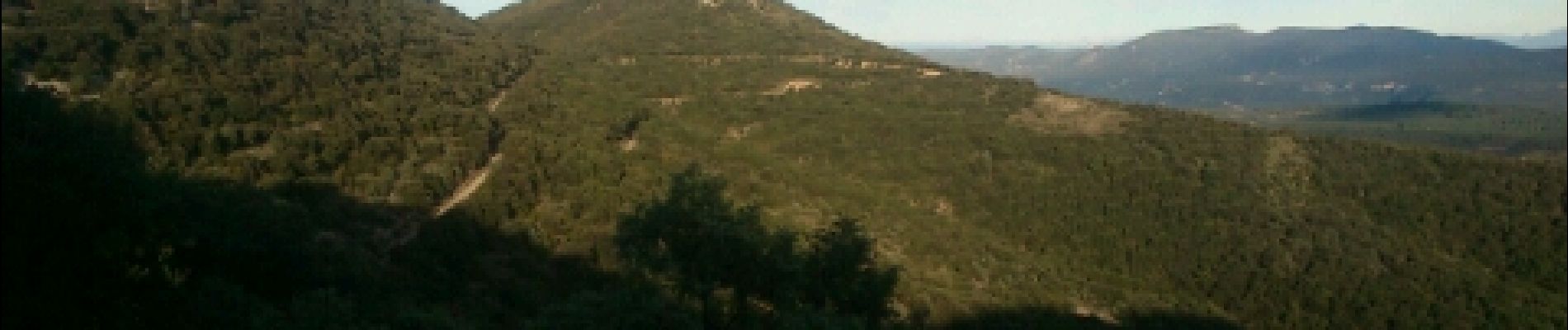
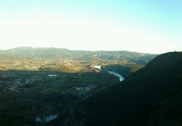
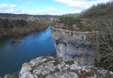
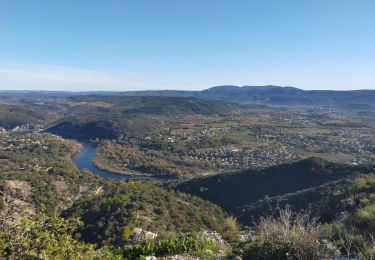
Belles vues depuis le haut des collines.
Départ de Grospierre par sentier facile.
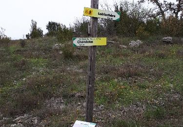
Après Mezeyras, balisage de croisement peu clair, parti sur un faux sentier => hors piste dans les broussailles. Le vrai sentier part 10 ou 20 m après.
Entre col de la Cize et pas de l'Estrel, belle vue - voir points 1 et 2.

Elevation profile

Photos

Points of interest

Point of interest Grospierres - Point 1 - Photo
pb07
GROSPIERRES 
Point of interest Grospierres - Point 2 - Photo
pb07
GROSPIERRES 
Point of interest Grospierres - Point 3 - Photo
pb07
GROSPIERRES 

Positioning

Country:
France
Region :
Auvergne-Rhône-Alpes
Department/Province :
Ardèche
Municipality :
Grospierres
Location:
Unknown
Start:(UTM)
602713 ; 4917169 (31T) N.

Comments

Please log in to post a review or rate the element


Trails nearby

Trail Nordic walking Grospierres - YG Grospierres - Photo
Nordic walking
yago1404

Nordic walking

Medium
(1)
Grospierres, Auvergne-Rhône-Alpes, Ardèche, France
13.4 km | 20 km-effort
3h 0min
Yes
Trail Walking Sampzon - Sampzon - Pas des pigeons - Photo
Walking
pb07

Walking

Easy
(3)
Sampzon, Auvergne-Rhône-Alpes, Ardèche, France
11.6 km | 17.1 km-effort
3h 11min
Yes
Trail Walking Saint-Alban-Auriolles - St Alban la falaise - Photo
Walking
marquet

Walking

Easy
(1)
Saint-Alban-Auriolles, Auvergne-Rhône-Alpes, Ardèche, France
9.5 km | 12.1 km-effort
3h 2min
Yes
Trail Walking Chandolas - 3 - Maisoneuve Ron Redon Chandolas 8041m - Photo
Walking
ganinette

Walking

Medium
Chandolas, Auvergne-Rhône-Alpes, Ardèche, France
8 km | 9.4 km-effort
2h 7min
Yes
Trail Walking Grospierres - sampzon - Photo
Walking
Gisele Denaes

Walking

Very difficult
Grospierres, Auvergne-Rhône-Alpes, Ardèche, France
14.7 km | 19.2 km-effort
2h 27min
No
Trail Walking Saint-Alban-Auriolles - Font Méjane - Photo
Walking
dadodeca

Walking

Easy
Saint-Alban-Auriolles, Auvergne-Rhône-Alpes, Ardèche, France
7.5 km | 9.1 km-effort
1h 57min
Yes
Trail Walking Chandolas - vallon de Fontgraze  ARDE`CHE GPS - Photo
Walking
silvestreclaudine

Walking

Easy
Chandolas, Auvergne-Rhône-Alpes, Ardèche, France
15.1 km | 18.2 km-effort
5h 39min
Yes
Trail Walking Saint-Alban-Auriolles - la beaume - Photo
Walking
av162100

Walking

Easy
(2)
Saint-Alban-Auriolles, Auvergne-Rhône-Alpes, Ardèche, France
7.8 km | 10.2 km-effort
2h 12min
Yes
Trail Walking Lablachère - Remejadou - circuit court - Photo
Walking
pb07

Walking

Easy
Lablachère, Auvergne-Rhône-Alpes, Ardèche, France
6.8 km | 7.9 km-effort
2h 8min
Yes


Close
My subscriptions