Trail Walking Duranus - Cime de Roccassièra (1501m) et ruines de Rocca Sparviera - Photo

Cime de Roccassièra (1501m) et ruines de Rocca Sparviera

© OpenStreetMap contributors
Length
Length
18 km
Max alt
Max alt
1480 m
Uphill gradient
Uphill gradient
1159 m
Km-Effort
Km-Effort  
33 km
Min alt
Min alt
435 m
Downhill gradient
Downhill gradient
1122 m
Boucle
Boucle
No
Creation date :
2020-02-23 09:58:37.502
Updated on :
2020-04-05 14:05:23.043

(0 Reviews)

Walking
Walking
5h38
Difficulty : Medium

Scan this QR Code to open this trail in the SityTrail application

FREE GPS app for hiking

Logo SityTrail SityTrail

IGN / Geographical institutes

Download SityTrail from the App Store Download SityTrail from Google Play

Logo SityTrail SityTrail World

The world is yours!

Download SityTrail from the App Store Download SityTrail from Google Play Download SityTrail on Huawei AppGallery

About

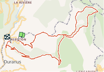
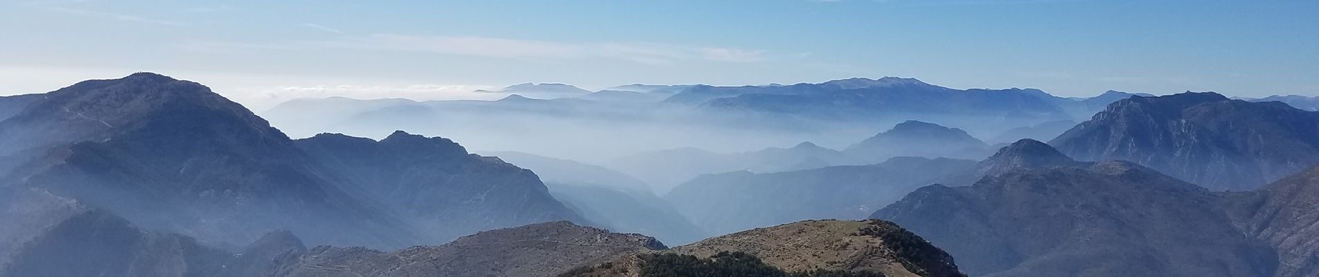
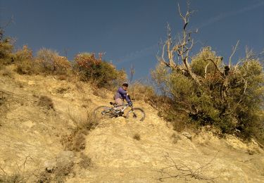
Trail Walking of 18 km to be discovered at Provence-Alpes-Côte d'Azur, Maritime Alps, Duranus. This trail is proposed by AntoineBM.

Description

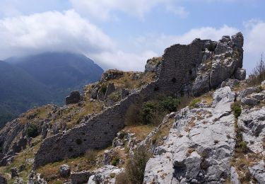
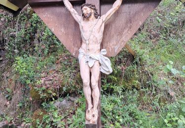
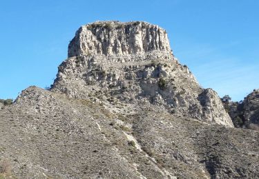
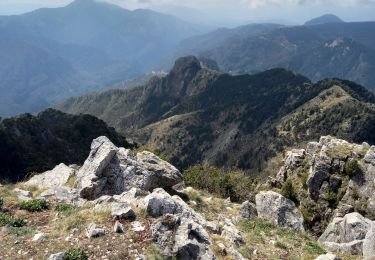
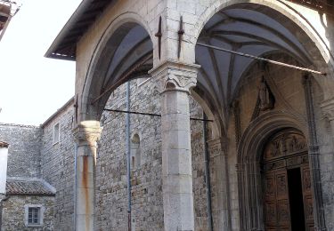
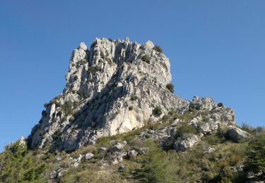
Magnifique randonnée au départ de Calençon, Cime de Roccassièra (1501m, sur la commune de Duranus) et retour via les ruines de Rocca Sparviera et la crête Saint-Antoine.
Topo (sans le détour par Rocca Sparviera au retour) : https://www.altituderando.com/Cime-de-Roccassiera-1501m-par-Calencon-Vallee-de-la-Vesubie.

Elevation profile

Photos

Positioning

Country:
France
Region :
Provence-Alpes-Côte d'Azur
Department/Province :
Maritime Alps
Municipality :
Duranus
Location:
Unknown
Start:(UTM)
360443 ; 4862514 (32T) N.

Trails nearby

Trail On foot Coaraze - Rocca Sparvièra - Photo
On foot
PRO

On foot

Easy
Coaraze, Provence-Alpes-Côte d'Azur, Maritime Alps, France
10.5 km | 17.6 km-effort
3h 59min
Yes
Trail On foot Utelle - Gorges de la Vésubie - Photo
On foot
PRO

On foot

Medium
(1)
Utelle, Provence-Alpes-Côte d'Azur, Maritime Alps, France
14.6 km | 27 km-effort
6h 11min
Yes
Trail On foot Utelle - Madone d'Utelle - Photo
On foot
PRO

On foot

Easy
Utelle, Provence-Alpes-Côte d'Azur, Maritime Alps, France
9.9 km | 19.4 km-effort
4h 24min
Yes
Trail Walking Coaraze - Rocca Spavierra - Photo
Walking
franquen

Walking

Medium
(1)
Coaraze, Provence-Alpes-Côte d'Azur, Maritime Alps, France
11.6 km | 19.6 km-effort
4h 6min
Yes
Trail Walking Utelle - Cros d Utelle chapelle St Antoine - Photo
Walking
56jj

Walking

Difficult
Utelle, Provence-Alpes-Côte d'Azur, Maritime Alps, France
7.5 km | 13.7 km-effort
4h 6min
Yes
Trail Walking Utelle - Utelle, Brec d'Utelle - Photo
Walking
GrouGary

Walking

Very difficult
(1)
Utelle, Provence-Alpes-Côte d'Azur, Maritime Alps, France
11.2 km | 22 km-effort
4h 59min
Yes
Trail Walking Utelle - Le Brec d'Utelle 1604m 19-04-22 - Photo
Walking
fredetpascale

Walking

Medium
Utelle, Provence-Alpes-Côte d'Azur, Maritime Alps, France
11.2 km | 22 km-effort
4h 15min
Yes
Trail On foot Utelle - Brec d'Utelle - Photo
On foot
PRO

On foot

Medium
Utelle, Provence-Alpes-Côte d'Azur, Maritime Alps, France
11.2 km | 22 km-effort
5h 2min
Yes
Trail On foot Duranus - Mine de l'Eguisse - Photo
On foot
PRO

On foot

Easy
Duranus, Provence-Alpes-Côte d'Azur, Maritime Alps, France
6.8 km | 14.5 km-effort
3h 17min
Yes


Close
My subscriptions