Trail Walking Furmeyer - Col des Traverses par le sentier de chamois - Photo

Col des Traverses par le sentier de chamois

 jlv05
jlv05

User

© OpenStreetMap contributors
Length
Length
7.8 km
Max alt
Max alt
1405 m
Uphill gradient
Uphill gradient
518 m
Km-Effort
Km-Effort  
14.8 km
Min alt
Min alt
940 m
Downhill gradient
Downhill gradient
517 m
Boucle
Boucle
Yes
Creation date :
2020-03-18 12:13:03.465
Updated on :
2020-03-18 15:13:33.841

(0 Reviews)

Walking
Walking
2h59
Difficulty : Medium

Scan this QR Code to open this trail in the SityTrail application

FREE GPS app for hiking

Logo SityTrail SityTrail

IGN / Geographical institutes

Download SityTrail from the App Store Download SityTrail from Google Play

Logo SityTrail SityTrail World

The world is yours!

Download SityTrail from the App Store Download SityTrail from Google Play Download SityTrail on Huawei AppGallery

About

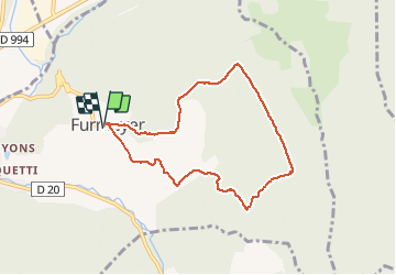
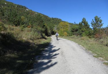
Trail Walking of 7.8 km to be discovered at Provence-Alpes-Côte d'Azur, Hautes-Alpes, Furmeyer. This trail is proposed by jlv05.

Description

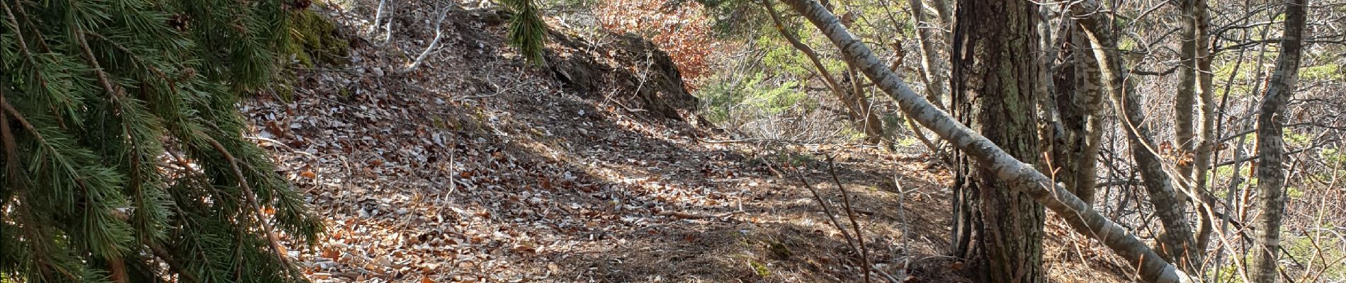
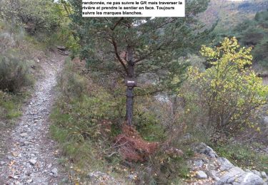
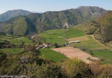
La montée au col se fait sur des sentes raides et étroites, mais balisées en jaune.

Elevation profile

Photos

Positioning

Country:
France
Region :
Provence-Alpes-Côte d'Azur
Department/Province :
Hautes-Alpes
Municipality :
Furmeyer
Location:
Unknown
Start:(UTM)
728193 ; 4935802 (31T) N.

Trails nearby

Trail Walking Veynes - R06   glaise - Photo
Walking
GUIDE+

Walking

Easy
(1)
Veynes, Provence-Alpes-Côte d'Azur, Hautes-Alpes, France
9.1 km | 14.9 km-effort
3h 4min
Yes
Trail Walking Veynes - R03  oule depuis veynes - Photo
Walking
GUIDE+

Walking

Difficult
(4)
Veynes, Provence-Alpes-Côte d'Azur, Hautes-Alpes, France
7.1 km | 17.2 km-effort
3h 24min
Yes
Trail Walking Montmaur - Montmaur Le Terrail - Photo
Walking
Marco05

Walking

Easy
(1)
Montmaur, Provence-Alpes-Côte d'Azur, Hautes-Alpes, France
5.3 km | 6.2 km-effort
1h 22min
Yes
Trail Mountain bike Châteauneuf-d'Oze - ceuse9 avril 2012 - Photo
Mountain bike
GUIDE
harydh

Mountain bike

Medium
(2)
Châteauneuf-d'Oze, Provence-Alpes-Côte d'Azur, Hautes-Alpes, France
18.1 km | 26 km-effort
Unknown
Yes
Trail Mountain bike Montmaur - VTT28 - Rabioux - Photo
Mountain bike
GUIDE+

Mountain bike

Difficult
Montmaur, Provence-Alpes-Côte d'Azur, Hautes-Alpes, France
24 km | 36 km-effort
2h 12min
Yes
Trail Mountain bike Châteauneuf-d'Oze - VTT04 - Les balcons de Ceuze - Photo
Mountain bike
GUIDE+

Mountain bike

Medium
Châteauneuf-d'Oze, Provence-Alpes-Côte d'Azur, Hautes-Alpes, France
24 km | 37 km-effort
2h 15min
Yes
Trail Walking Furmeyer - R04  Le sentier botanique de Furmeyer - Photo
Walking
GUIDE+

Walking

Easy
(2)
Furmeyer, Provence-Alpes-Côte d'Azur, Hautes-Alpes, France
4 km | 6.9 km-effort
1h 34min
Yes
Trail Walking Saint-Auban-d'Oze - R02 oule depuis saint auban - Photo
Walking
GUIDE+

Walking

Medium
(1)
Saint-Auban-d'Oze, Provence-Alpes-Côte d'Azur, Hautes-Alpes, France
5.9 km | 13.9 km-effort
2h 44min
Yes
Trail Walking Furmeyer - Pic de la Fayole - Photo
Walking
jlv05

Walking

Difficult
(1)
Furmeyer, Provence-Alpes-Côte d'Azur, Hautes-Alpes, France
5.4 km | 10.4 km-effort
2h 11min
Yes


Close
My subscriptions