Trail Walking Veynes - R06   glaise - Photo

Les Hautes Alpes à découvrir ! GUIDE+

© OpenStreetMap contributors
Length
Length
9.1 km
Max alt
Max alt
1418 m
Uphill gradient
Uphill gradient
440 m
Km-Effort
Km-Effort  
14.9 km
Min alt
Min alt
1006 m
Downhill gradient
Downhill gradient
444 m
Boucle
Boucle
Yes
Creation date :
2018-03-23 05:41:22.903
Updated on :
2018-10-16 11:36:15.071

(1 Reviews)

Walking
Walking
3h04
Difficulty : Easy

Scan this QR Code to open this trail in the SityTrail application

FREE GPS app for hiking

Logo SityTrail SityTrail

IGN / Geographical institutes

Download SityTrail from the App Store Download SityTrail from Google Play

Logo SityTrail SityTrail World

The world is yours!

Download SityTrail from the App Store Download SityTrail from Google Play Download SityTrail on Huawei AppGallery

About

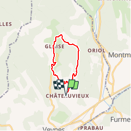
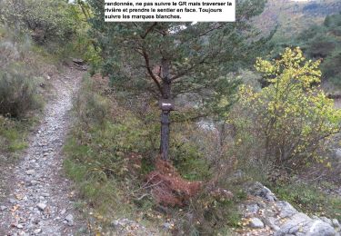
Trail Walking of 9.1 km to be discovered at Provence-Alpes-Côte d'Azur, Hautes-Alpes, Veynes. This trail is proposed by Camping Les Rives du Lac.

Description

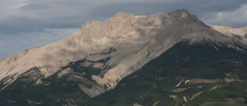
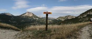
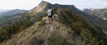
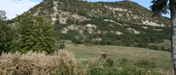
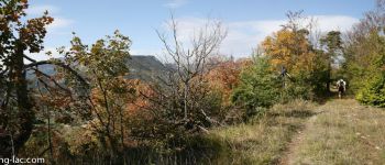
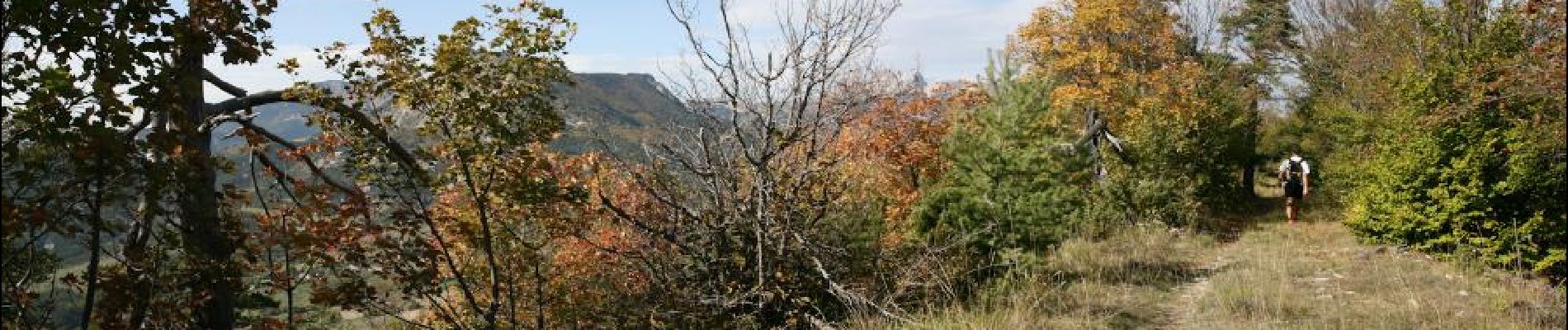
Balade très agréable dans les alpages et en sous bois. Nous vous conseillons de monter en direction du col de la Selle (direction sud). Le passage par la cîme de Pignerole offre une très belle vue sur le Dévoluy et ensuite, plus au Nord, un détour par la tête de Combe Rau prendra 15 minutes et offre un panorama encore plus complet.

Elevation profile

Photos

Points of interest

Point of interest Veynes - Vue depuis la Cime de Pignerole - Photo
CampingLesRivesduLac
Point of interest Veynes - Col de la Seile - Photo
CampingLesRivesduLac
Point of interest Veynes - La Tête de Tombereau - Photo
CampingLesRivesduLac
Point of interest Veynes - Glaise - Photo
CampingLesRivesduLac
VEYNES 
Point of interest Veynes - Cime de Pignerole - Photo
CampingLesRivesduLac

Positioning

Country:
France
Region :
Provence-Alpes-Côte d'Azur
Department/Province :
Hautes-Alpes
Municipality :
Veynes
Location:
Unknown
Start:(UTM)
725041 ; 4936997 (31T) N.

Comments

Please log in to post a review or rate the element


Trails nearby

Trail Mountain bike Veynes - VTT29 - Rando famille - Photo
Mountain bike
GUIDE+

Mountain bike

Easy
(1)
Veynes, Provence-Alpes-Côte d'Azur, Hautes-Alpes, France
10.9 km | 13.6 km-effort
54min
Yes
Trail Mountain bike Veynes - VTT14 - Les crêtes de la Longeagne - Photo
Mountain bike
GUIDE+

Mountain bike

Very difficult
(1)
Veynes, Provence-Alpes-Côte d'Azur, Hautes-Alpes, France
39 km | 57 km-effort
3h 15min
Yes
Trail Mountain bike Veynes - VTT03 - Tous les Eygaux - Photo
Mountain bike
GUIDE+

Mountain bike

Medium
(2)
Veynes, Provence-Alpes-Côte d'Azur, Hautes-Alpes, France
23 km | 31 km-effort
1h 31min
Yes
Trail Mountain bike Veynes - VTT02 - Aiguebelle - Photo
Mountain bike
GUIDE+

Mountain bike

Easy
(2)
Veynes, Provence-Alpes-Côte d'Azur, Hautes-Alpes, France
16.7 km | 21 km-effort
1h 23min
Yes
Trail Mountain bike Veynes - VTT01 - Les Eygaux - Photo
Mountain bike
GUIDE+

Mountain bike

Easy
(3)
Veynes, Provence-Alpes-Côte d'Azur, Hautes-Alpes, France
14.1 km | 19.2 km-effort
1h 13min
Yes
Trail Walking Veynes - R10   Le tour des Eygaux - Photo
Walking
GUIDE+

Walking

Very easy
(4)
Veynes, Provence-Alpes-Côte d'Azur, Hautes-Alpes, France
7.8 km | 11.3 km-effort
2h 24min
Yes
Trail Walking Veynes - R09   Le tour de Veynes - Photo
Walking
GUIDE+

Walking

Very easy
(3)
Veynes, Provence-Alpes-Côte d'Azur, Hautes-Alpes, France
9.5 km | 12.3 km-effort
2h 40min
Yes
Trail Walking Veynes - R52   Le col de Cuberselle - Photo
Walking
GUIDE+

Walking

Medium
(3)
Veynes, Provence-Alpes-Côte d'Azur, Hautes-Alpes, France
10.8 km | 17.2 km-effort
3h 31min
Yes
Trail Walking Veynes - R03  oule depuis veynes - Photo
Walking
GUIDE+

Walking

Difficult
(4)
Veynes, Provence-Alpes-Côte d'Azur, Hautes-Alpes, France
7.1 km | 17.2 km-effort
3h 24min
Yes


Close
My subscriptions