9.1 km | 14.9 km-effort
Montmaur Le Terrail
Marco05
User
Length
5.3 km
Max alt
920 m
Uphill gradient
68 m
Km-Effort
6.2 km
Min alt
862 m
Downhill gradient
66 m
Boucle
Yes
Creation date :
2022-04-01 12:01:41.691
Updated on :
2022-11-14 09:27:53.295
1h22
Difficulty : Easy
FREE GPS app for hiking
About
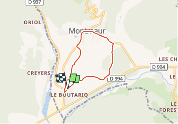
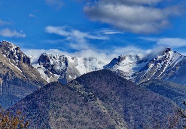
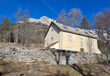
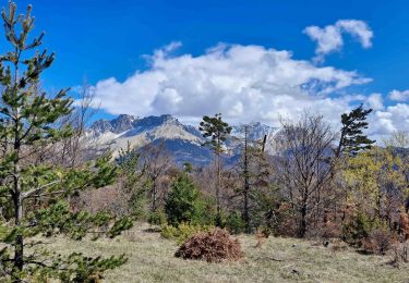
Trail Walking of 5.3 km to be discovered at Provence-Alpes-Côte d'Azur, Hautes-Alpes, Montmaur. This trail is proposed by Marco05.
Description
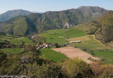
Petite ballade sur la commune de Montmaur.
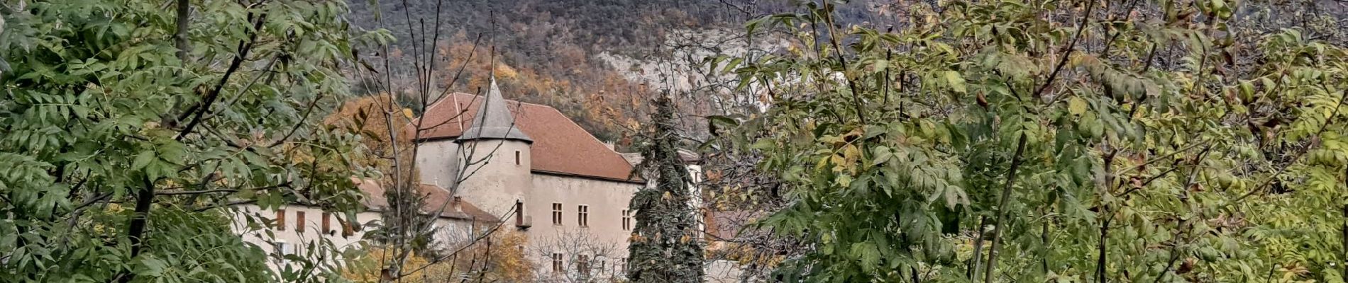
Passage devant les chateaux du Terrail et de Montmaur.
Positioning
Country:
France
Region :
Provence-Alpes-Côte d'Azur
Department/Province :
Hautes-Alpes
Municipality :
Montmaur
Location:
Unknown
Start:(Dec)
Start:(UTM)
727622 ; 4937673 (31T) N.
Comments
Trails nearby
R03 oule depuis veynes
Walking
Difficult
(4)
Veynes,
Provence-Alpes-Côte d'Azur,
Hautes-Alpes,
France
7.1 km | 17.2 km-effort
3h 24min
Yes
VTT28 - Rabioux
Mountain bike
Difficult
Montmaur,
Provence-Alpes-Côte d'Azur,
Hautes-Alpes,
France
24 km | 36 km-effort
2h 12min
Yes
R04 Le sentier botanique de Furmeyer
Walking
Easy
(2)
Furmeyer,
Provence-Alpes-Côte d'Azur,
Hautes-Alpes,
France
4 km | 6.9 km-effort
1h 34min
Yes
Pic de la Fayole
Walking
Difficult
(1)
Furmeyer,
Provence-Alpes-Côte d'Azur,
Hautes-Alpes,
France
5.4 km | 10.4 km-effort
2h 11min
Yes
Furmeyer - Le Fays
Walking
Very difficult
Furmeyer,
Provence-Alpes-Côte d'Azur,
Hautes-Alpes,
France
11.3 km | 22 km-effort
4h 57min
Yes
Les Sauvas
Walking
Medium
Montmaur,
Provence-Alpes-Côte d'Azur,
Hautes-Alpes,
France
12.9 km | 21 km-effort
4h 42min
Yes
Champérus-Oriol
Walking
Difficult
Veynes,
Provence-Alpes-Côte d'Azur,
Hautes-Alpes,
France
8 km | 16.6 km-effort
3h 45min
No
SityTrail - Circuit de la combe du Duc
Walking
Medium
La Roche-des-Arnauds,
Provence-Alpes-Côte d'Azur,
Hautes-Alpes,
France
6.7 km | 9.6 km-effort
2h 11min
Yes
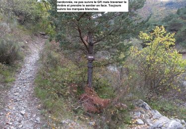
Une bonne petite promenade. Assez facile.