Trail On foot Noirétable - Le châtaignier de la Bitortie - Photo

Le châtaignier de la Bitortie

 jeanic63
jeanic63

User

© OpenStreetMap contributors
Length
Length
13.3 km
Max alt
Max alt
1063 m
Uphill gradient
Uphill gradient
450 m
Km-Effort
Km-Effort  
19.3 km
Min alt
Min alt
671 m
Downhill gradient
Downhill gradient
448 m
Boucle
Boucle
Yes
Creation date :
2020-05-17 13:09:05.878
Updated on :
2020-05-17 13:30:58.129

(0 Reviews)

On foot
On foot
--
Difficulty : Medium

Scan this QR Code to open this trail in the SityTrail application

FREE GPS app for hiking

Logo SityTrail SityTrail

IGN / Geographical institutes

Download SityTrail from the App Store Download SityTrail from Google Play

Logo SityTrail SityTrail World

The world is yours!

Download SityTrail from the App Store Download SityTrail from Google Play Download SityTrail on Huawei AppGallery

About

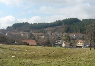
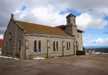
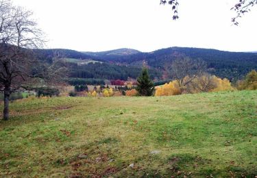
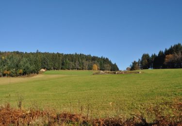
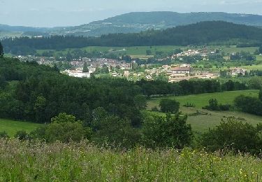
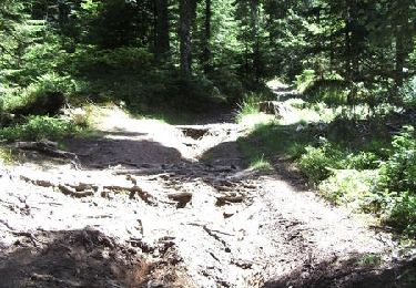
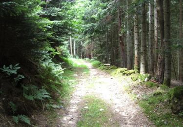
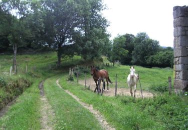
Trail On foot of 13.3 km to be discovered at Auvergne-Rhône-Alpes, Loire, Noirétable. This trail is proposed by jeanic63.

Description

départ plan d'eau de Noirétable

Elevation profile

Points of interest

Point of interest Noirétable - Parking plan d'eau - Photo
jeanic63
NOIRÉTABLE 
Point of interest Noirétable - Voie ferrée - Photo
jeanic63
NOIRÉTABLE 
Point of interest Noirétable - bal13 mais plus de flech a si - Photo
jeanic63
Point of interest Saint-Jean-la-Vêtre - Hameau le Bruchet - Photo
jeanic63
SAINT-JEAN-LA-VÊTRE 
Point of interest Saint-Jean-la-Vêtre - 13 - Photo
jeanic63
SAINT-JEAN-LA-VÊTRE 
Point of interest Saint-Jean-la-Vêtre - fin goudron croi fer et 13 et gr - Photo
jeanic63
SAINT-JEAN-LA-VÊTRE 
Point of interest Saint-Priest-la-Vêtre - Croix de Saint-Jean-la-Vêtre - Photo
jeanic63
SAINT-PRIEST-LA-VÊTRE 
Point of interest Saint-Jean-la-Vêtre - Aller-retour Puy de Rot - Photo
jeanic63
SAINT-JEAN-LA-VÊTRE 
Point of interest Saint-Jean-la-Vêtre - che croi et rout - Photo
jeanic63
SAINT-JEAN-LA-VÊTRE 
Point of interest Noirétable - Châtaignier de la Bitortie - Photo
jeanic63
Point of interest Noirétable - goudron ici - Photo
jeanic63
NOIRÉTABLE 
Point of interest Noirétable - 2 beau chat - Photo
jeanic63
NOIRÉTABLE 
Point of interest Noirétable - pan impass tt droi - Photo
jeanic63
NOIRÉTABLE 
Point of interest Noirétable - reserv et ruis - Photo
jeanic63
NOIRÉTABLE 
Point of interest Noirétable - autre chat a droi - Photo
jeanic63
NOIRÉTABLE 
Point of interest Noirétable - Route à gauche - Photo
jeanic63
NOIRÉTABLE 
Point of interest Noirétable - ig sent gau - Photo
jeanic63
NOIRÉTABLE 
Point of interest Noirétable - Hameau La Fressinie - Photo
jeanic63
NOIRÉTABLE 
Point of interest Noirétable - Hameau La Rivale - Photo
jeanic63
NOIRÉTABLE 
Point of interest Noirétable - ruis - Photo
jeanic63
NOIRÉTABLE 
Point of interest Noirétable - ruis - Photo
jeanic63
NOIRÉTABLE 
Point of interest Noirétable - Hameau de La Rivalsupt. - Photo
jeanic63
Point of interest Noirétable - ruis sur gau - Photo
jeanic63
NOIRÉTABLE 
Point of interest Noirétable - Chemin à droite - Photo
jeanic63
NOIRÉTABLE 
Point of interest Noirétable - Parking plan d'eau - Photo
jeanic63
NOIRÉTABLE 

Positioning

Country:
France
Region :
Auvergne-Rhône-Alpes
Department/Province :
Loire
Municipality :
Noirétable
Location:
Unknown
Start:(UTM)
559783 ; 5072972 (31T) N.

Trails nearby

Trail Walking Noirétable - De Notre Dame L’héritage a Chabreloche  - Photo
Walking
NANE51

Walking

Medium
Noirétable, Auvergne-Rhône-Alpes, Loire, France
18.6 km | 26 km-effort
6h 6min
No
Trail Cycle Noirétable - Col du Frissonnet et du Pertuis - Noirétable - Photo
Cycle
tracegps

Cycle

Medium
Noirétable, Auvergne-Rhône-Alpes, Loire, France
42 km | 52 km-effort
2h 0min
Yes
Trail Mountain bike Noirétable - La Croix St Guillaume - Noirétable - Photo
Mountain bike
tracegps

Mountain bike

Difficult
Noirétable, Auvergne-Rhône-Alpes, Loire, France
19.2 km | 27 km-effort
1h 45min
Yes
Trail Mountain bike Noirétable - Chausseterre - Noirétable - Photo
Mountain bike
tracegps

Mountain bike

Medium
Noirétable, Auvergne-Rhône-Alpes, Loire, France
25 km | 34 km-effort
2h 0min
Yes
Trail Mountain bike Noirétable - Col du St Thomas - Noirétable - Photo
Mountain bike
tracegps

Mountain bike

Medium
Noirétable, Auvergne-Rhône-Alpes, Loire, France
23 km | 30 km-effort
2h 0min
Yes
Trail Mountain bike Noirétable - 12ème Bois Noirs Oxygène (2013-VTT-100km) - Noirétable - Photo
Mountain bike
tracegps

Mountain bike

Very difficult
Noirétable, Auvergne-Rhône-Alpes, Loire, France
100 km | 137 km-effort
8h 30min
Yes
Trail Mountain bike Saint-Jean-la-Vêtre - VVF - Ventuel - Saint-Jean-La-Vêtre - Circuit 3 - Photo
Mountain bike
tracegps

Mountain bike

Difficult
Saint-Jean-la-Vêtre, Auvergne-Rhône-Alpes, Loire, France
16.7 km | 24 km-effort
2h 45min
Yes
Trail Mountain bike Saint-Jean-la-Vêtre - VVF - Ventuel - Saint-Jean-La-Vêtre - Circuit 2 - Photo
Mountain bike
tracegps

Mountain bike

Medium
Saint-Jean-la-Vêtre, Auvergne-Rhône-Alpes, Loire, France
15.3 km | 20 km-effort
2h 0min
Yes
Trail Mountain bike Saint-Jean-la-Vêtre - VVF - Ventuel - Saint-Jean-La-Vêtre - Circuit 1 - Photo
Mountain bike
tracegps

Mountain bike

Easy
Saint-Jean-la-Vêtre, Auvergne-Rhône-Alpes, Loire, France
11.8 km | 16.3 km-effort
1h 45min
Yes


Close
My subscriptions