Trail Walking Saint-Quentin-sur-Isère - st Quentin montaud boucle - Photo
© OpenStreetMap contributors
Length
Length
8.9 km
Max alt
Max alt
741 m
Uphill gradient
Uphill gradient
550 m
Km-Effort
Km-Effort  
16.3 km
Min alt
Min alt
193 m
Downhill gradient
Downhill gradient
550 m
Boucle
Boucle
Yes
Creation date :
2020-05-30 12:14:52.032
Updated on :
2020-06-04 09:37:12.888

(0 Reviews)

Walking
Walking
2h58
Difficulty : Medium

Scan this QR Code to open this trail in the SityTrail application

FREE GPS app for hiking

Logo SityTrail SityTrail

IGN / Geographical institutes

Download SityTrail from the App Store Download SityTrail from Google Play

Logo SityTrail SityTrail World

The world is yours!

Download SityTrail from the App Store Download SityTrail from Google Play Download SityTrail on Huawei AppGallery

About

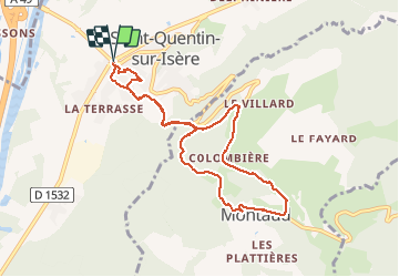
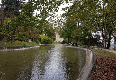
Trail Walking of 8.9 km to be discovered at Auvergne-Rhône-Alpes, Isère, Saint-Quentin-sur-Isère. This trail is proposed by floup6138.

Description

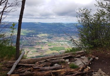
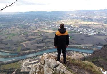
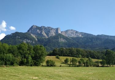
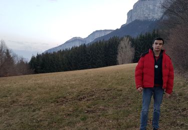
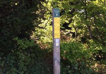
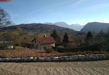
Circuit assez bien balisé en grande patie abrité du soleil. des fortes pentes à l'aller et retour, prudence à la descente, cailloux pouvant rouler sous les pieds. La première partie de la descente arrivé à MONTAUD se fait sur la route mais quelques beaux paysages.
Pas de danger mais pente moyenne importante

Elevation profile

Photos

Positioning

Country:
France
Region :
Auvergne-Rhône-Alpes
Department/Province :
Isère
Municipality :
Saint-Quentin-sur-Isère
Location:
Unknown
Start:(UTM)
699155 ; 5017180 (31T) N.

Trails nearby

Trail Walking Saint-Quentin-sur-Isère - Dent de Moirans - Photo
Walking
GuyVachet

Walking

Very difficult
Saint-Quentin-sur-Isère, Auvergne-Rhône-Alpes, Isère, France
14.7 km | 26 km-effort
6h 17min
Yes
Trail Walking Saint-Quentin-sur-Isère - 38 St Quentin sur isere - Photo
Walking
himba26100

Walking

Medium
Saint-Quentin-sur-Isère, Auvergne-Rhône-Alpes, Isère, France
17 km | 28 km-effort
7h 22min
Yes
Trail Walking Tullins - Clos des Chartreux Parmenie 2 - Photo
Walking
micoud

Walking

Medium
Tullins, Auvergne-Rhône-Alpes, Isère, France
14.1 km | 23 km-effort
5h 29min
Yes
Trail Walking Montaud - La Dent de Moirans - Photo
Walking
patjobou

Walking

Easy
Montaud, Auvergne-Rhône-Alpes, Isère, France
11 km | 16.4 km-effort
4h 38min
Yes
Trail Walking Montaud - La dent de Moirans - Photo
Walking
crocau

Walking

Very easy
(1)
Montaud, Auvergne-Rhône-Alpes, Isère, France
8.9 km | 13.5 km-effort
2h 57min
Yes
Trail Walking Montaud - BOUCLE MONTAUD DE T DE MOIRANS - Photo
Walking
floup6138

Walking

Medium
Montaud, Auvergne-Rhône-Alpes, Isère, France
11.1 km | 16.7 km-effort
3h 12min
Yes
Trail Walking Noyarey - Ezy Montaud par les chemins communaux - Photo
Walking
crocau

Walking

Very easy
(1)
Noyarey, Auvergne-Rhône-Alpes, Isère, France
6.5 km | 10.6 km-effort
1h 51min
Yes
Trail Walking Montaud - Pas Brochier  - Photo
Walking
ajd26

Walking

Very difficult
Montaud, Auvergne-Rhône-Alpes, Isère, France
11.5 km | 27 km-effort
6h 0min
Yes
Trail Walking Montaud - DENT DE MOIRANS GROUPE 1 - Photo
Walking
floup6138

Walking

Difficult
Montaud, Auvergne-Rhône-Alpes, Isère, France
12.7 km | 21 km-effort
4h 14min
Yes


Close
My subscriptions