Trail Walking Saint-Quentin-sur-Isère - Dent de Moirans - Photo
© OpenStreetMap contributors
Length
Length
14.7 km
Max alt
Max alt
990 m
Uphill gradient
Uphill gradient
871 m
Km-Effort
Km-Effort  
26 km
Min alt
Min alt
267 m
Downhill gradient
Downhill gradient
870 m
Boucle
Boucle
Yes
Creation date :
2023-12-19 08:38:09.141
Updated on :
2023-12-23 15:40:08.062

(0 Reviews)

Walking
Walking
6h17
Difficulty : Very difficult

Scan this QR Code to open this trail in the SityTrail application

FREE GPS app for hiking

Logo SityTrail SityTrail

IGN / Geographical institutes

Download SityTrail from the App Store Download SityTrail from Google Play

Logo SityTrail SityTrail World

The world is yours!

Download SityTrail from the App Store Download SityTrail from Google Play Download SityTrail on Huawei AppGallery

About

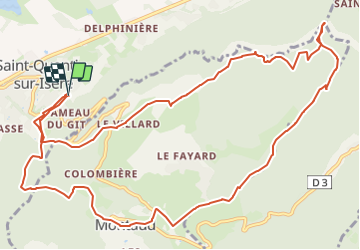
Trail Walking of 14.7 km to be discovered at Auvergne-Rhône-Alpes, Isère, Saint-Quentin-sur-Isère. This trail is proposed by GuyVachet.

Description

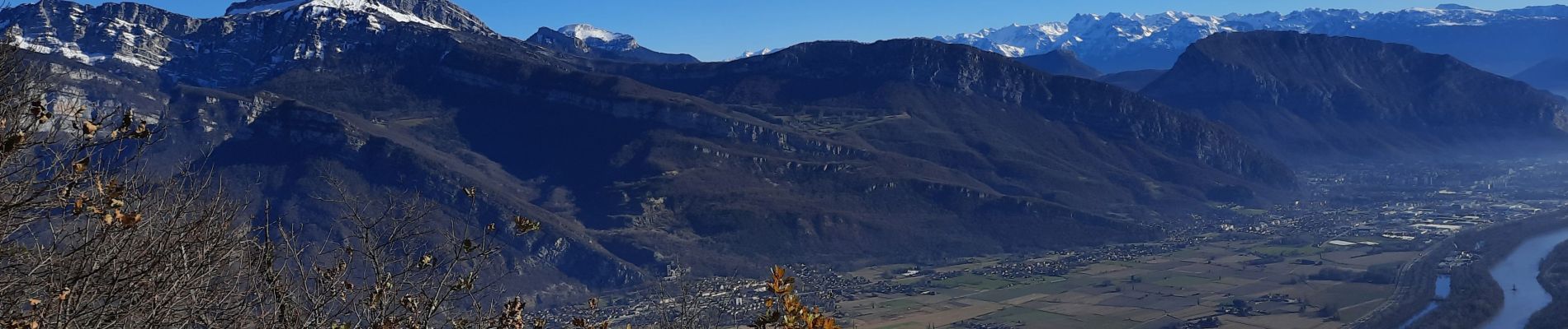
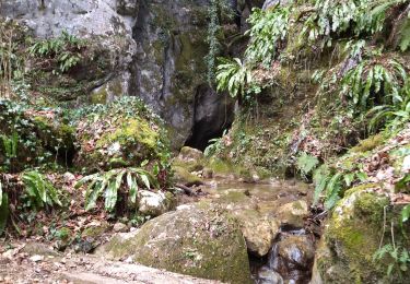
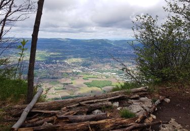
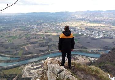
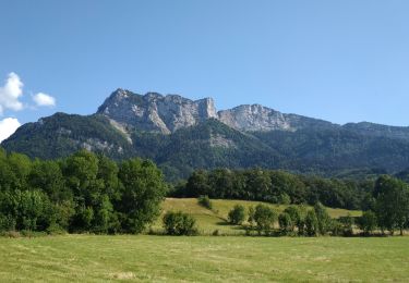
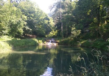
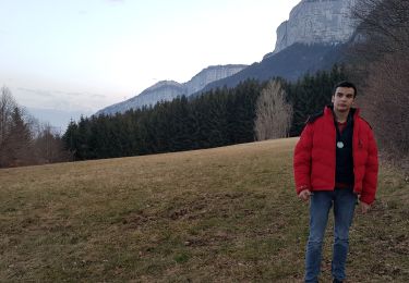
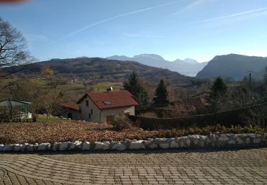
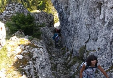
Belle boucle qui permet d'apprécier la vallée de l'Isère à partir des 2 versants de la pointe nord du Vercors (en d'autres termes, en direction de Valence et de l'autre en sortie de Grenoble). La première partie de la montée est soutenue jusqu'à la côte 409m puis continue plus tranquillement en forêt après le hameau des Maîtres. Avant d'arriver la Dent qui domine le Bec de l'Echaillon, un petit détour pour apprécier la verticalité du calcaire. A la Dent, la vue est face à la Chartreuse et ensuite, il ne faut pas manquer le belvédère qui découvre Grenoble, Belledonne et le Taillefer. Retour par Montaud et une petite rallonge à partir de la Colombière pour découvrir un chemin secret avec la source de Bacchus avant de retrouver l'itinéraire emprunté au début.

Elevation profile

Photos

Positioning

Country:
France
Region :
Auvergne-Rhône-Alpes
Department/Province :
Isère
Municipality :
Saint-Quentin-sur-Isère
Location:
Unknown
Start:(UTM)
700121 ; 5017094 (31T) N.

Trails nearby

Trail Walking Saint-Quentin-sur-Isère - 38 St Quentin sur isere - Photo
Walking
himba26100

Walking

Medium
Saint-Quentin-sur-Isère, Auvergne-Rhône-Alpes, Isère, France
17 km | 28 km-effort
7h 22min
Yes
Trail Walking Montaud - La Dent de Moirans - Photo
Walking
patjobou

Walking

Easy
Montaud, Auvergne-Rhône-Alpes, Isère, France
11 km | 16.4 km-effort
4h 38min
Yes
Trail Walking Montaud - La dent de Moirans - Photo
Walking
crocau

Walking

Very easy
(1)
Montaud, Auvergne-Rhône-Alpes, Isère, France
8.9 km | 13.5 km-effort
2h 57min
Yes
Trail Walking Montaud - BOUCLE MONTAUD DE T DE MOIRANS - Photo
Walking
floup6138

Walking

Medium
Montaud, Auvergne-Rhône-Alpes, Isère, France
11.1 km | 16.7 km-effort
3h 12min
Yes
Trail Walking Saint-Quentin-sur-Isère - st Quentin montaud boucle - Photo
Walking
floup6138

Walking

Medium
Saint-Quentin-sur-Isère, Auvergne-Rhône-Alpes, Isère, France
8.9 km | 16.3 km-effort
2h 58min
Yes
Trail Walking Noyarey - Ezy Montaud par les chemins communaux - Photo
Walking
crocau

Walking

Very easy
(1)
Noyarey, Auvergne-Rhône-Alpes, Isère, France
6.5 km | 10.6 km-effort
1h 51min
Yes
Trail Walking Montaud - Pas Brochier  - Photo
Walking
ajd26

Walking

Very difficult
Montaud, Auvergne-Rhône-Alpes, Isère, France
11.5 km | 27 km-effort
6h 0min
Yes
Trail Walking Montaud - DENT DE MOIRANS GROUPE 1 - Photo
Walking
floup6138

Walking

Difficult
Montaud, Auvergne-Rhône-Alpes, Isère, France
12.7 km | 21 km-effort
4h 14min
Yes
Trail Walking Montaud - bec deLorient - Photo
Walking
patchil

Walking

Very easy
(1)
Montaud, Auvergne-Rhône-Alpes, Isère, France
16 km | 30 km-effort
5h 54min
No


Close
My subscriptions