Trail Electric bike Roquestéron - Boucle Roquesteron - Collongues - St Auban - Aiglun - Roquesteron - Photo

Boucle Roquesteron - Collongues - St Auban - Aiglun - Roquesteron

 franquen
franquen

User

© OpenStreetMap contributors
Length
Length
72 km
Max alt
Max alt
1167 m
Uphill gradient
Uphill gradient
1831 m
Km-Effort
Km-Effort  
97 km
Min alt
Min alt
342 m
Downhill gradient
Downhill gradient
1862 m
Boucle
Boucle
Yes
Creation date :
2020-06-14 07:56:16.302
Updated on :
2020-06-14 15:58:23.907

(0 Reviews)

Electric bike
Electric bike
5h02
Difficulty : Medium

Scan this QR Code to open this trail in the SityTrail application

FREE GPS app for hiking

Logo SityTrail SityTrail

IGN / Geographical institutes

Download SityTrail from the App Store Download SityTrail from Google Play

Logo SityTrail SityTrail World

The world is yours!

Download SityTrail from the App Store Download SityTrail from Google Play Download SityTrail on Huawei AppGallery

About

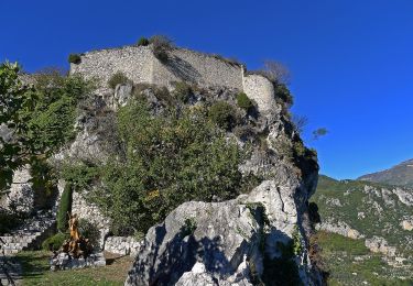
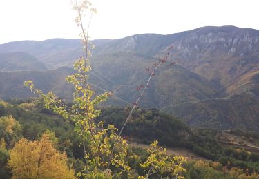
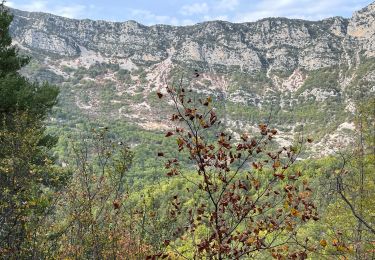
Trail Electric bike of 72 km to be discovered at Provence-Alpes-Côte d'Azur, Maritime Alps, Roquestéron. This trail is proposed by franquen.

Description

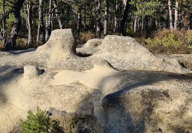
belle balade forêts pour l'aller et très minéral au retour . de belles clues (St Auban,  Le Mas, Aiglun)
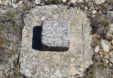
économiser la batterie car pas mal de dénivelé !

Elevation profile

Positioning

Country:
France
Region :
Provence-Alpes-Côte d'Azur
Department/Province :
Maritime Alps
Municipality :
Roquestéron
Location:
Unknown
Start:(UTM)
339529 ; 4859916 (32T) N.

Trails nearby

Trail On foot Cuébris - Traversée de l'Estéron - Etape 4 - Photo
On foot
PRO

On foot

Very difficult
Cuébris, Provence-Alpes-Côte d'Azur, Maritime Alps, France
24 km | 46 km-effort
10h 21min
No
Trail On foot Sigale - Circuit de la Cacia - Photo
On foot
PRO

On foot

Easy
Sigale, Provence-Alpes-Côte d'Azur, Maritime Alps, France
9.6 km | 18.7 km-effort
4h 15min
Yes
Trail Walking Sigale - Cime CACCIA, SIGALE (06) - Photo
Walking
ch2slv

Walking

Medium
(1)
Sigale, Provence-Alpes-Côte d'Azur, Maritime Alps, France
9.3 km | 17.7 km-effort
3h 42min
Yes
Trail Walking Sigale - Sigale, Cime Caccia, Clue Riolan - Photo
Walking
GrouGary

Walking

Easy
Sigale, Provence-Alpes-Côte d'Azur, Maritime Alps, France
10.9 km | 20 km-effort
3h 44min
Yes
Trail Walking Roquestéron - Roquesteron : la cime de la Cacia - Photo
Walking
ETMU5496

Walking

Difficult
Roquestéron, Provence-Alpes-Côte d'Azur, Maritime Alps, France
22 km | 39 km-effort
6h 9min
Yes
Trail Walking Roquestéron - mont auviere de roquesteron  - Photo
Walking
Mariephil

Walking

Very difficult
Roquestéron, Provence-Alpes-Côte d'Azur, Maritime Alps, France
14.3 km | 0 m-effort
6h 0min
Yes
Trail Walking Cuébris - cuebris st antonin  - Photo
Walking
Mariephil

Walking

Very difficult
Cuébris, Provence-Alpes-Côte d'Azur, Maritime Alps, France
12 km | 21 km-effort
4h 38min
Yes
Trail Walking Gréolières - Greolieres les neiges, le sentier des pivoines et les crêtes - Photo
Walking
domi06

Walking

Medium
Gréolières, Provence-Alpes-Côte d'Azur, Maritime Alps, France
14 km | 22 km-effort
5h 25min
Yes
Trail Walking Sigale - Sigale - Mont Saint Martin - Photo
Walking
ETMU5496

Walking

Difficult
Sigale, Provence-Alpes-Côte d'Azur, Maritime Alps, France
16.8 km | 30 km-effort
6h 56min
Yes


Close
My subscriptions