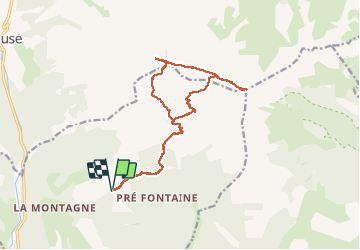
8.5 km | 15.9 km-effort
pic de bure
Joel26400
User
Length
17.4 km
Boucle
Yes
Creation date :
2020-07-19 04:41:39.558
Updated on :
2020-07-19 13:48:13.368
8h04
Difficulty : Difficult
FREE GPS app for hiking
About
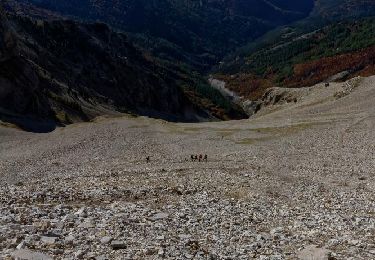
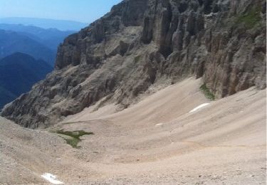
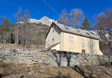
Trail Walking of 17.4 km to be discovered at Provence-Alpes-Côte d'Azur, Hautes-Alpes, Montmaur. This trail is proposed by Joel26400.
Description
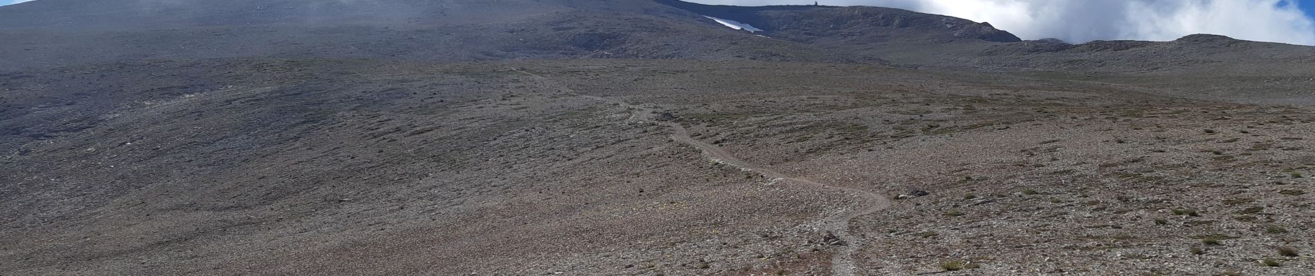
dommage du brouillard au sommet
Positioning
Country:
France
Region :
Provence-Alpes-Côte d'Azur
Department/Province :
Hautes-Alpes
Municipality :
Montmaur
Location:
Unknown
Start:(Dec)
Start:(UTM)
729217 ; 4942790 (31T) N.
Comments
Trails nearby
R13 Le Col de Lauteret
Walking
Medium
(1)
Le Dévoluy,
Provence-Alpes-Côte d'Azur,
Hautes-Alpes,
France
3h 12min
Yes
VTT16 - Boudelle
Mountain bike
Difficult
Le Dévoluy,
Provence-Alpes-Côte d'Azur,
Hautes-Alpes,
France
18.9 km | 30 km-effort
1h 51min
Yes
VTT28 - Rabioux
Mountain bike
Difficult
Montmaur,
Provence-Alpes-Côte d'Azur,
Hautes-Alpes,
France
24 km | 36 km-effort
2h 12min
Yes
R23 Observation des Chamois
Walking
Medium
Montmaur,
Provence-Alpes-Côte d'Azur,
Hautes-Alpes,
France
4.6 km | 9.3 km-effort
1h 56min
Yes
R20 Col de Conode
Walking
Medium
La Roche-des-Arnauds,
Provence-Alpes-Côte d'Azur,
Hautes-Alpes,
France
8.9 km | 17.6 km-effort
3h 33min
Yes
R18 Le Pic de Bure
Walking
Very difficult
Montmaur,
Provence-Alpes-Côte d'Azur,
Hautes-Alpes,
France
13.8 km | 33 km-effort
6h 20min
Yes
Dévoluy - Pic de Bure
Walking
Very difficult
(1)
Montmaur,
Provence-Alpes-Côte d'Azur,
Hautes-Alpes,
France
14.6 km | 33 km-effort
8h 20min
Yes
Pic et observatoire de BURE
Walking
Difficult
(1)
Montmaur,
Provence-Alpes-Côte d'Azur,
Hautes-Alpes,
France
22 km | 58 km-effort
4h 59min
Yes
Les Sauvas
Walking
Medium
Montmaur,
Provence-Alpes-Côte d'Azur,
Hautes-Alpes,
France
12.9 km | 21 km-effort
4h 42min
Yes