Trail Walking Storckensohn - Storckensohn-Gazon Vert vers l'étang - Photo

Storckensohn-Gazon Vert vers l'étang

 JCLUTT
JCLUTT

User

© OpenStreetMap contributors
Length
Length
10.8 km
Max alt
Max alt
937 m
Uphill gradient
Uphill gradient
546 m
Km-Effort
Km-Effort  
18.1 km
Min alt
Min alt
478 m
Downhill gradient
Downhill gradient
547 m
Boucle
Boucle
Yes
Creation date :
2020-07-30 07:42:56.0
Updated on :
2020-07-31 08:47:53.258

(0 Reviews)

Walking
Walking
4h12
Difficulty : Difficult

Scan this QR Code to open this trail in the SityTrail application

FREE GPS app for hiking

Logo SityTrail SityTrail

IGN / Geographical institutes

Download SityTrail from the App Store Download SityTrail from Google Play

Logo SityTrail SityTrail World

The world is yours!

Download SityTrail from the App Store Download SityTrail from Google Play Download SityTrail on Huawei AppGallery

About

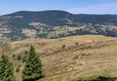
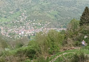
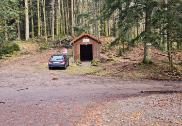
Trail Walking of 10.8 km to be discovered at Grand Est, Haut-Rhin, Storckensohn. This trail is proposed by JCLUTT.

Description

Très belle balade pratiquement entièrement à couvert. C'est bien appréciable par cette canicule !
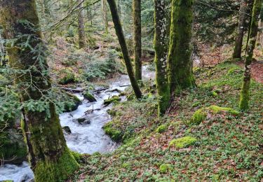
La montée est un peu rude vers les cascades et le refuge. Les cascades étaient totalement à sec, d'ailleurs !
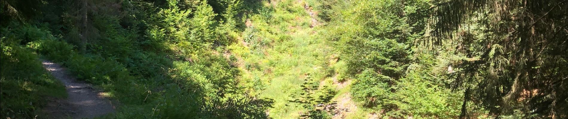
La descente par contre est  pénible par le Kuttelmattwalt, le sentier est
très rocheux et la plus part du temps, très raide.
Mal aux jambes garanti à l'arrivée !

Elevation profile

Photos

Positioning

Country:
France
Region :
Grand Est
Department/Province :
Haut-Rhin
Municipality :
Storckensohn
Location:
Unknown
Start:(UTM)
347322 ; 5304816 (32T) N.

Trails nearby

Trail Walking Bussang - Col de Bussang - Rouge Gazon - Séchenat - Photo
Walking
VacheKiri67

Walking

Difficult
(1)
Bussang, Grand Est, Vosges, France
15 km | 24 km-effort
6h 0min
No
Trail Walking Storckensohn - lac des perches marchettes - Photo
Walking
lacote

Walking

Medium
(1)
Storckensohn, Grand Est, Haut-Rhin, France
11.9 km | 20 km-effort
4h 8min
Yes
Trail Walking Storckensohn - 2022-07-16 Marche Auberge Gazon Vert Chapelle des Ves - Photo
Walking
GUIDE
holtzv

Walking

Very difficult
Storckensohn, Grand Est, Haut-Rhin, France
21 km | 37 km-effort
6h 11min
No
Trail Walking Oderen - 6146369-Chapelle St Nicolas 2 - Photo
Walking

Walking

Medium
(1)
Oderen, Grand Est, Haut-Rhin, France
10.9 km | 17.9 km-effort
3h 41min
Yes
Trail Walking Oderen - Oderen Bergenbach Langenbach - Photo
Walking
geishouse

Walking

Medium
Oderen, Grand Est, Haut-Rhin, France
7.1 km | 11.6 km-effort
3h 40min
No
Trail Walking Mollau - Le rossberg - Photo
Walking
margotte

Walking

Medium
Mollau, Grand Est, Haut-Rhin, France
14.9 km | 25 km-effort
7h 41min
Yes
Trail Walking Oderen - trek alsacien (1ère étape) - Photo
Walking
Godasses et Grosses Pattes

Walking

Medium
Oderen, Grand Est, Haut-Rhin, France
9.2 km | 18.1 km-effort
4h 0min
No
Trail Walking Ventron - Rando des Marcheurs..22/02/2024... - Photo
Walking
boubou68

Walking

Very difficult
Ventron, Grand Est, Vosges, France
19.5 km | 31 km-effort
5h 4min
Yes
Trail Walking Ventron - Rando les Marcheurs..Col d'Oderen.18 km..715m D+/- - Photo
Walking
boubou68

Walking

Very difficult
Ventron, Grand Est, Vosges, France
18.6 km | 28 km-effort
4h 38min
Yes


Close
My subscriptions