


GR10U et T depuis Gourette

LouisROGER
User GUIDE
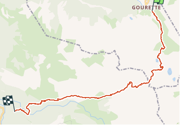

Length
17.8 km

Max alt
2466 m

Uphill gradient
1240 m
Km-Effort
35 km

Min alt
1082 m

Downhill gradient
1498 m
Boucle
No
Creation date :
2020-08-05 05:49:18.16
Updated on :
2020-08-05 17:07:41.244
10h50
Difficulty : Very difficult

FREE GPS app for hiking
 SityTrail
IGN / Geographical institutes
SityTrail Plus
The world is yours!
About
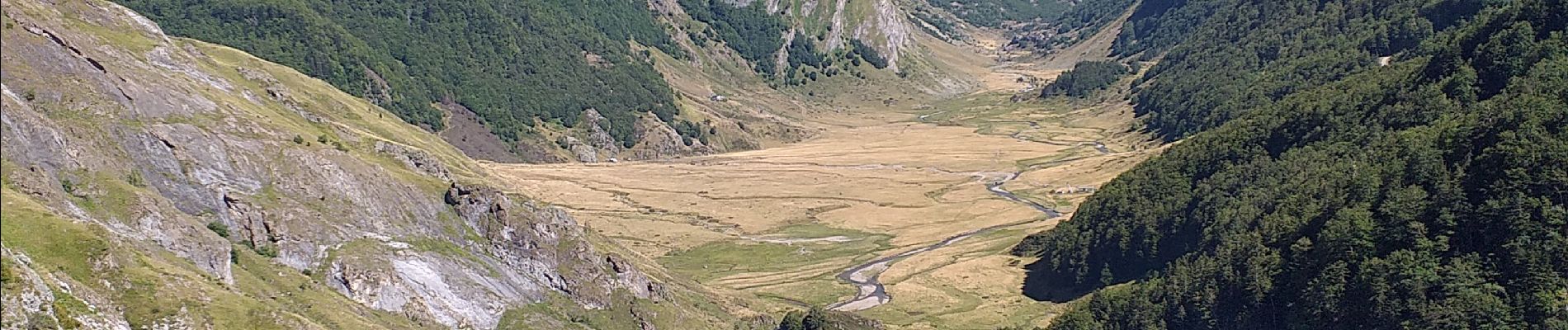
Trail Walking of 17.8 km to be discovered at New Aquitaine, Pyrénées-Atlantiques, Eaux-Bonnes. This trail is proposed by LouisROGER.
Photos


Positioning
Country:
France
Region :
New Aquitaine
Department/Province :
Pyrénées-Atlantiques
Municipality :
Eaux-Bonnes
Location:
Unknown
Start:(Dec)
Start:(UTM)
717887 ; 4759457 (30T) N.
Comments