Trail Walking Saint-Véran - Pic de Château Renard 2989 m - Photo
 astro45
astro45

User

© OpenStreetMap contributors
Length
Length
6.9 km
Max alt
Max alt
2961 m
Uphill gradient
Uphill gradient
926 m
Km-Effort
Km-Effort  
16.1 km
Min alt
Min alt
2027 m
Downhill gradient
Downhill gradient
1 m
Boucle
Boucle
No
Creation date :
2020-08-09 07:55:44.0
Updated on :
2020-08-11 16:36:07.58

(1 Reviews)

Walking
Walking
2h43
Difficulty : Medium

Scan this QR Code to open this trail in the SityTrail application

FREE GPS app for hiking

Logo SityTrail SityTrail

IGN / Geographical institutes

Download SityTrail from the App Store Download SityTrail from Google Play

Logo SityTrail SityTrail World

The world is yours!

Download SityTrail from the App Store Download SityTrail from Google Play Download SityTrail on Huawei AppGallery

About

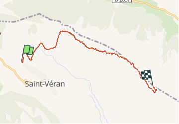
Trail Walking of 6.9 km to be discovered at Provence-Alpes-Côte d'Azur, Hautes-Alpes, Saint-Véran. This trail is proposed by astro45.

Description

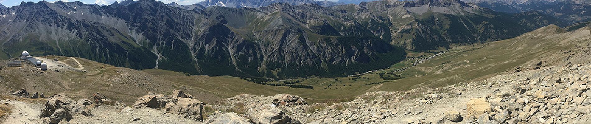
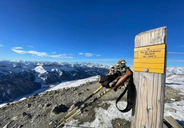
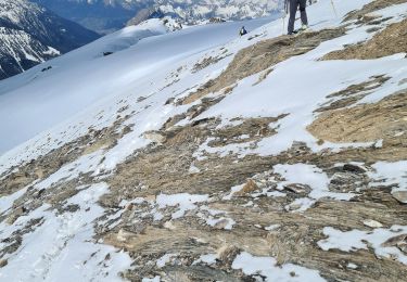
Belle montée dans les alpages au-dessus du village de Saint Véran vers le pic de Château Renard. Passage par les installations de ski l'hiver pour se continuer par un chemin bien balisé dans les rochers et se terminer par l'arrivée à l'observatoire astronomique de l'association AstroQueyras au pied du pic. Belle vue sur l'ensemble du massif.

Elevation profile

Photos

Positioning

Country:
France
Region :
Provence-Alpes-Côte d'Azur
Department/Province :
Hautes-Alpes
Municipality :
Saint-Véran
Location:
Unknown
Start:(UTM)
330533 ; 4952390 (32T) N.

Comments

Please log in to post a review or rate the element


Fait début juillet 2018. Pas trouvé le chemin après le TS du Grand Serre (névés), mais avons continué et sommes arrivé un peu trop bas (sur le chemin d'accès à l'Observatoire). Merci pour le bon tracé. Superbe vue sur St Véran, les massifs de la Font Sancte et du Viso Retour possible par la piste d'accès puis le grand canal


Trails nearby

Trail Walking Saint-Véran - Lac de la Blanche, lacs blanchet et pic de Caramantran - Photo
Walking
GUIDE
amiral13

Walking

Medium
(2)
Saint-Véran, Provence-Alpes-Côte d'Azur, Hautes-Alpes, France
13.1 km | 23 km-effort
6h 12min
Yes
Trail Walking Saint-Véran - boucle St Veran - Refuge de la blanche - Photo
Walking
gildascb

Walking

Medium
(1)
Saint-Véran, Provence-Alpes-Côte d'Azur, Hautes-Alpes, France
19.3 km | 28 km-effort
5h 15min
Yes
Trail Walking Saint-Véran - Pic de Caramantran - Photo
Walking
GUIDE
R@ph

Walking

Very difficult
Saint-Véran, Provence-Alpes-Côte d'Azur, Hautes-Alpes, France
12 km | 23 km-effort
4h 41min
Yes
Trail Other activity Molines-en-Queyras - ski tour du Rouchon - Photo
Other activity
CYCLOHC

Other activity

Medium
(2)
Molines-en-Queyras, Provence-Alpes-Côte d'Azur, Hautes-Alpes, France
8.6 km | 20 km-effort
5h 24min
No
Trail Walking Saint-Véran - saint véranda les hameaux le champ et le raux - Photo
Walking
marchev

Walking

Easy
Saint-Véran, Provence-Alpes-Côte d'Azur, Hautes-Alpes, France
4.9 km | 7.9 km-effort
1h 44min
No
Trail Snowshoes Saint-Véran - Saint Véran - Col de Chamoussière - Pic de Caramantran - Refuge de la Blanche - Photo
Snowshoes
Pierre Lefèvre

Snowshoes

Difficult
Saint-Véran, Provence-Alpes-Côte d'Azur, Hautes-Alpes, France
22 km | 38 km-effort
5h 30min
Yes
Trail Snowshoes Molines-en-Queyras - Pont de Lariane - Col de Longet - Observatoire et Pic de Château Renard - Photo
Snowshoes
Pierre Lefèvre

Snowshoes

Medium
Molines-en-Queyras, Provence-Alpes-Côte d'Azur, Hautes-Alpes, France
16.1 km | 30 km-effort
5h 0min
Yes
Trail Touring skiing Saint-Véran - tête de la Cula - Photo
Touring skiing
tchoua

Touring skiing

Difficult
Saint-Véran, Provence-Alpes-Côte d'Azur, Hautes-Alpes, France
14.2 km | 31 km-effort
3h 31min
Yes
Trail Touring skiing Saint-Véran - pointe des marcelettes  - Photo
Touring skiing
tchoua

Touring skiing

Difficult
Saint-Véran, Provence-Alpes-Côte d'Azur, Hautes-Alpes, France
9.3 km | 23 km-effort
2h 41min
No


Close
My subscriptions