Trail Snowshoes Molines-en-Queyras - Pont de Lariane - Col de Longet - Observatoire et Pic de Château Renard - Photo

Pont de Lariane - Col de Longet - Observatoire et Pic de Château Renard

© OpenStreetMap contributors
Length
Length
16.1 km
Max alt
Max alt
2961 m
Uphill gradient
Uphill gradient
1034 m
Km-Effort
Km-Effort  
30 km
Min alt
Min alt
2022 m
Downhill gradient
Downhill gradient
1035 m
Boucle
Boucle
Yes
Creation date :
2023-04-12 11:23:27.256
Updated on :
2023-04-12 11:45:41.057

(0 Reviews)

Snowshoes
Snowshoes
5h00
Difficulty : Medium

Scan this QR Code to open this trail in the SityTrail application

FREE GPS app for hiking

Logo SityTrail SityTrail

IGN / Geographical institutes

Download SityTrail from the App Store Download SityTrail from Google Play

Logo SityTrail SityTrail World

The world is yours!

Download SityTrail from the App Store Download SityTrail from Google Play Download SityTrail on Huawei AppGallery

About

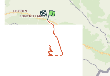
Trail Snowshoes of 16.1 km to be discovered at Provence-Alpes-Côte d'Azur, Hautes-Alpes, Molines-en-Queyras. This trail is proposed by Pierre Lefèvre.

Description

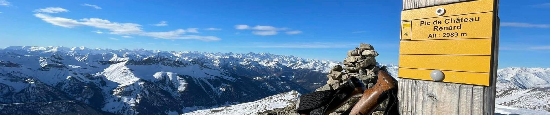
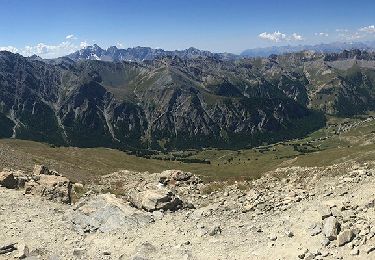
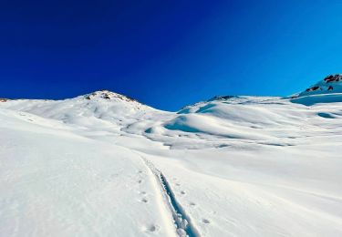
Belle randonnée en Aller/Retour depuis la vallée Agnel jusqu'aux emblématiques observatoire et pic de Château Renard (2989 m).

L'Aller/Retour prend environ 5 heures sans compter les pauses.

Retrouvez le compte-rendu de mes randos en raquettes dans le Queyras sur mon blog : https://par-monts-et-merveilles.be/2023/04/12/le-queyras-en-raquettes-janvier-2023/

Démarrez du parking situé au Pont de Lariane, c'est un bon point de départ pour de nombreuses randonnées dans la vallée Agnel.

Vous pouvez aussi démarrer de Fontgillarde gardant l'Aigue Agnelle sur votre gauche jusqu'au Pont de Lariane, comptez 2 Km du village jusqu'au parking.

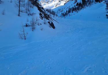
Traversez le bois de mélèzes en suivant les traces de ski jusqu'au col de Longet.

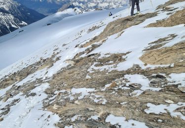
Suivez le sentier qui descend plein Ouest pendant un kilomètre avant de remonter en direction de l'observatoire et du pic de Château Renard.

Le retour se fait par le même chemin. A moins que vous ne souhaitiez longer la crête jusqu'au col de Longet ; l'itinéraire est parfois un peu scabreux par cette seconde option.

Elevation profile

Photos

Positioning

Country:
France
Region :
Provence-Alpes-Côte d'Azur
Department/Province :
Hautes-Alpes
Municipality :
Molines-en-Queyras
Location:
Unknown
Start:(UTM)
334010 ; 4953875 (32T) N.

Trails nearby

Trail Walking Saint-Véran - Lac de la Blanche, lacs blanchet et pic de Caramantran - Photo
Walking
GUIDE
amiral13

Walking

Medium
(2)
Saint-Véran, Provence-Alpes-Côte d'Azur, Hautes-Alpes, France
13.1 km | 23 km-effort
6h 12min
Yes
Trail Walking Saint-Véran - Pic de Château Renard 2989 m - Photo
Walking
astro45

Walking

Medium
(1)
Saint-Véran, Provence-Alpes-Côte d'Azur, Hautes-Alpes, France
6.9 km | 16.1 km-effort
2h 43min
No
Trail Walking Saint-Véran - boucle St Veran - Refuge de la blanche - Photo
Walking
gildascb

Walking

Medium
(1)
Saint-Véran, Provence-Alpes-Côte d'Azur, Hautes-Alpes, France
19.3 km | 28 km-effort
5h 15min
Yes
Trail Walking Saint-Véran - Pic de Caramantran - Photo
Walking
GUIDE
R@ph

Walking

Very difficult
Saint-Véran, Provence-Alpes-Côte d'Azur, Hautes-Alpes, France
12 km | 23 km-effort
4h 41min
Yes
Trail Other activity Molines-en-Queyras - ski tour du Rouchon - Photo
Other activity
CYCLOHC

Other activity

Medium
(2)
Molines-en-Queyras, Provence-Alpes-Côte d'Azur, Hautes-Alpes, France
8.6 km | 20 km-effort
5h 24min
No
Trail Walking Saint-Véran - saint véranda les hameaux le champ et le raux - Photo
Walking
marchev

Walking

Easy
Saint-Véran, Provence-Alpes-Côte d'Azur, Hautes-Alpes, France
4.9 km | 7.9 km-effort
1h 44min
No
Trail Snowshoes Saint-Véran - Saint Véran - Col de Chamoussière - Pic de Caramantran - Refuge de la Blanche - Photo
Snowshoes
Pierre Lefèvre

Snowshoes

Difficult
Saint-Véran, Provence-Alpes-Côte d'Azur, Hautes-Alpes, France
22 km | 38 km-effort
5h 30min
Yes
Trail Touring skiing Saint-Véran - tête de la Cula - Photo
Touring skiing
tchoua

Touring skiing

Difficult
Saint-Véran, Provence-Alpes-Côte d'Azur, Hautes-Alpes, France
14.2 km | 31 km-effort
3h 31min
Yes
Trail Touring skiing Saint-Véran - pointe des marcelettes  - Photo
Touring skiing
tchoua

Touring skiing

Difficult
Saint-Véran, Provence-Alpes-Côte d'Azur, Hautes-Alpes, France
9.3 km | 23 km-effort
2h 41min
No


Close
My subscriptions