


lac des miel - Roche de vic

joebartwix
User
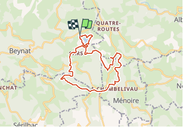

Length
16.3 km

Max alt
626 m

Uphill gradient
387 m
Km-Effort
21 km

Min alt
429 m

Downhill gradient
389 m
Boucle
Yes
Creation date :
2020-08-15 05:43:23.949
Updated on :
2020-08-15 09:10:53.953
3h10
Difficulty : Easy

FREE GPS app for hiking
 SityTrail
IGN / Geographical institutes
SityTrail Plus
The world is yours!
About
Trail Nordic walking of 16.3 km to be discovered at New Aquitaine, Corrèze, Beynat. This trail is proposed by joebartwix.
Description
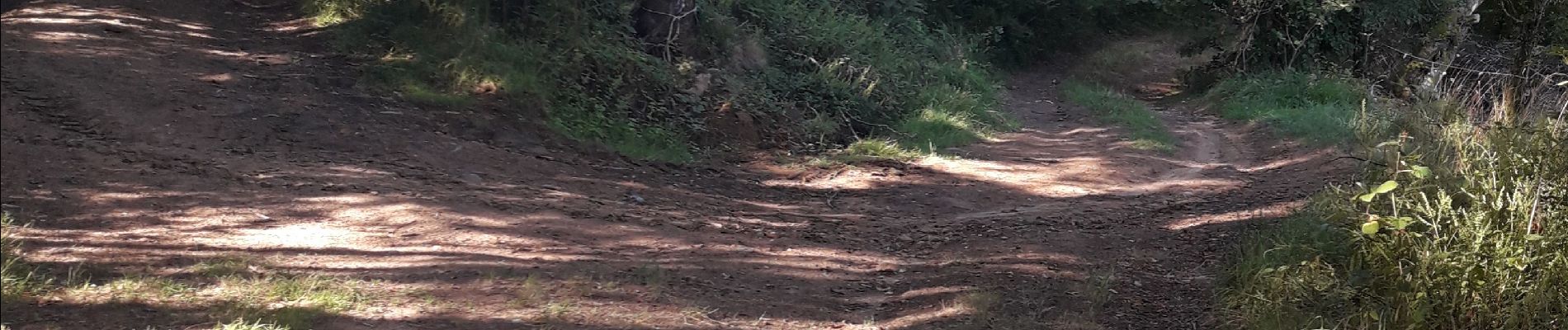
A la photo, prendre à gauche. Erreur balisage.
Photos

Positioning
Country:
France
Region :
New Aquitaine
Department/Province :
Corrèze
Municipality :
Beynat
Location:
Unknown
Start:(Dec)
Start:(UTM)
402702 ; 4998358 (31T) N.
Comments