


rdpr gaschney

stempfel52
User GUIDE
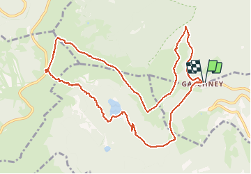

Length
12 km

Max alt
1338 m

Uphill gradient
532 m
Km-Effort
19.1 km

Min alt
923 m

Downhill gradient
531 m
Boucle
Yes
Creation date :
2020-08-18 06:59:41.319
Updated on :
2020-08-28 15:22:26.657
4h52
Difficulty : Difficult

FREE GPS app for hiking
 SityTrail
IGN / Geographical institutes
SityTrail Plus
The world is yours!
About
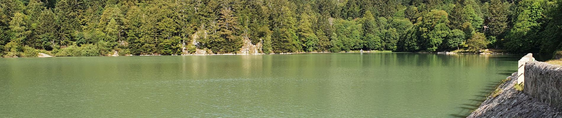
Trail Walking of 12 km to be discovered at Grand Est, Haut-Rhin, Stosswihr. This trail is proposed by stempfel52.
Photos


26 photos in total. Please click on a photo to see them all in the gallery.
Positioning
Country:
France
Region :
Grand Est
Department/Province :
Haut-Rhin
Municipality :
Stosswihr
Location:
Unknown
Start:(Dec)
Start:(UTM)
354430 ; 5321966 (32U) N.
Comments