Trail Walking Val-d'Isère - pointe de Méan Martin - Photo
 amiral13
amiral13

User GUIDE

© OpenStreetMap contributors
Length
Length
22 km
Max alt
Max alt
3318 m
Uphill gradient
Uphill gradient
1410 m
Km-Effort
Km-Effort  
41 km
Min alt
Min alt
1941 m
Downhill gradient
Downhill gradient
1409 m
Boucle
Boucle
Yes
Creation date :
2020-08-23 06:39:06.271
Updated on :
2020-12-23 17:52:33.639

(0 Reviews)

Walking
Walking
9h15
Difficulty : Very difficult

Scan this QR Code to open this trail in the SityTrail application

FREE GPS app for hiking

Logo SityTrail SityTrail

IGN / Geographical institutes

Download SityTrail from the App Store Download SityTrail from Google Play

Logo SityTrail SityTrail World

The world is yours!

Download SityTrail from the App Store Download SityTrail from Google Play Download SityTrail on Huawei AppGallery

About

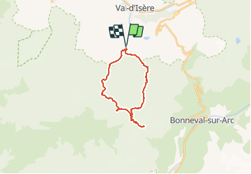
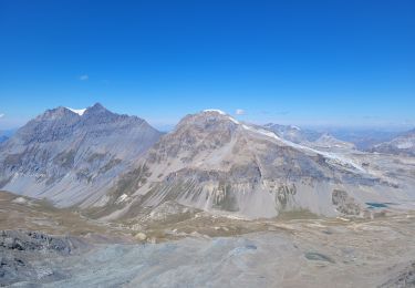
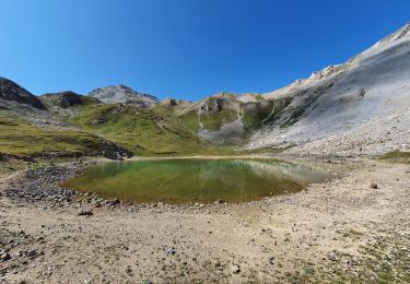
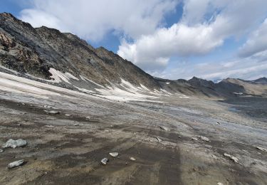
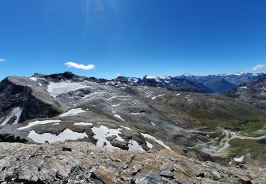
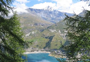
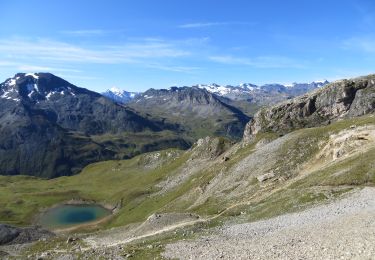
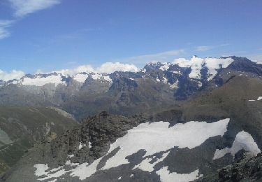
Trail Walking of 22 km to be discovered at Auvergne-Rhône-Alpes, Savoy, Val-d'Isère. This trail is proposed by amiral13.

Description

attention les 400 derniers mètres de dénivelée sont hors sentier et donc à réserver aux randonneurs expérimentés.
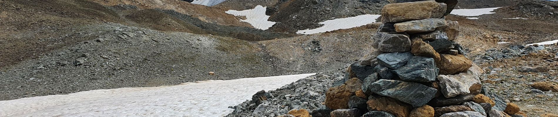
tout d'abord un cheminement assez facile pour contourner la pointe 3130, puis une traversée sous la dite pointe à flanc de talus plus ou moins instable. On remonte ensuite ce talus vers la ligne de crête, que l'on suit assez facilement sud-est jusqu'à faire la jonction avec une arête orientée est-nord-est , constituée de gros blocs plus ou moins stables et de pierres levées. le sommet,marqué par un gros cairn se situe au bout de cette arête.

Elevation profile

Photos

39 photos in total. Please click on a photo to see them all in the gallery.

Positioning

Country:
France
Region :
Auvergne-Rhône-Alpes
Department/Province :
Savoy
Municipality :
Val-d'Isère
Location:
Unknown
Start:(UTM)
341375 ; 5031920 (32T) N.

Trails nearby

Trail Walking Val-d'Isère - rocher du Charvet - Photo
Walking
GUIDE
amiral13

Walking

Difficult
(1)
Val-d'Isère, Auvergne-Rhône-Alpes, Savoy, France
12.6 km | 20 km-effort
5h 10min
No
Trail Walking Val-d'Isère - Les cascades des salins au départ de val d’Isère  - Photo
Walking
Klhn

Walking

Medium
(1)
Val-d'Isère, Auvergne-Rhône-Alpes, Savoy, France
9.5 km | 15.2 km-effort
3h 40min
Yes
Trail Walking Val-d'Isère - pointe de la Sana - Photo
Walking
GUIDE
amiral13

Walking

Very difficult
Val-d'Isère, Auvergne-Rhône-Alpes, Savoy, France
18.6 km | 38 km-effort
10h 38min
Yes
Trail Walking Val-d'Isère - Lac, col et pointe de la Bailletaz - Photo
Walking
GUIDE
amiral13

Walking

Difficult
Val-d'Isère, Auvergne-Rhône-Alpes, Savoy, France
9.6 km | 23 km-effort
4h 35min
Yes
Trail Walking Val-d'Isère - pointe de la Sana - Photo
Walking
GUIDE
amiral13

Walking

Very difficult
Val-d'Isère, Auvergne-Rhône-Alpes, Savoy, France
18.4 km | 38 km-effort
7h 3min
Yes
Trail Walking Bonneval-sur-Arc - signal de l'Iseran - Photo
Walking
GUIDE
amiral13

Walking

Very difficult
Bonneval-sur-Arc, Auvergne-Rhône-Alpes, Savoy, France
5.2 km | 11.7 km-effort
3h 9min
Yes
Trail Walking Val-d'Isère - tour du Roc de la Tovière - Photo
Walking
GUIDE
amiral13

Walking

Easy
Val-d'Isère, Auvergne-Rhône-Alpes, Savoy, France
8.8 km | 15.7 km-effort
4h 46min
Yes
Trail Walking Val-d'Isère - Col et pointe de la Bailletta - Photo
Walking
GUIDE
amiral13

Walking

Medium
Val-d'Isère, Auvergne-Rhône-Alpes, Savoy, France
11.6 km | 26 km-effort
4h 43min
Yes
Trail Walking Val-d'Isère - col et pointe des fours - Photo
Walking
GUIDE
amiral13

Walking

Medium
Val-d'Isère, Auvergne-Rhône-Alpes, Savoy, France
14.1 km | 29 km-effort
5h 39min
Yes


Close
My subscriptions