Trail Walking Sentenac-d'Oust - 2020-08-25 col de la cor - col d'Auédole - étang d'Ayes - col d'Auédole - étang d'Eychelle - col de la core. - Photo

2020-08-25 col de la cor - col d'Auédole - étang d'Ayes - col d'Auédole - étang d'Eychelle - col de la core.

 jacq58
jacq58

User

© OpenStreetMap contributors
Length
Length
11.4 km
Max alt
Max alt
1918 m
Uphill gradient
Uphill gradient
741 m
Km-Effort
Km-Effort  
21 km
Min alt
Min alt
1386 m
Downhill gradient
Downhill gradient
738 m
Boucle
Boucle
Yes
Creation date :
2020-08-25 15:42:34.649
Updated on :
2020-08-25 16:37:28.765

(1 Reviews)

Walking
Walking
4h16
Difficulty : Difficult

Scan this QR Code to open this trail in the SityTrail application

FREE GPS app for hiking

Logo SityTrail SityTrail

IGN / Geographical institutes

Download SityTrail from the App Store Download SityTrail from Google Play

Logo SityTrail SityTrail World

The world is yours!

Download SityTrail from the App Store Download SityTrail from Google Play Download SityTrail on Huawei AppGallery

About

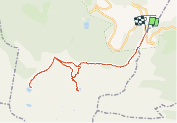
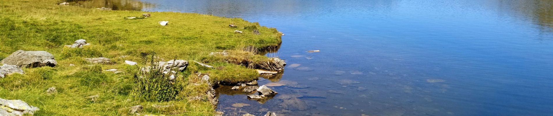
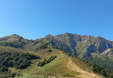
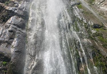
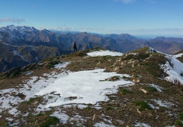
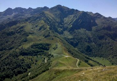
Trail Walking of 11.4 km to be discovered at Occitania, Ariège, Sentenac-d'Oust. This trail is proposed by jacq58.

Description

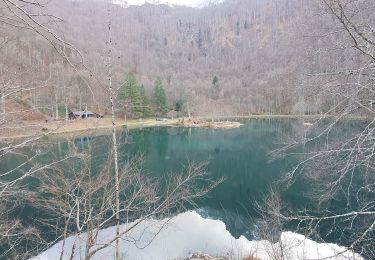
De beaux lacs mais randonné difficile avec certain sentiers chaotiques avec pierres et pente raides.

Elevation profile

Photos

Positioning

Country:
France
Region :
Occitania
Department/Province :
Ariège
Municipality :
Sentenac-d'Oust
Location:
Unknown
Start:(UTM)
345213 ; 4746865 (31T) N.

Comments

Please log in to post a review or rate the element


Trails nearby

Trail Walking Bethmale - Bethmale - Photo
Walking
Gepeto_22

Walking

Medium
(2)
Bethmale, Occitania, Ariège, France
5.4 km | 8.8 km-effort
2h 20min
Yes
Trail Walking Bethmale -  Circuit des cinq étangs (2237m) - Photo
Walking
tigrou31

Walking

Difficult
(3)
Bethmale, Occitania, Ariège, France
18.1 km | 33 km-effort
Unknown
Yes
Trail Walking Bethmale - Cap de Bouirex - Photo
Walking
counoise

Walking

Difficult
Bethmale, Occitania, Ariège, France
8.8 km | 16.1 km-effort
3h 18min
Yes
Trail Walking Seix - 2022 TRANSPYRÉNÉENNE : 6ème etape : Refuge d’Esbints - cabane Aula - Photo
Walking
LEGUE

Walking

Very difficult
Seix, Occitania, Ariège, France
23 km | 38 km-effort
6h 18min
No
Trail On foot Bethmale - Grand circuit dans la Réserve Naturelle du Mont Valier - Photo
On foot
PRO

On foot

Easy
Bethmale, Occitania, Ariège, France
9.5 km | 19.6 km-effort
4h 26min
No
Trail Walking Bethmale - refuge Salvador - Photo
Walking
chrisgps

Walking

Very difficult
Bethmale, Occitania, Ariège, France
16 km | 25 km-effort
5h 46min
Yes
Trail Walking Bethmale - cap de l'auternac  en boucle - Photo
Walking
chrisgps

Walking

Difficult
Bethmale, Occitania, Ariège, France
15 km | 30 km-effort
7h 51min
Yes
Trail Walking Seix - Cabane d'Aula - Photo
Walking
chrisgps

Walking

Very difficult
Seix, Occitania, Ariège, France
18.1 km | 31 km-effort
7h 2min
Yes
Trail Walking Bethmale - Pyrénées-140903 - CapBouirex - Photo
Walking
randodan

Walking

Difficult
Bethmale, Occitania, Ariège, France
4.8 km | 10.9 km-effort
5h 15min
Yes


Close
My subscriptions