Trail Walking Vallouise-Pelvoux - 2020-09-07 Marche Ailefroide Glaciers Blanc et Noir - Photo

2020-09-07 Marche Ailefroide Glaciers Blanc et Noir

 holtzv
holtzv

User GUIDE

© OpenStreetMap contributors
Length
Length
14 km
Max alt
Max alt
2547 m
Uphill gradient
Uphill gradient
1105 m
Km-Effort
Km-Effort  
29 km
Min alt
Min alt
1864 m
Downhill gradient
Downhill gradient
1106 m
Boucle
Boucle
Yes
Creation date :
2020-09-07 09:15:45.604
Updated on :
2020-09-21 16:23:20.283

(0 Reviews)

Walking
Walking
4h36
Difficulty : Easy

Scan this QR Code to open this trail in the SityTrail application

FREE GPS app for hiking

Logo SityTrail SityTrail

IGN / Geographical institutes

Download SityTrail from the App Store Download SityTrail from Google Play

Logo SityTrail SityTrail World

The world is yours!

Download SityTrail from the App Store Download SityTrail from Google Play Download SityTrail on Huawei AppGallery

About

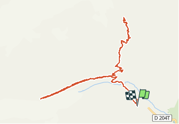
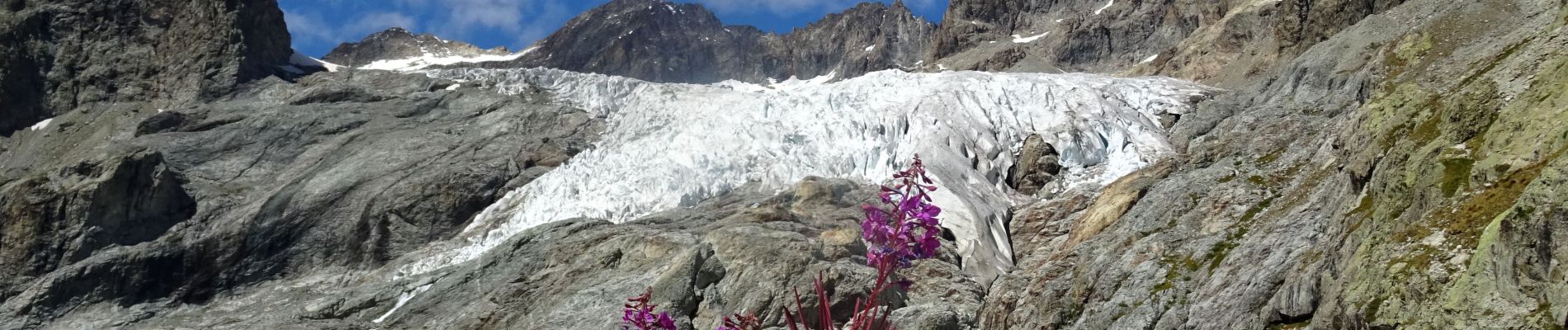
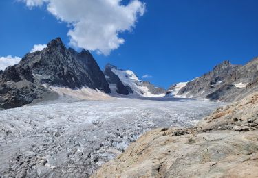
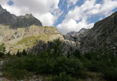
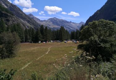
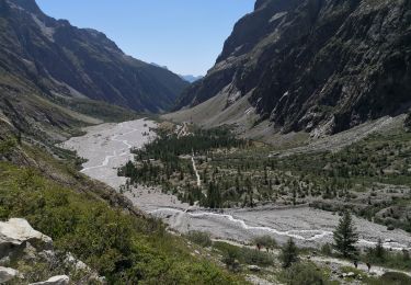
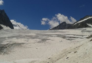
Trail Walking of 14 km to be discovered at Provence-Alpes-Côte d'Azur, Hautes-Alpes, Vallouise-Pelvoux. This trail is proposed by holtzv.

Description

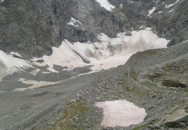
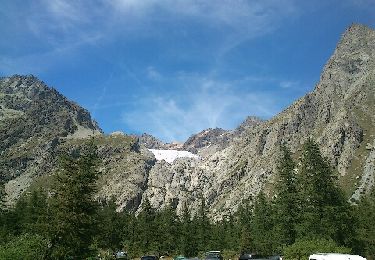
Boucle depuis le fond de la vallée d’Ailefroide au Pré de Madame Carle (alt 1900m) pour monter au refuge du Glacier Blanc (alt 2542m) offrant une belle vue sur ce dernier et sur le Mont Pelvoux. Repas un peu plus bas à l’ancien refuge Tuckett. Avant de revenir au parking, passage par le Glacier Noir (alt 2500m) et la vue sur la Barre des Ecrins.

Elevation profile

Photos

Positioning

Country:
France
Region :
Provence-Alpes-Côte d'Azur
Department/Province :
Hautes-Alpes
Municipality :
Vallouise-Pelvoux
Location:
Pelvoux
Start:(UTM)
296029 ; 4976939 (32T) N.

Trails nearby

Trail Walking Vallouise-Pelvoux - traversé du pelvoux - Photo
Walking
bellouelo46

Walking

Very easy
(2)
Vallouise-Pelvoux, Provence-Alpes-Côte d'Azur, Hautes-Alpes, France
25 km | 58 km-effort
19h 10min
No
Trail Walking Vallouise-Pelvoux - le refuge glacier blanc et le point de vue sur la barre - Photo
Walking
GUIDE
amiral13

Walking

Very difficult
Vallouise-Pelvoux, Provence-Alpes-Côte d'Azur, Hautes-Alpes, France
14.1 km | 29 km-effort
7h 51min
Yes
Trail Walking Vallouise-Pelvoux - 05-pre-Mme-Carle-glacier-noir-8km-600m-aout21 - Photo
Walking
SyMA

Walking

Medium
Vallouise-Pelvoux, Provence-Alpes-Côte d'Azur, Hautes-Alpes, France
8.4 km | 16.3 km-effort
4h 8min
Yes
Trail Walking Vallouise-Pelvoux - Source Puiseux - Photo
Walking
Sigmut

Walking

Medium
Vallouise-Pelvoux, Provence-Alpes-Côte d'Azur, Hautes-Alpes, France
9 km | 15.3 km-effort
4h 17min
Yes
Trail Walking Vallouise-Pelvoux - Le Glacier Blanc - Pré Madame Carle - Photo
Walking
Sigmut

Walking

Medium
Vallouise-Pelvoux, Provence-Alpes-Côte d'Azur, Hautes-Alpes, France
6.6 km | 12.2 km-effort
4h 23min
Yes
Trail Walking Vallouise-Pelvoux - Les Écrins jour 2 - Photo
Walking
Roulland

Walking

Medium
Vallouise-Pelvoux, Provence-Alpes-Côte d'Azur, Hautes-Alpes, France
6.4 km | 16.5 km-effort
2h 44min
No
Trail Walking Vallouise-Pelvoux - Les Écrins jour 1 bis - Photo
Walking
Roulland

Walking

Easy
Vallouise-Pelvoux, Provence-Alpes-Côte d'Azur, Hautes-Alpes, France
4.9 km | 6.2 km-effort
1h 29min
No
Trail Walking Vallouise-Pelvoux - Les Écrins Jour 1 - Photo
Walking
Roulland

Walking

Easy
Vallouise-Pelvoux, Provence-Alpes-Côte d'Azur, Hautes-Alpes, France
3.7 km | 9.6 km-effort
1h 25min
No
Trail Walking Vallouise-Pelvoux - glacier blanc  - Photo
Walking
Philou888

Walking

Medium
Vallouise-Pelvoux, Provence-Alpes-Côte d'Azur, Hautes-Alpes, France
6.4 km | 12.1 km-effort
2h 35min
Yes


Close
My subscriptions