2020-09-09 Marche Lac de L'Eychauda

holtzv
User GUIDE
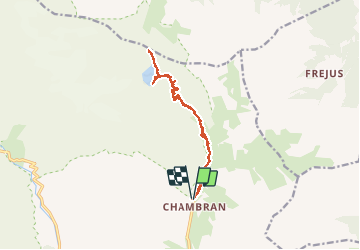

Length
14.5 km

Max alt
2668 m

Uphill gradient
977 m
Km-Effort
28 km

Min alt
1714 m

Downhill gradient
979 m
Boucle
Yes
Creation date :
2020-09-09 07:35:14.673
Updated on :
2020-09-21 16:59:24.425
6h02
Difficulty : Easy

FREE GPS app for hiking
 SityTrail
IGN / Geographical institutes
SityTrail Plus
The world is yours!
About
Trail Walking of 14.5 km to be discovered at Provence-Alpes-Côte d'Azur, Hautes-Alpes, Vallouise-Pelvoux. This trail is proposed by holtzv.
Description
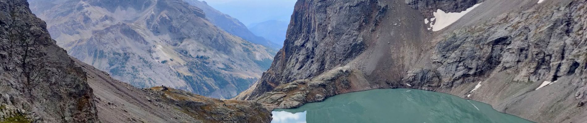
Depuis le parking du Chambran, ascension en direct vers le lac de l’Eychauda (alt 2539m) et la col des Grangettes (alt 2684m) offrant une belle vue sur le Mont Thabor.
Photos


Positioning
Country:
France
Region :
Provence-Alpes-Côte d'Azur
Department/Province :
Hautes-Alpes
Municipality :
Vallouise-Pelvoux
Location:
Pelvoux
Start:(Dec)
Start:(UTM)
302046 ; 4975093 (32T) N.
Comments