Trail Walking Vallouise-Pelvoux - 2020-09-09 Marche Lac de L'Eychauda - Photo

2020-09-09 Marche Lac de L'Eychauda

 holtzv
holtzv

User GUIDE

© OpenStreetMap contributors
Length
Length
14.5 km
Max alt
Max alt
2668 m
Uphill gradient
Uphill gradient
977 m
Km-Effort
Km-Effort  
28 km
Min alt
Min alt
1714 m
Downhill gradient
Downhill gradient
979 m
Boucle
Boucle
Yes
Creation date :
2020-09-09 07:35:14.673
Updated on :
2020-09-21 16:59:24.425

(1 Reviews)

Walking
Walking
6h02
Difficulty : Easy

Scan this QR Code to open this trail in the SityTrail application

FREE GPS app for hiking

Logo SityTrail SityTrail

IGN / Geographical institutes

Download SityTrail from the App Store Download SityTrail from Google Play

Logo SityTrail SityTrail World

The world is yours!

Download SityTrail from the App Store Download SityTrail from Google Play Download SityTrail on Huawei AppGallery

About

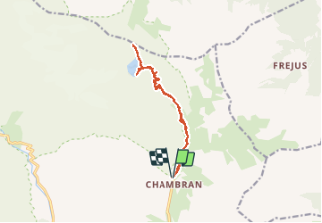
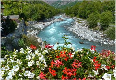
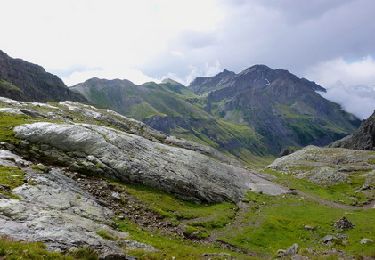
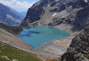
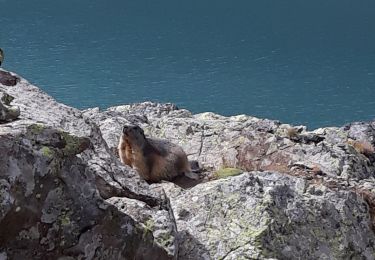
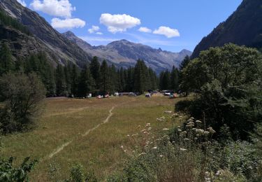
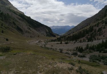
Trail Walking of 14.5 km to be discovered at Provence-Alpes-Côte d'Azur, Hautes-Alpes, Vallouise-Pelvoux. This trail is proposed by holtzv.

Description

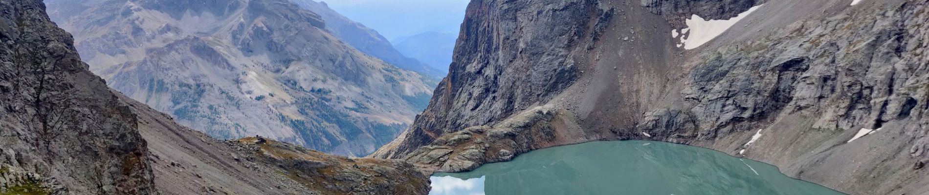
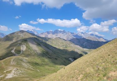
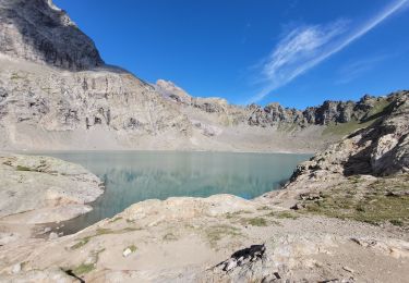
Depuis le parking du Chambran, ascension en direct vers le lac de l’Eychauda (alt 2539m) et la col des Grangettes (alt 2684m) offrant une belle vue sur le Mont Thabor.

Elevation profile

Photos

Positioning

Country:
France
Region :
Provence-Alpes-Côte d'Azur
Department/Province :
Hautes-Alpes
Municipality :
Vallouise-Pelvoux
Location:
Pelvoux
Start:(UTM)
302046 ; 4975093 (32T) N.

Comments

Please log in to post a review or rate the element


Trails nearby

Trail Walking Vallouise-Pelvoux - traversé du pelvoux - Photo
Walking
bellouelo46

Walking

Very easy
(2)
Vallouise-Pelvoux, Provence-Alpes-Côte d'Azur, Hautes-Alpes, France
25 km | 58 km-effort
19h 10min
No
Trail Walking Saint-Chaffrey - le Prorel au départ de la Serre Chevalier - Photo
Walking
GUIDE
amiral13

Walking

Easy
Saint-Chaffrey, Provence-Alpes-Côte d'Azur, Hautes-Alpes, France
7.9 km | 13.8 km-effort
3h 41min
Yes
Trail Walking Vallouise-Pelvoux - lac de l'Eychauda col des Grangettes pas de l'âne et col de l'Eychauda - Photo
Walking
GUIDE
amiral13

Walking

Difficult
Vallouise-Pelvoux, Provence-Alpes-Côte d'Azur, Hautes-Alpes, France
15.8 km | 31 km-effort
7h 46min
Yes
Trail On foot Vallouise-Pelvoux - Boucle vers Puy Aillaud - Photo
On foot
PRO

On foot

Easy
Vallouise-Pelvoux, Provence-Alpes-Côte d'Azur, Hautes-Alpes, France
5.3 km | 10.2 km-effort
2h 19min
No
Trail Walking Vallouise-Pelvoux - Lac Eychauda - Photo
Walking
MarcLEBARON

Walking

Medium
(1)
Vallouise-Pelvoux, Provence-Alpes-Côte d'Azur, Hautes-Alpes, France
8.4 km | 18.6 km-effort
3h 10min
Yes
Trail Walking Vallouise-Pelvoux - Lac de l'Eychauda en boucle - Photo
Walking
GuyVachet

Walking

Very difficult
Vallouise-Pelvoux, Provence-Alpes-Côte d'Azur, Hautes-Alpes, France
15.8 km | 31 km-effort
5h 47min
Yes
Trail Walking Vallouise-Pelvoux - Lac Eychauda et le  col des Grangettes - Photo
Walking
Forain

Walking

Medium
Vallouise-Pelvoux, Provence-Alpes-Côte d'Azur, Hautes-Alpes, France
13.2 km | 26 km-effort
3h 20min
Yes
Trail Walking Vallouise-Pelvoux - Source Puiseux - Photo
Walking
Sigmut

Walking

Medium
Vallouise-Pelvoux, Provence-Alpes-Côte d'Azur, Hautes-Alpes, France
9 km | 15.3 km-effort
4h 17min
Yes
Trail Walking Vallouise-Pelvoux - Cabane pastorale de l'Eychauda - Photo
Walking
Sigmut

Walking

Very easy
Vallouise-Pelvoux, Provence-Alpes-Côte d'Azur, Hautes-Alpes, France
3.7 km | 5 km-effort
1h 42min
Yes


Close
My subscriptions