Trail Walking Métabief - Mont d'Or - Photo
 helmut68
helmut68

User

© OpenStreetMap contributors
Length
Length
13.5 km
Max alt
Max alt
1450 m
Uphill gradient
Uphill gradient
531 m
Km-Effort
Km-Effort  
21 km
Min alt
Min alt
996 m
Downhill gradient
Downhill gradient
564 m
Boucle
Boucle
No
Creation date :
2020-09-30 08:26:05.131
Updated on :
2020-10-03 20:48:28.131

(0 Reviews)

Walking
Walking
3h39
Difficulty : Medium

Scan this QR Code to open this trail in the SityTrail application

FREE GPS app for hiking

Logo SityTrail SityTrail

IGN / Geographical institutes

Download SityTrail from the App Store Download SityTrail from Google Play

Logo SityTrail SityTrail World

The world is yours!

Download SityTrail from the App Store Download SityTrail from Google Play Download SityTrail on Huawei AppGallery

About

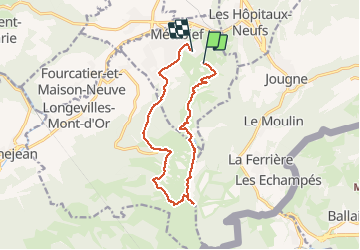
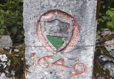
Trail Walking of 13.5 km to be discovered at Bourgogne-Franche-Comté, Doubs, Métabief. This trail is proposed by helmut68.

Description

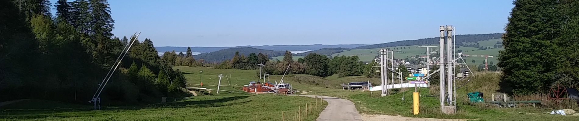
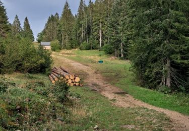
Départ et arrivée au parking en face de l'office de tourisme de Métabief . Rejoignez  le parcours du GR5 qui mène au " Le Morond "puis au Mont d'OR .Pour le retour , à partir du parking du Mont d'Or , suivez le balisage " jaune Bleu " jusqu'au  poteau de direction  " La Barthelette ", là , continuez  sur le sentier à droite jusqu'au départ des télésièges  " Le Paradis " . Ensuite un chemin forestier vous amènera jusqu'à Métabief ( près du stade de football ).
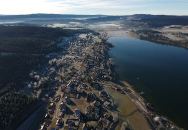
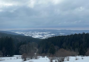
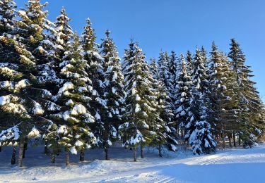
Au sommet ,le Mont d'Or son plateau et ses crêtes offrent l'oxygénation de ses grands espaces et le ravissement des yeux avec ses paysages et ses vues panoramiques .
Alors à vos chaussures !

Elevation profile

Photos

Positioning

Country:
France
Region :
Bourgogne-Franche-Comté
Department/Province :
Doubs
Municipality :
Métabief
Location:
Unknown
Start:(UTM)
298407 ; 5182606 (32T) N.

Trails nearby

Trail On foot Ballaigues - Ballaigues-Vallorbe - Photo
On foot
PRO

On foot

Easy
Ballaigues, Vaud, District du Jura-Nord vaudois, Switzerland
5.1 km | 6.3 km-effort
1h 25min
No
Trail Walking Métabief - GTJ  Metabief - Pontarlier - Photo
Walking
svp59

Walking

Medium
(1)
Métabief, Bourgogne-Franche-Comté, Doubs, France
25 km | 35 km-effort
7h 17min
No
Trail Walking Saint-Antoine - Boucle du fort St Antoine  - Photo
Walking
mallovon

Walking

Medium
Saint-Antoine, Bourgogne-Franche-Comté, Doubs, France
4.8 km | 6.2 km-effort
1h 25min
Yes
Trail Walking Rochejean - Mont d'or  - Photo
Walking
eltonnermou

Walking

Easy
Rochejean, Bourgogne-Franche-Comté, Doubs, France
11.9 km | 17.5 km-effort
4h 53min
Yes
Trail On foot Malbuisson - Sentier du Tour du Lac - Photo
On foot
PRO

On foot

Easy
Malbuisson, Bourgogne-Franche-Comté, Doubs, France
16 km | 19.9 km-effort
4h 30min
No
Trail Snowshoes Métabief - Les hauteurs de Metabief - Photo
Snowshoes
zefreefly

Snowshoes

Medium
Métabief, Bourgogne-Franche-Comté, Doubs, France
15.5 km | 23 km-effort
3h 51min
Yes
Trail Nordic walking Malbuisson - Fort St Antoine  - Photo
Nordic walking
mallovon

Nordic walking

Easy
Malbuisson, Bourgogne-Franche-Comté, Doubs, France
5.8 km | 7.3 km-effort
2h 21min
Yes
Trail Cross-country skiing Les Hôpitaux-Vieux - Les Essarts - Photo
Cross-country skiing
mallovon

Cross-country skiing

Easy
Les Hôpitaux-Vieux, Bourgogne-Franche-Comté, Doubs, France
6.5 km | 8.1 km-effort
2h 3min
Yes
Trail Walking Jougne - La Jougnena - Photo
Walking
daniellebou

Walking

Very difficult
(1)
Jougne, Bourgogne-Franche-Comté, Doubs, France
17.7 km | 24 km-effort
5h 32min
Yes


Close
My subscriptions