Trail Walking Rochejean - Mont d'or  - Photo
© OpenStreetMap contributors
Length
Length
11.9 km
Max alt
Max alt
1450 m
Uphill gradient
Uphill gradient
419 m
Km-Effort
Km-Effort  
17.5 km
Min alt
Min alt
1140 m
Downhill gradient
Downhill gradient
418 m
Boucle
Boucle
Yes
Creation date :
2022-08-22 07:56:15.926
Updated on :
2022-09-02 10:18:08.79

(0 Reviews)

Walking
Walking
4h53
Difficulty : Easy

Scan this QR Code to open this trail in the SityTrail application

FREE GPS app for hiking

Logo SityTrail SityTrail

IGN / Geographical institutes

Download SityTrail from the App Store Download SityTrail from Google Play

Logo SityTrail SityTrail World

The world is yours!

Download SityTrail from the App Store Download SityTrail from Google Play Download SityTrail on Huawei AppGallery

About

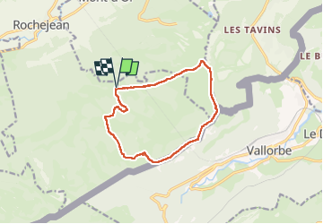
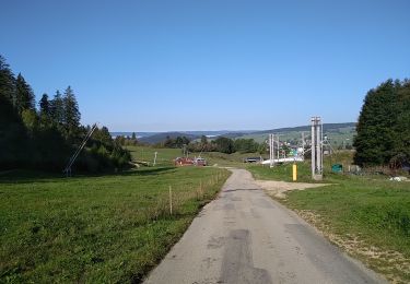
Trail Walking of 11.9 km to be discovered at Bourgogne-Franche-Comté, Doubs, Rochejean. This trail is proposed by eltonnermou.

Description

Parking : restaurant La Boissaude
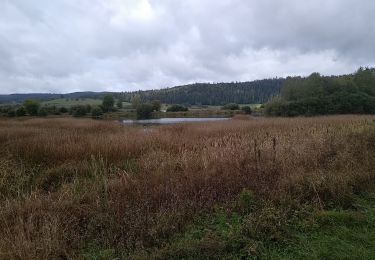
Cette très belle randonnée  pédestre vous entrainera à travers différents paysages, jalonnée de nombreux beaux points de vues sur la Suisse : lac de Genève, Neuchâtel, de Joux ; sur les Alpes et le Mont blanc (suivant la météo) ; et également côté français sur le haut-doubs.
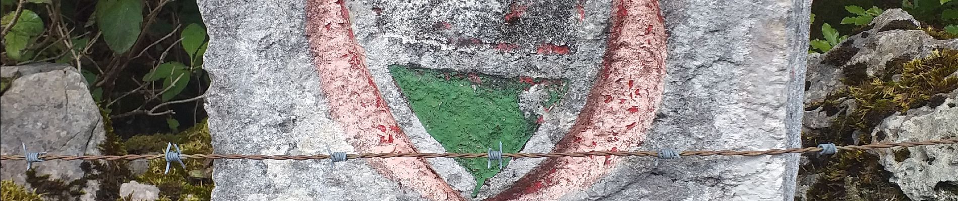
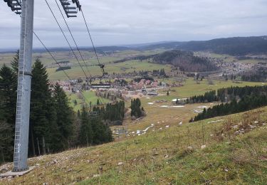
Une fois le bord des falaises passé, repérez la borne 72 et prendre le sentier à gauche, qui vous mènera à la Grande échelle puis à la petite (cela vous évitera le tout terrain pour atteindre cette dernière) après la petite échelle bien suivre le balisage (le resto à la petite échelle est décevant : l'accueil mauvais, la nourriture bonne mais fort peu pour un prix excessif) en passant près de la grange Authier. Continuer sur le sentier balisé Bleu/jaune et une fois sur un chemin carrossable bifurquer à droite sur GR5 (blanc/rouge). La distance est de 13,2 km.
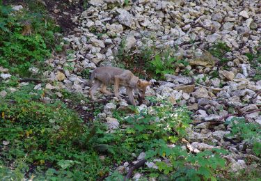
Avec un peu de chance, vous rencontrerez de belles surprises : chamois sur les pentes escarpées du secteur, renard, écureuil. Vous pourrez apprécier la diversité de la flore.  

Elevation profile

Photos

Positioning

Country:
France
Region :
Bourgogne-Franche-Comté
Department/Province :
Doubs
Municipality :
Rochejean
Location:
Unknown
Start:(UTM)
295303 ; 5178493 (32T) N.

Trails nearby

Trail Mountain bike Vallorbe - Le Suchet - Photo
Mountain bike
GUIDE+

Mountain bike

Very easy
(1)
Vallorbe, Vaud, District du Jura-Nord vaudois, Switzerland
35 km | 53 km-effort
14h 41min
Yes
Trail On foot Vallorbe - Mont d'Orzeires - Le Pont Gare - Photo
On foot
PRO

On foot

Easy
Vallorbe, Vaud, District du Jura-Nord vaudois, Switzerland
3.2 km | 4.4 km-effort
59min
No
Trail On foot Vallorbe - Saigne Geret-Les Revines - Photo
On foot
PRO

On foot

Easy
Vallorbe, Vaud, District du Jura-Nord vaudois, Switzerland
3.5 km | 4.1 km-effort
56min
No
Trail Snowshoes Métabief - Les hauteurs de Metabief - Photo
Snowshoes
zefreefly

Snowshoes

Medium
Métabief, Bourgogne-Franche-Comté, Doubs, France
15.5 km | 23 km-effort
3h 51min
Yes
Trail Walking Jougne - La Jougnena - Photo
Walking
daniellebou

Walking

Very difficult
(1)
Jougne, Bourgogne-Franche-Comté, Doubs, France
17.7 km | 24 km-effort
5h 32min
Yes
Trail Walking Métabief - Mont d'Or - Photo
Walking
helmut68

Walking

Medium
Métabief, Bourgogne-Franche-Comté, Doubs, France
13.5 km | 21 km-effort
3h 39min
No
Trail Walking Labergement-Sainte-Marie - Lac de Remoray - Photo
Walking
helmut68

Walking

Easy
Labergement-Sainte-Marie, Bourgogne-Franche-Comté, Doubs, France
14.5 km | 18.4 km-effort
3h 25min
No
Trail Snowshoes Longevilles-Mont-d'Or - Les Longevilles Mont D'Or CAF - Photo
Snowshoes
TRIMAILLE

Snowshoes

Medium
(1)
Longevilles-Mont-d'Or, Bourgogne-Franche-Comté, Doubs, France
8.4 km | 13 km-effort
8h 27min
Yes
Trail Walking Métabief - Metabief // Vallorbe par les sommets - Photo
Walking
BM25

Walking

Medium
Métabief, Bourgogne-Franche-Comté, Doubs, France
48 km | 71 km-effort
8h 13min
No


Close
My subscriptions