


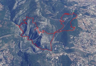
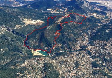
11.8 km | 19.3 km-effort


User GUIDE


FREE GPS app for hiking
 SityTrail
IGN / Geographical institutes
SityTrail World
The world is yours!
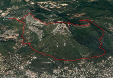
Trail Walking of 6.5 km to be discovered at Provence-Alpes-Côte d'Azur, Var, Toulon. This trail is proposed by affinetataille.
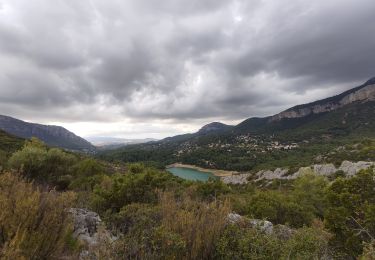
La montée entre la tour de l'ubac et l'antenne est assez difficile.
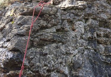
Plusieurs passages ou il faut "mettre les mains"
La descente depuis la tour de l'hubac vers le chemin de l'hubac est assez raide et se fait en partie dans des éboulis.


Walking
Walking
Walking
Walking
Walking

Walking
Walking

Walking
Walking