Trail Walking Aubignas - Aubignas Chenavari 17km - Photo

Aubignas Chenavari 17km

 thonyc
thonyc

User GUIDE

© OpenStreetMap contributors
Length
Length
16.5 km
Max alt
Max alt
604 m
Uphill gradient
Uphill gradient
671 m
Km-Effort
Km-Effort  
25 km
Min alt
Min alt
307 m
Downhill gradient
Downhill gradient
670 m
Boucle
Boucle
Yes
Creation date :
2020-12-13 08:23:56.073
Updated on :
2023-02-28 17:03:31.985

(0 Reviews)

Walking
Walking
5h20
Difficulty : Difficult

Scan this QR Code to open this trail in the SityTrail application

FREE GPS app for hiking

Logo SityTrail SityTrail

IGN / Geographical institutes

Download SityTrail from the App Store Download SityTrail from Google Play

Logo SityTrail SityTrail World

The world is yours!

Download SityTrail from the App Store Download SityTrail from Google Play Download SityTrail on Huawei AppGallery

About

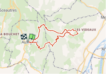
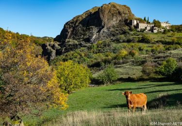
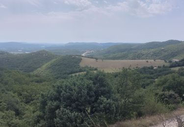
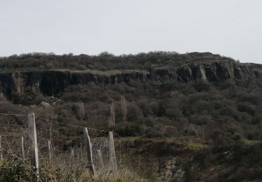
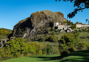
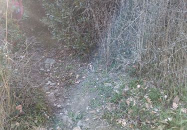
Trail Walking of 16.5 km to be discovered at Auvergne-Rhône-Alpes, Ardèche, Aubignas. This trail is proposed by thonyc.

Description

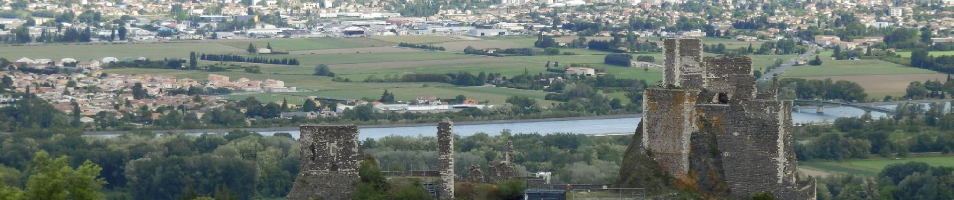
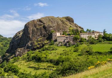
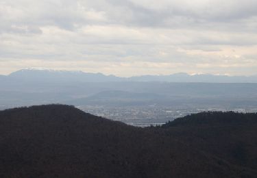
Village basaltique, le Coiron avec le volcan du Chenavari, panoramas sur le château de Rochemaure, la vallée du Rhône et les montagnes dromoises. Un régal.

Elevation profile

Photos

Positioning

Country:
France
Region :
Auvergne-Rhône-Alpes
Department/Province :
Ardèche
Municipality :
Aubignas
Location:
Unknown
Start:(UTM)
629533 ; 4938429 (31T) N.

Trails nearby

Trail Walking Alba-la-Romaine - Alba côté Coiron 7km - Photo
Walking
GUIDE
thonyc

Walking

Easy
(1)
Alba-la-Romaine, Auvergne-Rhône-Alpes, Ardèche, France
7.1 km | 9.5 km-effort
2h 30min
Yes
Trail Walking Rochemaure - Randonnée entre Rochemaure et Aubignas - Photo
Walking
tracegps

Walking

Difficult
(2)
Rochemaure, Auvergne-Rhône-Alpes, Ardèche, France
16.8 km | 26 km-effort
5h 30min
Yes
Trail Walking Alba-la-Romaine - 2022-03-12_17h47m49_Sceautres-La carrière 15km.gpx.xml - Photo
Walking
chancha

Walking

Very difficult
(1)
Alba-la-Romaine, Auvergne-Rhône-Alpes, Ardèche, France
14.7 km | 22 km-effort
4h 57min
Yes
Trail Mountain bike Aubignas - Aubignas tour coiron all mountain - Photo
Mountain bike
royco

Mountain bike

Difficult
(2)
Aubignas, Auvergne-Rhône-Alpes, Ardèche, France
20 km | 30 km-effort
1h 54min
No
Trail Mountain bike Sceautres - COIRON boucle sympa - Photo
Mountain bike
royco

Mountain bike

Medium
(2)
Sceautres, Auvergne-Rhône-Alpes, Ardèche, France
7.4 km | 10.4 km-effort
1h 10min
Yes
Trail Walking Rochemaure - Le Chenavary 11km. - Photo
Walking
chancha

Walking

Difficult
Rochemaure, Auvergne-Rhône-Alpes, Ardèche, France
11 km | 17.3 km-effort
3h 56min
Yes
Trail Walking Saint-Pons - Saint pons - Photo
Walking
Vero7684

Walking

Medium
Saint-Pons, Auvergne-Rhône-Alpes, Ardèche, France
16.1 km | 23 km-effort
5h 0min
Yes
Trail Walking Aubignas - Aubignas-La carrière 12km - Photo
Walking
GUIDE
thonyc

Walking

Difficult
Aubignas, Auvergne-Rhône-Alpes, Ardèche, France
11.8 km | 16.9 km-effort
3h 41min
Yes
Trail Walking Le Teil - 07 le teil - Photo
Walking
himba26100

Walking

Medium
Le Teil, Auvergne-Rhône-Alpes, Ardèche, France
16.1 km | 23 km-effort
6h 20min
Yes


Close
My subscriptions