Trail Walking Saint-Pons - Saint pons - Photo
 Vero7684
Vero7684

User

© OpenStreetMap contributors
Length
Length
16.1 km
Max alt
Max alt
677 m
Uphill gradient
Uphill gradient
496 m
Km-Effort
Km-Effort  
23 km
Min alt
Min alt
292 m
Downhill gradient
Downhill gradient
498 m
Boucle
Boucle
Yes
Creation date :
2023-03-21 08:40:14.077
Updated on :
2023-03-21 14:30:42.242

(0 Reviews)

Walking
Walking
5h00
Difficulty : Medium

Scan this QR Code to open this trail in the SityTrail application

FREE GPS app for hiking

Logo SityTrail SityTrail

IGN / Geographical institutes

Download SityTrail from the App Store Download SityTrail from Google Play

Logo SityTrail SityTrail World

The world is yours!

Download SityTrail from the App Store Download SityTrail from Google Play Download SityTrail on Huawei AppGallery

About

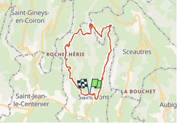
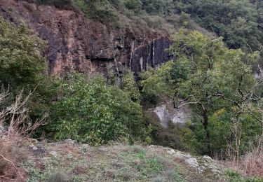
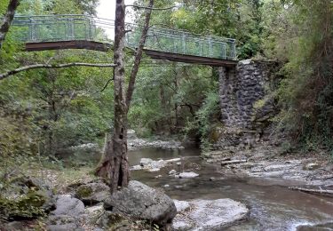
Trail Walking of 16.1 km to be discovered at Auvergne-Rhône-Alpes, Ardèche, Saint-Pons. This trail is proposed by Vero7684.

Description

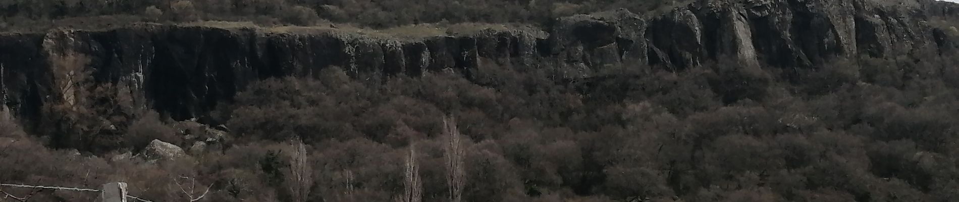
Environ 6km de route mais sans voiture et beau paysage, plus les orgues de bauzon

Elevation profile

Photos

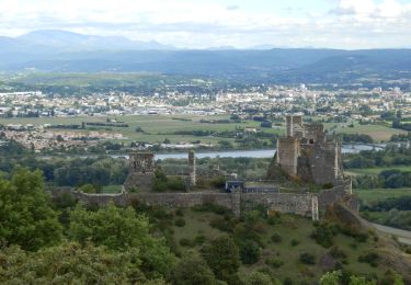
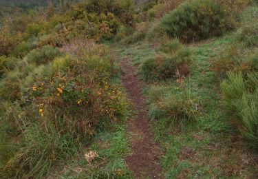
24 photos in total. Please click on a photo to see them all in the gallery.

Positioning

Country:
France
Region :
Auvergne-Rhône-Alpes
Department/Province :
Ardèche
Municipality :
Saint-Pons
Location:
Unknown
Start:(UTM)
625014 ; 4939017 (31T) N.

Trails nearby

Trail Walking Alba-la-Romaine - Alba côté Coiron 7km - Photo
Walking
GUIDE
thonyc

Walking

Easy
(1)
Alba-la-Romaine, Auvergne-Rhône-Alpes, Ardèche, France
7.1 km | 9.5 km-effort
2h 30min
Yes
Trail Walking Alba-la-Romaine - 2022-03-12_17h47m49_Sceautres-La carrière 15km.gpx.xml - Photo
Walking
chancha

Walking

Very difficult
(1)
Alba-la-Romaine, Auvergne-Rhône-Alpes, Ardèche, France
14.7 km | 22 km-effort
4h 57min
Yes
Trail Walking Aubignas - Aubignas Chenavari 17km - Photo
Walking
GUIDE
thonyc

Walking

Difficult
Aubignas, Auvergne-Rhône-Alpes, Ardèche, France
16.5 km | 25 km-effort
5h 20min
Yes
Trail Mountain bike Aubignas - Aubignas tour coiron all mountain - Photo
Mountain bike
royco

Mountain bike

Difficult
(2)
Aubignas, Auvergne-Rhône-Alpes, Ardèche, France
20 km | 30 km-effort
1h 54min
No
Trail Mountain bike Sceautres - COIRON boucle sympa - Photo
Mountain bike
royco

Mountain bike

Medium
(2)
Sceautres, Auvergne-Rhône-Alpes, Ardèche, France
7.4 km | 10.4 km-effort
1h 10min
Yes
Trail Walking Saint-Gineys-en-Coiron - 07 claduergue 09.10.2022 reco - Photo
Walking
himba26100

Walking

Difficult
Saint-Gineys-en-Coiron, Auvergne-Rhône-Alpes, Ardèche, France
7.6 km | 11.7 km-effort
4h 17min
Yes
Trail Walking Saint-Gineys-en-Coiron - St Gineys /Coiron - Photo
Walking
cousam

Walking

Difficult
Saint-Gineys-en-Coiron, Auvergne-Rhône-Alpes, Ardèche, France
6.1 km | 9.4 km-effort
2h 55min
No
Trail Walking Saint-Gineys-en-Coiron - Claduégne - Photo
Walking
cousam

Walking

Difficult
(1)
Saint-Gineys-en-Coiron, Auvergne-Rhône-Alpes, Ardèche, France
3.9 km | 5.5 km-effort
2h 19min
Yes
Trail Walking Aubignas - Aubignas-La carrière 12km - Photo
Walking
GUIDE
thonyc

Walking

Difficult
Aubignas, Auvergne-Rhône-Alpes, Ardèche, France
11.8 km | 16.9 km-effort
3h 41min
Yes


Close
My subscriptions