Trail Walking Marolles-sur-Seine - Boucle Marolles sur Seine  - Brays sur Seine 44 km - Photo

Boucle Marolles sur Seine - Brays sur Seine 44 km

 chessyca
chessyca

User

© OpenStreetMap contributors
Length
Length
44 km
Max alt
Max alt
82 m
Uphill gradient
Uphill gradient
240 m
Km-Effort
Km-Effort  
47 km
Min alt
Min alt
47 m
Downhill gradient
Downhill gradient
239 m
Boucle
Boucle
Yes
Creation date :
2020-12-30 07:07:25.923
Updated on :
2020-12-30 19:44:53.158

(0 Reviews)

Walking
Walking
10h08
Difficulty : Very easy

Scan this QR Code to open this trail in the SityTrail application

FREE GPS app for hiking

Logo SityTrail SityTrail

IGN / Geographical institutes

Download SityTrail from the App Store Download SityTrail from Google Play

Logo SityTrail SityTrail World

The world is yours!

Download SityTrail from the App Store Download SityTrail from Google Play Download SityTrail on Huawei AppGallery

About

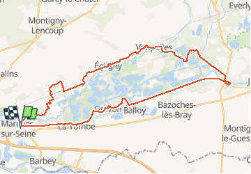
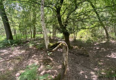
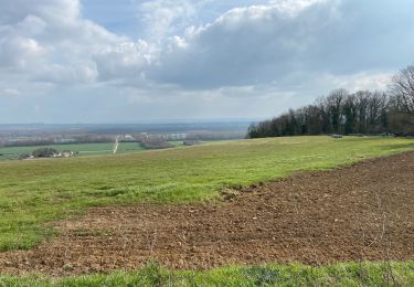
Trail Walking of 44 km to be discovered at Ile-de-France, Seine-et-Marne, Marolles-sur-Seine. This trail is proposed by chessyca.

Description

Dernière rando de l'année à l'initiative de Thierry
Superbe parcours notamment l'après midi
En cette saison, beaucoup de villages décorés

Elevation profile

Positioning

Country:
France
Region :
Ile-de-France
Department/Province :
Seine-et-Marne
Municipality :
Marolles-sur-Seine
Location:
Unknown
Start:(UTM)
502520 ; 5359278 (31U) N.

Trails nearby

Trail Road bike Salins - Sortie vélo la tombe  - Photo
Road bike
joelinou

Road bike

Very difficult
(1)
Salins, Ile-de-France, Seine-et-Marne, France
45 km | 50 km-effort
2h 59min
Yes
Trail Nordic walking Montereau-Fault-Yonne - Boucle les deux fleuves - Photo
Nordic walking
joelinou

Nordic walking

Montereau-Fault-Yonne, Ile-de-France, Seine-et-Marne, France
18.6 km | 20 km-effort
3h 38min
Yes
Trail On foot La Brosse-Montceaux - Les Plaines du Sud - Photo
On foot
PRO

On foot

Easy
La Brosse-Montceaux, Ile-de-France, Seine-et-Marne, France
11.1 km | 12.7 km-effort
2h 52min
No
Trail Nordic walking Salins -  Salin jc  à l'ombre R - Photo
Nordic walking
grene

Nordic walking

Very easy
Salins, Ile-de-France, Seine-et-Marne, France
16.2 km | 19.3 km-effort
5h 34min
Yes
Trail Nordic walking Montereau-Fault-Yonne - Boucle des deux fleuves - Photo
Nordic walking
joelinou

Nordic walking

Very difficult
(1)
Montereau-Fault-Yonne, Ile-de-France, Seine-et-Marne, France
18.5 km | 20 km-effort
3h 17min
Yes
Trail Walking Salins - Le bois du Maulny - Photo
Walking
joelinou

Walking

Very difficult
Salins, Ile-de-France, Seine-et-Marne, France
17.8 km | 0 m-effort
4h 10min
Yes
Trail Nordic walking Salins - Le dimanche 21 Mars  - Photo
Nordic walking
joelinou

Nordic walking

Medium
Salins, Ile-de-France, Seine-et-Marne, France
19.8 km | 24 km-effort
4h 2min
Yes
Trail Walking Misy-sur-Yonne - JC 03 Misy sur Yonne Les sablières  - Photo
Walking

Walking

Difficult
Misy-sur-Yonne, Ile-de-France, Seine-et-Marne, France
22 km | 23 km-effort
4h 33min
Yes
Trail Walking Salins - Essai 316 avec bcp de photos  - Photo
Walking
joelinou

Walking

Easy
Salins, Ile-de-France, Seine-et-Marne, France
6.8 km | 7.8 km-effort
1h 40min
Yes


Close
My subscriptions