


La Toussuire / l'Ouillon

laurentnecca
User
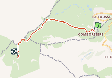

Length
5.2 km

Max alt
2420 m

Uphill gradient
685 m
Km-Effort
12.2 km

Min alt
1755 m

Downhill gradient
27 m
Boucle
No
Creation date :
2021-02-11 09:19:48.266
Updated on :
2021-02-11 14:00:07.075
2h30
Difficulty : Medium

FREE GPS app for hiking
 SityTrail
IGN / Geographical institutes
SityTrail Plus
The world is yours!
About
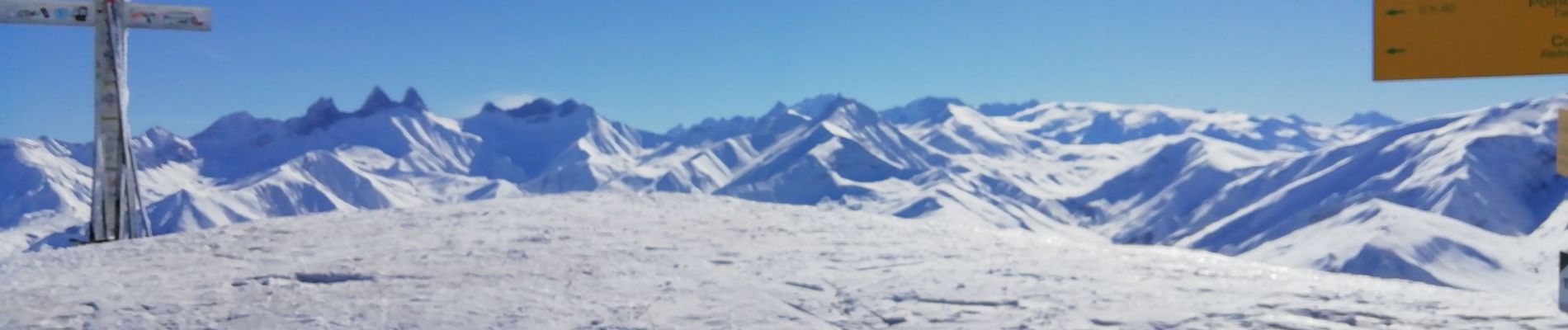
Trail Touring skiing of 5.2 km to be discovered at Auvergne-Rhône-Alpes, Savoy, Fontcouverte-la-Toussuire. This trail is proposed by laurentnecca.
Photos


Positioning
Country:
France
Region :
Auvergne-Rhône-Alpes
Department/Province :
Savoy
Municipality :
Fontcouverte-la-Toussuire
Location:
Unknown
Start:(Dec)
Start:(UTM)
284709 ; 5014364 (32T) N.
Comments