


11.9 km | 17.3 km-effort

User


FREE GPS app for hiking
 SityTrail
IGN / Geographical institutes
SityTrail World
The world is yours!
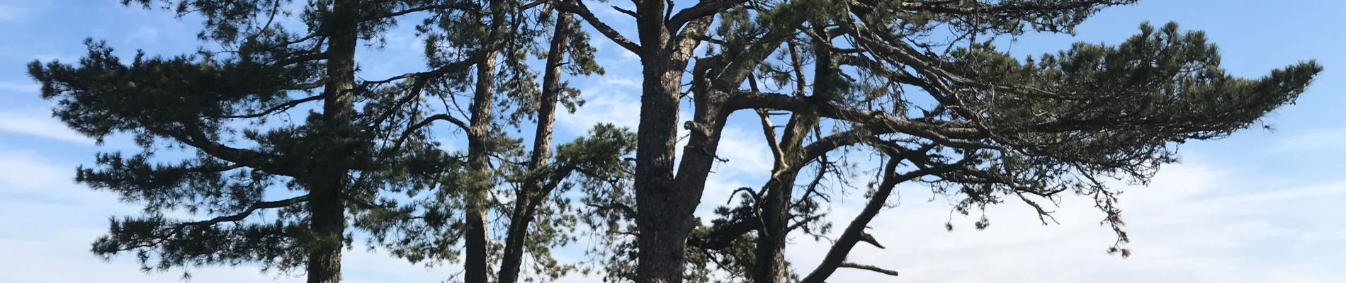
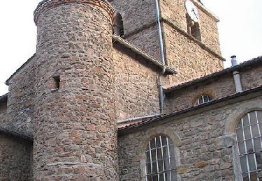
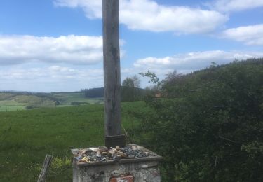
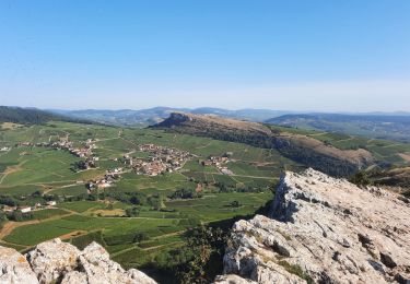
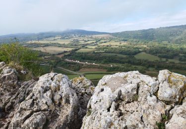
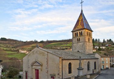
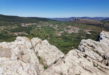
Trail Walking of 14.2 km to be discovered at Auvergne-Rhône-Alpes, Rhône, Cenves. This trail is proposed by Thomasdanielle.
D/A : Parking salle polyvalente
Attention à Cenves tous les sentiers sont à suivre les panneaux de la "Chèvre". Le sentier de 14 km est à suivre selon mon enregistrement.
 "
data-pinterest-text="Pin it"
data-tweet-text="share on twitter"
data-facebook-share-url="https://www.sitytrail.com/en/trails/2701524-cenves--cenves-xcircuit-des-pentesx-x14-km-x-d-643-mx/?photo=1#lg=1&slide=1"
data-twitter-share-url="https://www.sitytrail.com/en/trails/2701524-cenves--cenves-xcircuit-des-pentesx-x14-km-x-d-643-mx/?photo=1#lg=1&slide=1"
data-googleplus-share-url="https://www.sitytrail.com/en/trails/2701524-cenves--cenves-xcircuit-des-pentesx-x14-km-x-d-643-mx/?photo=1#lg=1&slide=1"
data-pinterest-share-url="https://www.sitytrail.com/en/trails/2701524-cenves--cenves-xcircuit-des-pentesx-x14-km-x-d-643-mx/?photo=1#lg=1&slide=1">
"
data-pinterest-text="Pin it"
data-tweet-text="share on twitter"
data-facebook-share-url="https://www.sitytrail.com/en/trails/2701524-cenves--cenves-xcircuit-des-pentesx-x14-km-x-d-643-mx/?photo=1#lg=1&slide=1"
data-twitter-share-url="https://www.sitytrail.com/en/trails/2701524-cenves--cenves-xcircuit-des-pentesx-x14-km-x-d-643-mx/?photo=1#lg=1&slide=1"
data-googleplus-share-url="https://www.sitytrail.com/en/trails/2701524-cenves--cenves-xcircuit-des-pentesx-x14-km-x-d-643-mx/?photo=1#lg=1&slide=1"
data-pinterest-share-url="https://www.sitytrail.com/en/trails/2701524-cenves--cenves-xcircuit-des-pentesx-x14-km-x-d-643-mx/?photo=1#lg=1&slide=1">
 "
data-pinterest-text="Pin it"
data-tweet-text="share on twitter"
data-facebook-share-url="https://www.sitytrail.com/en/trails/2701524-cenves--cenves-xcircuit-des-pentesx-x14-km-x-d-643-mx/?photo=2#lg=1&slide=2"
data-twitter-share-url="https://www.sitytrail.com/en/trails/2701524-cenves--cenves-xcircuit-des-pentesx-x14-km-x-d-643-mx/?photo=2#lg=1&slide=2"
data-googleplus-share-url="https://www.sitytrail.com/en/trails/2701524-cenves--cenves-xcircuit-des-pentesx-x14-km-x-d-643-mx/?photo=2#lg=1&slide=2"
data-pinterest-share-url="https://www.sitytrail.com/en/trails/2701524-cenves--cenves-xcircuit-des-pentesx-x14-km-x-d-643-mx/?photo=2#lg=1&slide=2">
"
data-pinterest-text="Pin it"
data-tweet-text="share on twitter"
data-facebook-share-url="https://www.sitytrail.com/en/trails/2701524-cenves--cenves-xcircuit-des-pentesx-x14-km-x-d-643-mx/?photo=2#lg=1&slide=2"
data-twitter-share-url="https://www.sitytrail.com/en/trails/2701524-cenves--cenves-xcircuit-des-pentesx-x14-km-x-d-643-mx/?photo=2#lg=1&slide=2"
data-googleplus-share-url="https://www.sitytrail.com/en/trails/2701524-cenves--cenves-xcircuit-des-pentesx-x14-km-x-d-643-mx/?photo=2#lg=1&slide=2"
data-pinterest-share-url="https://www.sitytrail.com/en/trails/2701524-cenves--cenves-xcircuit-des-pentesx-x14-km-x-d-643-mx/?photo=2#lg=1&slide=2">
 "
data-pinterest-text="Pin it"
data-tweet-text="share on twitter"
data-facebook-share-url="https://www.sitytrail.com/en/trails/2701524-cenves--cenves-xcircuit-des-pentesx-x14-km-x-d-643-mx/?photo=3#lg=1&slide=3"
data-twitter-share-url="https://www.sitytrail.com/en/trails/2701524-cenves--cenves-xcircuit-des-pentesx-x14-km-x-d-643-mx/?photo=3#lg=1&slide=3"
data-googleplus-share-url="https://www.sitytrail.com/en/trails/2701524-cenves--cenves-xcircuit-des-pentesx-x14-km-x-d-643-mx/?photo=3#lg=1&slide=3"
data-pinterest-share-url="https://www.sitytrail.com/en/trails/2701524-cenves--cenves-xcircuit-des-pentesx-x14-km-x-d-643-mx/?photo=3#lg=1&slide=3">
"
data-pinterest-text="Pin it"
data-tweet-text="share on twitter"
data-facebook-share-url="https://www.sitytrail.com/en/trails/2701524-cenves--cenves-xcircuit-des-pentesx-x14-km-x-d-643-mx/?photo=3#lg=1&slide=3"
data-twitter-share-url="https://www.sitytrail.com/en/trails/2701524-cenves--cenves-xcircuit-des-pentesx-x14-km-x-d-643-mx/?photo=3#lg=1&slide=3"
data-googleplus-share-url="https://www.sitytrail.com/en/trails/2701524-cenves--cenves-xcircuit-des-pentesx-x14-km-x-d-643-mx/?photo=3#lg=1&slide=3"
data-pinterest-share-url="https://www.sitytrail.com/en/trails/2701524-cenves--cenves-xcircuit-des-pentesx-x14-km-x-d-643-mx/?photo=3#lg=1&slide=3">
 "
data-pinterest-text="Pin it"
data-tweet-text="share on twitter"
data-facebook-share-url="https://www.sitytrail.com/en/trails/2701524-cenves--cenves-xcircuit-des-pentesx-x14-km-x-d-643-mx/?photo=4#lg=1&slide=4"
data-twitter-share-url="https://www.sitytrail.com/en/trails/2701524-cenves--cenves-xcircuit-des-pentesx-x14-km-x-d-643-mx/?photo=4#lg=1&slide=4"
data-googleplus-share-url="https://www.sitytrail.com/en/trails/2701524-cenves--cenves-xcircuit-des-pentesx-x14-km-x-d-643-mx/?photo=4#lg=1&slide=4"
data-pinterest-share-url="https://www.sitytrail.com/en/trails/2701524-cenves--cenves-xcircuit-des-pentesx-x14-km-x-d-643-mx/?photo=4#lg=1&slide=4">
"
data-pinterest-text="Pin it"
data-tweet-text="share on twitter"
data-facebook-share-url="https://www.sitytrail.com/en/trails/2701524-cenves--cenves-xcircuit-des-pentesx-x14-km-x-d-643-mx/?photo=4#lg=1&slide=4"
data-twitter-share-url="https://www.sitytrail.com/en/trails/2701524-cenves--cenves-xcircuit-des-pentesx-x14-km-x-d-643-mx/?photo=4#lg=1&slide=4"
data-googleplus-share-url="https://www.sitytrail.com/en/trails/2701524-cenves--cenves-xcircuit-des-pentesx-x14-km-x-d-643-mx/?photo=4#lg=1&slide=4"
data-pinterest-share-url="https://www.sitytrail.com/en/trails/2701524-cenves--cenves-xcircuit-des-pentesx-x14-km-x-d-643-mx/?photo=4#lg=1&slide=4">
 "
data-pinterest-text="Pin it"
data-tweet-text="share on twitter"
data-facebook-share-url="https://www.sitytrail.com/en/trails/2701524-cenves--cenves-xcircuit-des-pentesx-x14-km-x-d-643-mx/?photo=5#lg=1&slide=5"
data-twitter-share-url="https://www.sitytrail.com/en/trails/2701524-cenves--cenves-xcircuit-des-pentesx-x14-km-x-d-643-mx/?photo=5#lg=1&slide=5"
data-googleplus-share-url="https://www.sitytrail.com/en/trails/2701524-cenves--cenves-xcircuit-des-pentesx-x14-km-x-d-643-mx/?photo=5#lg=1&slide=5"
data-pinterest-share-url="https://www.sitytrail.com/en/trails/2701524-cenves--cenves-xcircuit-des-pentesx-x14-km-x-d-643-mx/?photo=5#lg=1&slide=5">
"
data-pinterest-text="Pin it"
data-tweet-text="share on twitter"
data-facebook-share-url="https://www.sitytrail.com/en/trails/2701524-cenves--cenves-xcircuit-des-pentesx-x14-km-x-d-643-mx/?photo=5#lg=1&slide=5"
data-twitter-share-url="https://www.sitytrail.com/en/trails/2701524-cenves--cenves-xcircuit-des-pentesx-x14-km-x-d-643-mx/?photo=5#lg=1&slide=5"
data-googleplus-share-url="https://www.sitytrail.com/en/trails/2701524-cenves--cenves-xcircuit-des-pentesx-x14-km-x-d-643-mx/?photo=5#lg=1&slide=5"
data-pinterest-share-url="https://www.sitytrail.com/en/trails/2701524-cenves--cenves-xcircuit-des-pentesx-x14-km-x-d-643-mx/?photo=5#lg=1&slide=5">

Walking
Walking
Walking

Mountain bike
Walking
On foot
Walking
Walking
Walking