Trail Walking Cenves - Séjour RCY Les crêtes du Haut Beaujolais journée 2 - Photo

Séjour RCY Les crêtes du Haut Beaujolais journée 2

 chessyca
chessyca

User

© OpenStreetMap contributors
Length
Length
27 km
Max alt
Max alt
735 m
Uphill gradient
Uphill gradient
962 m
Km-Effort
Km-Effort  
40 km
Min alt
Min alt
346 m
Downhill gradient
Downhill gradient
1019 m
Boucle
Boucle
No
Creation date :
2021-05-18 06:26:32.851
Updated on :
2021-05-23 10:29:06.427

(0 Reviews)

Walking
Walking
6h53
Difficulty : Very difficult
Trail
Trail
--
Difficulty : Very difficult

Scan this QR Code to open this trail in the SityTrail application

FREE GPS app for hiking

Logo SityTrail SityTrail

IGN / Geographical institutes

Download SityTrail from the App Store Download SityTrail from Google Play

Logo SityTrail SityTrail World

The world is yours!

Download SityTrail from the App Store Download SityTrail from Google Play Download SityTrail on Huawei AppGallery

About

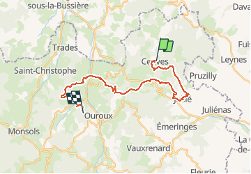
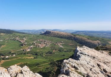
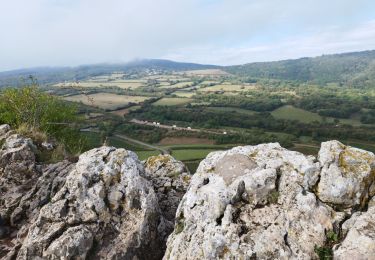
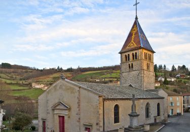
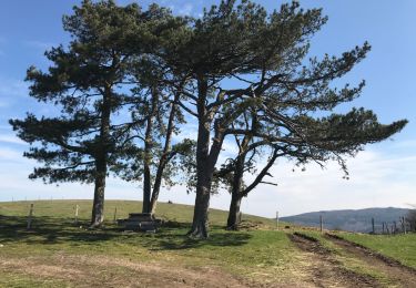
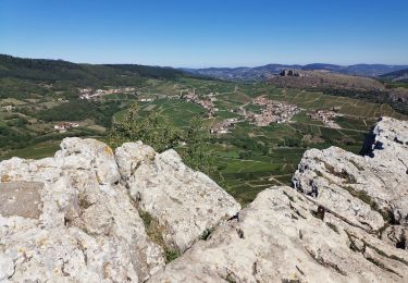
Trail Walking of 27 km to be discovered at Auvergne-Rhône-Alpes, Rhône, Cenves. This trail is proposed by chessyca.

Description

2ème étape d'un trek de 6 jours
Départ du gite de Cenves vers Ouroux
Des dénivelés importants mais plus facile que la journée précédente

Elevation profile

Photos

Positioning

Country:
France
Region :
Auvergne-Rhône-Alpes
Department/Province :
Rhône
Municipality :
Cenves
Location:
Unknown
Start:(UTM)
627278 ; 5125171 (31T) N.

Trails nearby

Trail Walking Deux-Grosnes - Circuit de Saint-Jacques des Arrêts - Photo
Walking
tracegps

Walking

Medium
(1)
Deux-Grosnes, Auvergne-Rhône-Alpes, Rhône, France
11.9 km | 17.3 km-effort
3h 0min
Yes
Trail Walking Deux-Grosnes - Ouroux - Photo
Walking
Galoche

Walking

Difficult
(1)
Deux-Grosnes, Auvergne-Rhône-Alpes, Rhône, France
19.1 km | 0 m-effort
5h 57min
Yes
Trail Walking Solutré-Pouilly - Roche de Solutré 4km - Photo
Walking
GUIDE
thonyc

Walking

Easy
(1)
Solutré-Pouilly, Bourgogne-Franche-Comté, Saône-et-Loire, France
3.7 km | 5.5 km-effort
2h 0min
Yes
Trail Mountain bike Serrières - RTT 2015 SAMEDI - Photo
Mountain bike
Tollard

Mountain bike

Difficult
(2)
Serrières, Bourgogne-Franche-Comté, Saône-et-Loire, France
66 km | 98 km-effort
6h 7min
Yes
Trail Walking Solutré-Pouilly - La roche de Solutré  - Photo
Walking
alainjoseph6

Walking

Easy
Solutré-Pouilly, Bourgogne-Franche-Comté, Saône-et-Loire, France
3.4 km | 4.8 km-effort
1h 17min
Yes
Trail On foot Deux-Grosnes - Circuit des Sapins - Photo
On foot
PRO

On foot

Difficult
Deux-Grosnes, Auvergne-Rhône-Alpes, Rhône, France
22 km | 33 km-effort
7h 34min
Yes
Trail Walking Cenves - cenves la madone  - Photo
Walking
darrisa

Walking

Very difficult
Cenves, Auvergne-Rhône-Alpes, Rhône, France
16.6 km | 26 km-effort
6h 0min
Yes
Trail Walking Cenves - Cenves
Walking
Thomasdanielle

Walking

Difficult
Cenves, Auvergne-Rhône-Alpes, Rhône, France
14.2 km | 23 km-effort
5h 2min
Yes
Trail Walking Solutré-Pouilly - SOLUTRÉ-Pouilly ... Grand site de la France.  - Photo
Walking
GerardBouche

Walking

Easy
Solutré-Pouilly, Bourgogne-Franche-Comté, Saône-et-Loire, France
4.1 km | 5.8 km-effort
1h 51min
Yes


Close
My subscriptions