![](/images/other/stat-length.png)
![Trail Walking Stoumont - 2021-03-12_16h39m43_LaGleizeP3TourduMontSaintVictor - Photo](https://media.geolcdn.com/t/1900/400/ext.pjpeg?maxdim=2&url=https%3A%2F%2Fmedia.geolcdn.com%2Ff%2Feeda461f-0b98-4912-915c-63b0e2025382.jpg)
2021-03-12_16h39m43_LaGleizeP3TourduMontSaintVictor
mumu.larandonneuse
User GUIDE
![Length](/images/other/stat-length.png)
Length
15.8 km
![Max alt](https://static1.geolcdn.com/siteimages/upload/files/1508320355ic_sort_altitude_max_24dp.png)
Max alt
498 m
![Uphill gradient](https://static1.geolcdn.com/siteimages/upload/files/1508320355ic_sort_den_pos_24dp.png)
Uphill gradient
480 m
![Km-Effort](/images/other/stat-length.png)
Km-Effort
22 km
![Min alt](https://static1.geolcdn.com/siteimages/upload/files/1508320355ic_sort_altitude_min_24dp.png)
Min alt
202 m
![Downhill gradient](https://static1.geolcdn.com/siteimages/upload/files/1508320355ic_sort_den_neg_24dp.png)
Downhill gradient
482 m
![Boucle](https://static1.geolcdn.com/siteimages/upload/files/16400158638029165_repeat_loop_refresh_sync_direction_icon.png)
Boucle
Yes
Creation date :
2021-03-12 15:39:44.027
Updated on :
2021-03-15 14:21:21.314
![Walking](https://static1.geolcdn.com/sitytour/trail-icons/101.png)
5h02
Difficulty : Medium
![Scan this QR Code to open this trail in the SityTrail application](https://capi.geolives.com/qq0zvz2zws4bq2lad0pu/sitytour/trails/2704732/qr.png?size=200)
FREE GPS app for hiking
About
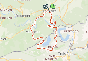
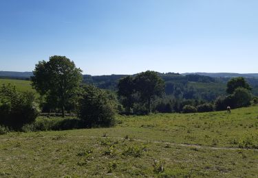
Trail Walking of 15.8 km to be discovered at Wallonia, Liège, Stoumont. This trail is proposed by mumu.larandonneuse.
Description
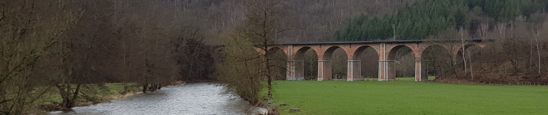
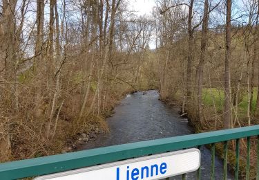
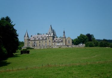
Superbe randonnée offrant des vues panoramiques sur la vallée de l'Amblève et sur le lac de Coo.
📌 & 🅿️ Devant l'église.
Balisage rectangle rouge.
ℹ sur www.ovatourisme.be.
Positioning
Country:
Belgium
Region :
Wallonia
Department/Province :
Liège
Municipality :
Stoumont
Location:
La Gleize
Start:(Dec)
Start:(UTM)
702195 ; 5588120 (31U) N.
Comments
Trails nearby
![Trail Walking Trois-Ponts - RB-Lg-27_Trois-Ponts - Photo](https://media.geolcdn.com/t/375/260/ext.jpg?maxdim=2&url=https%3A%2F%2Fservices.sitytrail.com%2FGeolivesWS%2FDownloadMedia.ashx%3FTrailID%3D402090%26Media%3Ddb9e80d9-8efc-4045-abb6-cee4f6885ea2.jpg)
![Walking Walking](https://static1.geolcdn.com/sitytour/trail-icons/101.png)
RB-Lg-27_Trois-Ponts
Walking
(7)
Trois-Ponts,
Wallonia,
Liège,
Belgium
![](/images/other/stat-length.png)
23 km | 33 km-effort
7h 30min
![](https://static1.geolcdn.com/siteimages/upload/files/16400158638029165_repeat_loop_refresh_sync_direction_icon.png)
Yes
![Trail Walking Stoumont - RB-LG-13 - Par monts et par vaux autour de Stoumont - Photo](https://media.geolcdn.com/t/375/260/ext.jpg?maxdim=2&url=https%3A%2F%2Fservices.sitytrail.com%2FGeolivesWS%2FDownloadMedia.ashx%3FTrailID%3D179571%26Media%3Dfca3b0ca-06fe-45d6-8ded-857ea27270cf.jpg)
![Walking Walking](https://static1.geolcdn.com/sitytour/trail-icons/101.png)
RB-LG-13 - Par monts et par vaux autour de Stoumont
Walking
Very difficult
(11)
Stoumont,
Wallonia,
Liège,
Belgium
![](/images/other/stat-length.png)
23 km | 32 km-effort
7h 19min
![](https://static1.geolcdn.com/siteimages/upload/files/16400158638029165_repeat_loop_refresh_sync_direction_icon.png)
Yes
![Trail Walking Stoumont - 2022-02-03_17h52m52_StoumontP14PromenadedessommetsdelaLienne - Photo](https://media.geolcdn.com/t/375/260/ext.jpg?maxdim=2&url=https%3A%2F%2Fmedia.geolcdn.com%2Ff%2Fa2987c7f-4dfa-4904-87e7-be0c835ea8dd.jpg)
![Walking Walking](https://static1.geolcdn.com/sitytour/trail-icons/101.png)
2022-02-03_17h52m52_StoumontP14PromenadedessommetsdelaLienne
Walking
Medium
(2)
Stoumont,
Wallonia,
Liège,
Belgium
![](/images/other/stat-length.png)
16.1 km | 23 km-effort
5h 11min
![](https://static1.geolcdn.com/siteimages/upload/files/16400158638029165_repeat_loop_refresh_sync_direction_icon.png)
Yes
![Trail Walking Stoumont - IR-224 & RB-SoirMag-06_La-Glaise-_QR3_Rac1Rac2_13_9_km - Photo](https://media.geolcdn.com/t/375/260/ext.jpg?maxdim=2&url=https%3A%2F%2Fmedia.geolcdn.com%2Ff%2Fc833c403-820e-4132-8cfd-95c8fa336790.JPG)
![Walking Walking](https://static1.geolcdn.com/sitytour/trail-icons/101.png)
IR-224 & RB-SoirMag-06_La-Glaise-_QR3_Rac1Rac2_13_9_km
Walking
Medium
(2)
Stoumont,
Wallonia,
Liège,
Belgium
![](/images/other/stat-length.png)
13.9 km | 19.8 km-effort
4h 30min
![](https://static1.geolcdn.com/siteimages/upload/files/16400158638029165_repeat_loop_refresh_sync_direction_icon.png)
Yes
![Trail Walking Stavelot - 2021-03-10_14h59m08_1227 - Photo](https://media.geolcdn.com/t/375/260/ext.jpg?maxdim=2&url=https%3A%2F%2Fmedia.geolcdn.com%2Ff%2F8b34c446-55a9-478c-88d7-9cb986b390fb.jpg)
![Walking Walking](https://static1.geolcdn.com/sitytour/trail-icons/101.png)
2021-03-10_14h59m08_1227
Walking
Difficult
(3)
Stavelot,
Wallonia,
Liège,
Belgium
![](/images/other/stat-length.png)
18.8 km | 26 km-effort
5h 53min
![](https://static1.geolcdn.com/siteimages/upload/files/16400158638029165_repeat_loop_refresh_sync_direction_icon.png)
No
![Trail Walking Trois-Ponts - RB-Lg-27_Trois-Ponts_via-racc - Photo](https://media.geolcdn.com/t/375/260/ext.jpg?maxdim=2&url=https%3A%2F%2Fservices.sitytrail.com%2FGeolivesWS%2FDownloadMedia.ashx%3FTrailID%3D402091%26Media%3Ddb9e80d9-8efc-4045-abb6-cee4f6885ea2.jpg)
![Walking Walking](https://static1.geolcdn.com/sitytour/trail-icons/101.png)
RB-Lg-27_Trois-Ponts_via-racc
Walking
Very difficult
(1)
Trois-Ponts,
Wallonia,
Liège,
Belgium
![](/images/other/stat-length.png)
16.9 km | 25 km-effort
5h 36min
![](https://static1.geolcdn.com/siteimages/upload/files/16400158638029165_repeat_loop_refresh_sync_direction_icon.png)
Yes
![Trail Walking Stoumont - stoumont . corniche - congo . chateau froidcourt . ambleve . stoumont - Photo](https://media.geolcdn.com/t/375/260/ext.jpg?maxdim=2&url=https%3A%2F%2Fmedia.geolcdn.com%2Ff%2Fe9a69a2e-c189-4076-b755-49e5203b8455.jpg)
![Walking Walking](https://static1.geolcdn.com/sitytour/trail-icons/101.png)
stoumont . corniche - congo . chateau froidcourt . ambleve . stoumont
Walking
Very easy
(1)
Stoumont,
Wallonia,
Liège,
Belgium
![](/images/other/stat-length.png)
9.1 km | 12.1 km-effort
2h 44min
![](https://static1.geolcdn.com/siteimages/upload/files/16400158638029165_repeat_loop_refresh_sync_direction_icon.png)
Yes
![Trail Walking Theux - petit tour à Bronromme - Photo](https://media.geolcdn.com/t/375/260/ext.jpg?maxdim=2&url=https%3A%2F%2Fmedia.geolcdn.com%2Ff%2F3bde52fd-19d7-4e01-be15-97a6eaa8c76d.jpg)
![Walking Walking](https://static1.geolcdn.com/sitytour/trail-icons/101.png)
petit tour à Bronromme
Walking
Very easy
(1)
Theux,
Wallonia,
Liège,
Belgium
![](/images/other/stat-length.png)
7.6 km | 9.1 km-effort
1h 53min
![](https://static1.geolcdn.com/siteimages/upload/files/16400158638029165_repeat_loop_refresh_sync_direction_icon.png)
Yes
![Trail Walking Stoumont - RB-Lg-13-BC-2019_Rac - Photo](https://media.geolcdn.com/t/375/260/ext.jpg?maxdim=2&url=https%3A%2F%2Fservices.sitytrail.com%2FGeolivesWS%2FDownloadMedia.ashx%3FTrailID%3D179572%26Media%3Ddd649bf1-a115-4c1e-9e23-c1a80ab51103.jpg)
![Walking Walking](https://static1.geolcdn.com/sitytour/trail-icons/101.png)
RB-Lg-13-BC-2019_Rac
Walking
Very difficult
(3)
Stoumont,
Wallonia,
Liège,
Belgium
![](/images/other/stat-length.png)
17.6 km | 24 km-effort
5h 25min
![](https://static1.geolcdn.com/siteimages/upload/files/16400158638029165_repeat_loop_refresh_sync_direction_icon.png)
Yes
Superbe randonnée, magnifique parcours avec de belles vues panoramiques.