Trail Walking Aubais - aubais-junas - Photo

aubais-junas

 v.rabot
v.rabot

User

© OpenStreetMap contributors
Length
Length
13.3 km
Max alt
Max alt
96 m
Uphill gradient
Uphill gradient
161 m
Km-Effort
Km-Effort  
15.4 km
Min alt
Min alt
31 m
Downhill gradient
Downhill gradient
161 m
Boucle
Boucle
Yes
Creation date :
2021-03-31 19:44:31.114
Updated on :
2021-05-03 16:21:43.965

(0 Reviews)

Walking
Walking
3h43
Difficulty : Difficult

Scan this QR Code to open this trail in the SityTrail application

FREE GPS app for hiking

Logo SityTrail SityTrail

IGN / Geographical institutes

Download SityTrail from the App Store Download SityTrail from Google Play

Logo SityTrail SityTrail World

The world is yours!

Download SityTrail from the App Store Download SityTrail from Google Play Download SityTrail on Huawei AppGallery

About

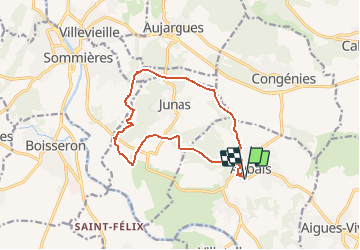
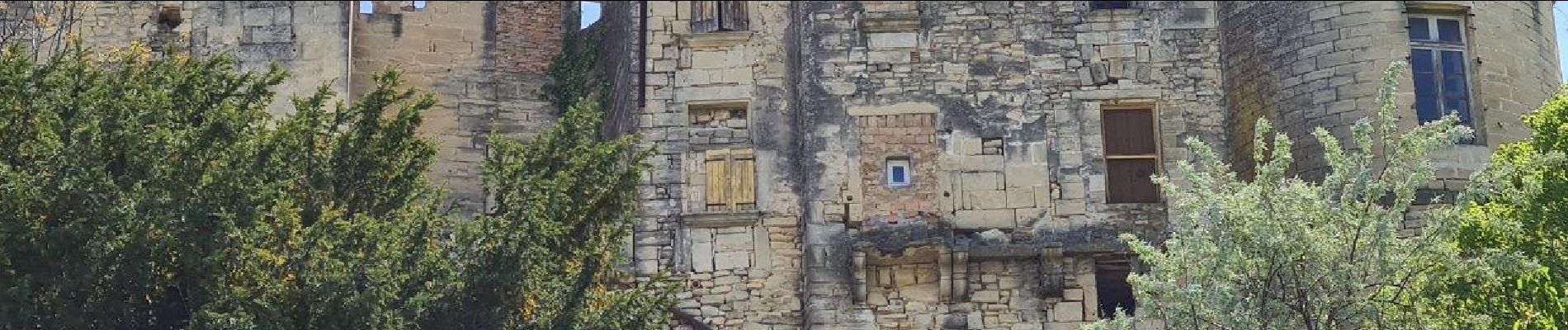
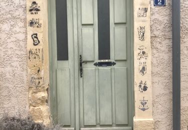
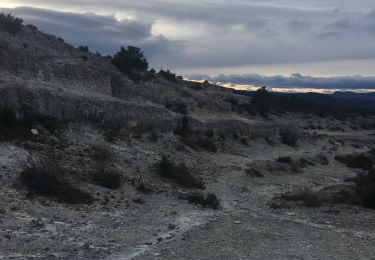
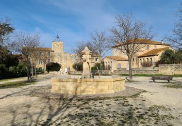
Trail Walking of 13.3 km to be discovered at Occitania, Gard, Aubais. This trail is proposed by v.rabot.

Description

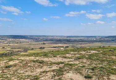
Parking facile, au départ, passage dans le joli village d'Aubais, attention à ne pas suivre la voie verte peu agréable à la marche, mais utilisez les chemins parralèle. Passage au moulin de Corbières, vous verrez peut être un chevreuil ou une chevrette au mas de Christin. Aucune difficulté, passage sur quelques chemins goudronnés mais sans circulation. Pour moi elle n'est pas difficile

Elevation profile

Photos

Positioning

Country:
France
Region :
Occitania
Department/Province :
Gard
Municipality :
Aubais
Location:
Unknown
Start:(UTM)
592337 ; 4844976 (31T) N.

Trails nearby

Trail Mountain bike Villetelle - Grande Traversée de l'Hérault à VTT - De Ambrussum à Fondespierre - Photo
Mountain bike
tracegps

Mountain bike

Medium
(2)
Villetelle, Occitania, Hérault, France
29 km | 33 km-effort
3h 30min
No
Trail Mountain bike Calvisson - Espace VTT-FFC Pays de Sommières n°7 - Les Châteaux du Sommiérois - Photo
Mountain bike
tracegps

Mountain bike

Difficult
(1)
Calvisson, Occitania, Gard, France
42 km | 50 km-effort
3h 30min
Yes
Trail Walking Junas - Entre Junas et Aujargues - Photo
Walking
GUIDE
randotines

Walking

Easy
Junas, Occitania, Gard, France
7.9 km | 9.4 km-effort
2h 2min
Yes
Trail Equestrian Gallargues-le-Montueux - Aujargues - Photo
Equestrian
N-Letessier

Equestrian

Easy
(1)
Gallargues-le-Montueux, Occitania, Gard, France
28 km | 32 km-effort
5h 33min
Yes
Trail Walking Sommières - Autour de Villevielle 30 - Photo
Walking
guignier

Walking

Easy
(2)
Sommières, Occitania, Gard, France
10.5 km | 12.3 km-effort
3h 0min
Yes
Trail Walking Junas - Aubais  - Photo
Walking
Galoche

Walking

Very easy
Junas, Occitania, Gard, France
6.4 km | 7.8 km-effort
1h 39min
Yes
Trail Walking Sommières - Les matches de géants  - Photo
Walking
gscholasch

Walking

Easy
Sommières, Occitania, Gard, France
48 km | 67 km-effort
3h 29min
No
Trail Walking Congénies - congenies-lemazet-calvisson - Photo
Walking
v.rabot

Walking

Medium
Congénies, Occitania, Gard, France
16.9 km | 21 km-effort
5h 0min
Yes
Trail Walking Sommières - villevielle-aujargues-souvignargues - Photo
Walking
v.rabot

Walking

Medium
Sommières, Occitania, Gard, France
18.2 km | 21 km-effort
5h 0min
Yes


Close
My subscriptions