


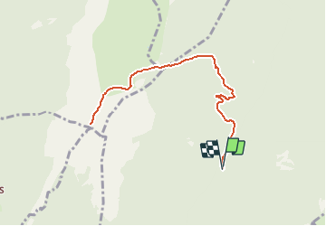

12.3 km | 25 km-effort


User


FREE GPS app for hiking
 SityTrail
IGN / Geographical institutes
SityTrail World
The world is yours!
Trail On foot of 9.7 km to be discovered at Auvergne-Rhône-Alpes, Isère, Proveysieux. This trail is proposed by mzonzon05.
Jolie randonnée facile.
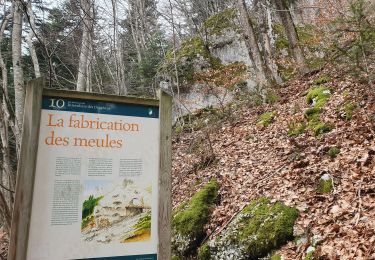
Après Proveysieux garer sa voiture au lieu-dit des Fourneaux. Après le passage du ruisseau du Tenaison prendre un large chemin tout d'abord austère puis donnant de jolis points de vue sur la forêt. En arrivant nez à nez sur une falaise (tout de même à votre droite) n'oubliez pas de vous retourner pour jeter un oeil à la cabane, gare d'arrivée d'une carrière de terre réfractaire !
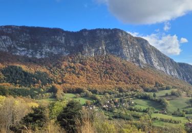
La suite est un enchantement de lacets dans une forêt de hêtres majestueux. Puis tout à coup la vue se dégage et l'on arrive sur le 'plateau' entre les Banettes et Hurtières.
Filez sur votre gauche jusqu'au refuge !

Walking

Walking

Walking

Walking

Walking
Walking
Walking
Touring skiing
Walking