Trail Walking Avilly-Saint-Léonard - randonnée en forêt de chantilly - Photo

randonnée en forêt de chantilly

© OpenStreetMap contributors
Length
Length
12.1 km
Max alt
Max alt
71 m
Uphill gradient
Uphill gradient
86 m
Km-Effort
Km-Effort  
13.2 km
Min alt
Min alt
51 m
Downhill gradient
Downhill gradient
84 m
Boucle
Boucle
Yes
Creation date :
2021-04-28 07:00:43.207
Updated on :
2021-04-28 09:51:56.544

(0 Reviews)

Walking
Walking
2h54
Difficulty : Very easy

Scan this QR Code to open this trail in the SityTrail application

FREE GPS app for hiking

Logo SityTrail SityTrail

IGN / Geographical institutes

Download SityTrail from the App Store Download SityTrail from Google Play

Logo SityTrail SityTrail World

The world is yours!

Download SityTrail from the App Store Download SityTrail from Google Play Download SityTrail on Huawei AppGallery

About

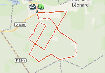
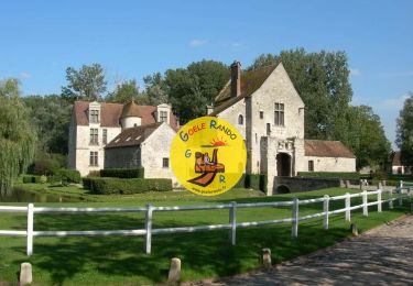
Trail Walking of 12.1 km to be discovered at Hauts-de-France, Oise, Avilly-Saint-Léonard. This trail is proposed by jumetz philippe.

Description

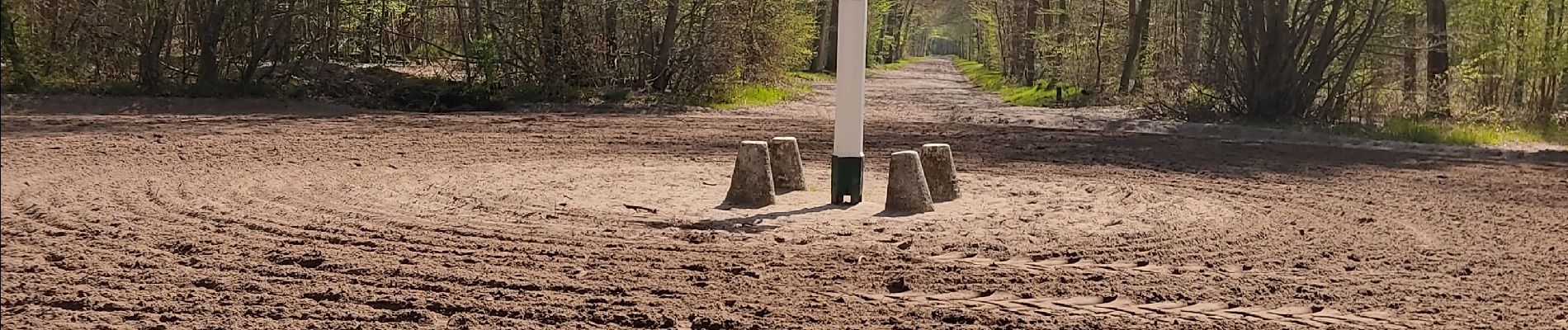
randonnée facile avec la végétation qui commence à sortir de même que le muguet

Elevation profile

Photos

Positioning

Country:
France
Region :
Hauts-de-France
Department/Province :
Oise
Municipality :
Avilly-Saint-Léonard
Location:
Unknown
Start:(UTM)
464508 ; 5448743 (31U) N.

Trails nearby

Trail Walking Orry-la-Ville - SM_MONTGRESIN_EST_8.2Km - Photo
Walking
GR77LP

Walking

Medium
(5)
Orry-la-Ville, Hauts-de-France, Oise, France
8.2 km | 9.2 km-effort
1h 51min
Yes
Trail Walking Pontarmé - MR_PONTARME-OUEST_4.9Km - Photo
Walking
GR77LP

Walking

Easy
(1)
Pontarmé, Hauts-de-France, Oise, France
4.9 km | 5.5 km-effort
1h 12min
Yes
Trail Walking Thiers-sur-Thève - MR_THIERS-sur-THEVE_5.3Km - Photo
Walking

Walking

Medium
(4)
Thiers-sur-Thève, Hauts-de-France, Oise, France
5.3 km | 6 km-effort
1h 22min
Yes
Trail Walking Thiers-sur-Thève - SM_THIERS-sur-THEVE_8.2Km  - Photo
Walking
GR77LP

Walking

Medium
(4)
Thiers-sur-Thève, Hauts-de-France, Oise, France
8.3 km | 9.2 km-effort
1h 57min
Yes
Trail Walking Pontarmé - SM_PONTARME_EST(Chateau)_8.6Km - Photo
Walking

Walking

Medium
(5)
Pontarmé, Hauts-de-France, Oise, France
8.6 km | 9.7 km-effort
2h 9min
Yes
Trail Walking Orry-la-Ville - Mongrésin Grand parcours - Photo
Walking
CC.RIDER

Walking

Easy
(1)
Orry-la-Ville, Hauts-de-France, Oise, France
21 km | 24 km-effort
5h 12min
Yes
Trail Walking Apremont - apremont 60300 - Photo
Walking
dartoisclaude

Walking

Difficult
(1)
Apremont, Hauts-de-France, Oise, France
20 km | 23 km-effort
4h 49min
Yes
Trail Walking Chantilly - chantilly Gouvieux - Photo
Walking
Jacques Salfati

Walking

Easy
Chantilly, Hauts-de-France, Oise, France
20 km | 0 m-effort
5h 59min
Yes
Trail Walking Coye-la-Forêt - Boucle autour des étangs de Commelles - Photo
Walking
chessyca

Walking

Very easy
Coye-la-Forêt, Hauts-de-France, Oise, France
23 km | 26 km-effort
5h 5min
Yes


Close
My subscriptions