Trail Walking Chantilly - chantilly Gouvieux - Photo

chantilly Gouvieux

© OpenStreetMap contributors
Length
Length
20 km
Boucle
Boucle
Yes
Creation date :
2022-10-09 07:38:50.048
Updated on :
2022-10-09 13:40:21.884

(0 Reviews)

Walking
Walking
5h59
Difficulty : Easy

Scan this QR Code to open this trail in the SityTrail application

FREE GPS app for hiking

Logo SityTrail SityTrail

IGN / Geographical institutes

Download SityTrail from the App Store Download SityTrail from Google Play

Logo SityTrail SityTrail World

The world is yours!

Download SityTrail from the App Store Download SityTrail from Google Play Download SityTrail on Huawei AppGallery

About

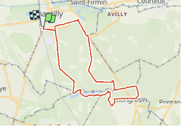
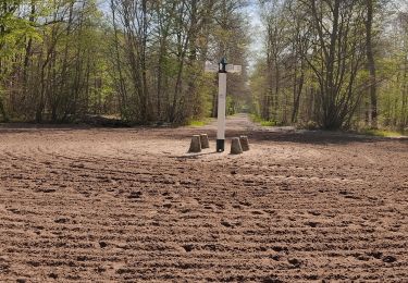
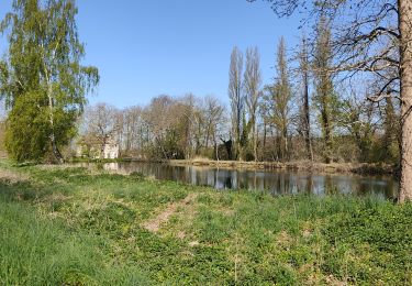
Trail Walking of 20 km to be discovered at Hauts-de-France, Oise, Chantilly. This trail is proposed by Jacques Salfati.

Description

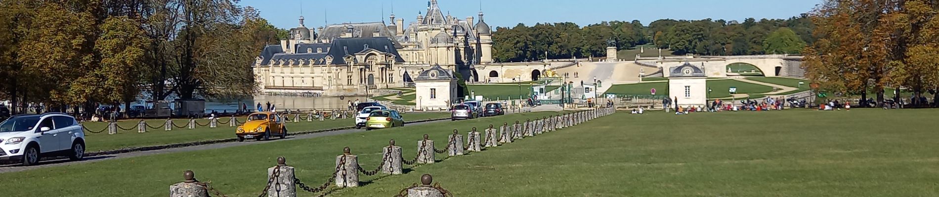
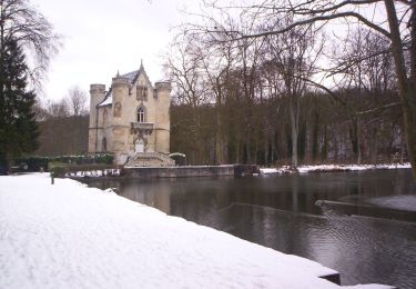
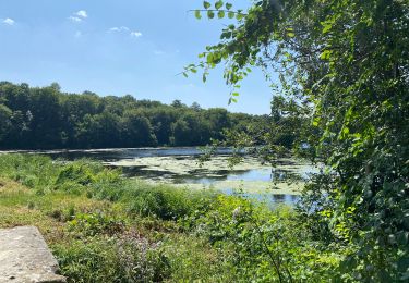
Marche à travers forêt, étangs et château

Elevation profile

Photos

Positioning

Country:
France
Region :
Hauts-de-France
Department/Province :
Oise
Municipality :
Chantilly
Location:
Unknown
Start:(UTM)
460722 ; 5448263 (31U) N.

Trails nearby

Trail Walking Orry-la-Ville - SM_MONTGRESIN_EST_8.2Km - Photo
Walking
GR77LP

Walking

Medium
(5)
Orry-la-Ville, Hauts-de-France, Oise, France
8.2 km | 9.2 km-effort
1h 51min
Yes
Trail Walking Orry-la-Ville - Mongrésin Grand parcours - Photo
Walking
CC.RIDER

Walking

Easy
(1)
Orry-la-Ville, Hauts-de-France, Oise, France
21 km | 24 km-effort
5h 12min
Yes
Trail Walking Apremont - apremont 60300 - Photo
Walking
dartoisclaude

Walking

Difficult
(1)
Apremont, Hauts-de-France, Oise, France
20 km | 23 km-effort
4h 49min
Yes
Trail Walking Coye-la-Forêt - Boucle autour des étangs de Commelles - Photo
Walking
chessyca

Walking

Very easy
Coye-la-Forêt, Hauts-de-France, Oise, France
23 km | 26 km-effort
5h 5min
Yes
Trail On foot Coye-la-Forêt - Du GR 655 au GR14 - Photo
On foot
PRO

On foot

Easy
Coye-la-Forêt, Hauts-de-France, Oise, France
3.7 km | 4.1 km-effort
56min
No
Trail Walking Coye-la-Forêt - Chantilly Etanf reine Blanche - Photo
Walking
avdem

Walking

Difficult
Coye-la-Forêt, Hauts-de-France, Oise, France
14.9 km | 16.8 km-effort
3h 18min
Yes
Trail Running Orry-la-Ville - Étangs de Commelles - Photo
Running
caroline83150

Running

Orry-la-Ville, Hauts-de-France, Oise, France
7.8 km | 8.7 km-effort
1h 5min
Yes
Trail Walking Avilly-Saint-Léonard - randonnée en forêt de chantilly - Photo
Walking
jumetz philippe

Walking

Very easy
Avilly-Saint-Léonard, Hauts-de-France, Oise, France
12.1 km | 13.2 km-effort
2h 54min
Yes
Trail Walking Coye-la-Forêt - randonnée découverte depuis côté la forêt jusqu'au étangs de comelles et retour sur coye - Photo
Walking
jumetz philippe

Walking

Easy
Coye-la-Forêt, Hauts-de-France, Oise, France
10.3 km | 11.9 km-effort
2h 43min
Yes


Close
My subscriptions