Trail Walking Montréal - Sentier des bucherons - Photo

Sentier des bucherons

 PI11
PI11

User

© OpenStreetMap contributors
Length
Length
7.1 km
Max alt
Max alt
348 m
Uphill gradient
Uphill gradient
195 m
Km-Effort
Km-Effort  
9.7 km
Min alt
Min alt
217 m
Downhill gradient
Downhill gradient
198 m
Boucle
Boucle
Yes
Creation date :
2021-05-15 07:28:48.827
Updated on :
2021-05-16 12:54:03.511

(0 Reviews)

Walking
Walking
2h18
Difficulty : Very easy

Scan this QR Code to open this trail in the SityTrail application

FREE GPS app for hiking

Logo SityTrail SityTrail

IGN / Geographical institutes

Download SityTrail from the App Store Download SityTrail from Google Play

Logo SityTrail SityTrail World

The world is yours!

Download SityTrail from the App Store Download SityTrail from Google Play Download SityTrail on Huawei AppGallery

About

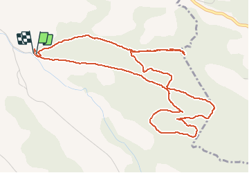
Trail Walking of 7.1 km to be discovered at Occitania, Aude, Montréal. This trail is proposed by PI11.

Description

Petite balade familiale proche de Montréal dans l'Aude.
Traversée de forêts domaniales aux chênes centenaires, petite cascade calcifiée et vue sur les Pyrénées.
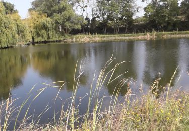
Autour de la cascade vous pourrez peut-être observer des tritons.
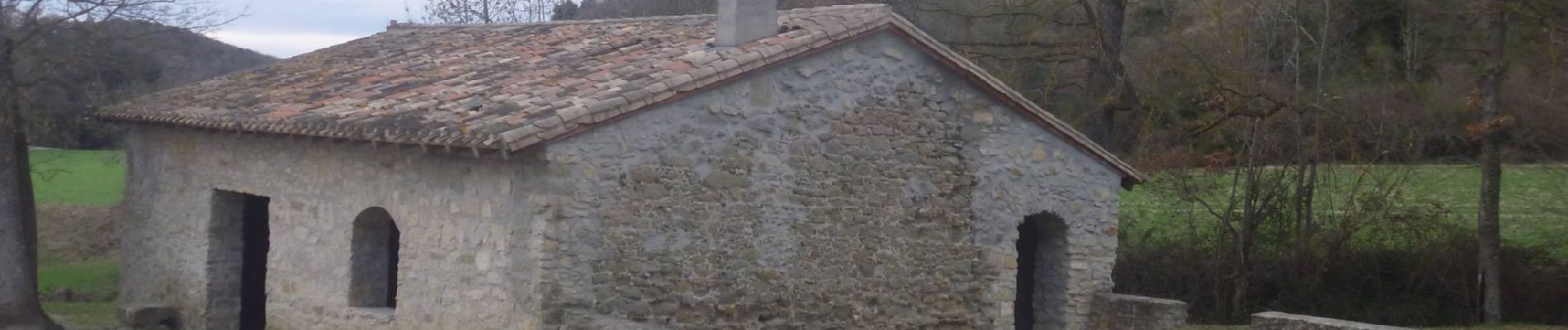
Le départ s'effectue à la bergerie du Chapitre dans laquelle se trouve une cheminée et la possibilité de manger à l'abris des intempéries.

Elevation profile

Photos

Positioning

Country:
France
Region :
Occitania
Department/Province :
Aude
Municipality :
Montréal
Location:
Unknown
Start:(UTM)
431698 ; 4781591 (31T) N.

Trails nearby

Trail Walking Arzens - Chemin du Piémont Pyrénéen - Arzens à Fanjeaux - Photo
Walking
tracegps

Walking

Difficult
Arzens, Occitania, Aude, France
18.7 km | 24 km-effort
6h 0min
No
Trail Walking Cailhau - papillon cailhau - Photo
Walking
obriet

Walking

Very easy
Cailhau, Occitania, Aude, France
9.9 km | 12 km-effort
2h 52min
Yes
Trail Walking Cailhau - Boucle au Sud de Montréal dans l'Aude - Photo
Walking
Combaut11

Walking

Medium
Cailhau, Occitania, Aude, France
9.5 km | 11.6 km-effort
2h 38min
Yes
Trail Walking Cailhau - papillon de Cailhau - Photo
Walking
Mascart

Walking

Easy
Cailhau, Occitania, Aude, France
10.5 km | 12.6 km-effort
3h 0min
No
Trail Walking Villarzel-du-Razès - chemin du Rec Grand - Photo
Walking
Mascart

Walking

Easy
Villarzel-du-Razès, Occitania, Aude, France
7.7 km | 10 km-effort
2h 31min
Yes
Trail Walking Montréal - Petit tour Montréal Est - Photo
Walking
geli.henri

Walking

Easy
Montréal, Occitania, Aude, France
3.2 km | 4.2 km-effort
90h 39min
Yes
Trail Walking Montréal - Les bois du Chapitre Montrŕal d'aude - Photo
Walking
geli.henri

Walking

Medium
Montréal, Occitania, Aude, France
7.5 km | 9.6 km-effort
34h 17min
Yes
Trail Walking Montréal - Compost.Montré-Hounoux 2 - Photo
Walking
ColetteDocteur

Walking

Very difficult
Montréal, Occitania, Aude, France
20 km | 26 km-effort
5h 59min
No
Trail Walking Montréal - le bois du chapitre - Photo
Walking
Mascart

Walking

Medium
Montréal, Occitania, Aude, France
11.3 km | 15 km-effort
3h 20min
Yes


Close
My subscriptions