Trail Walking Montfaucon - Monfaucon - Photo
© OpenStreetMap contributors
Length
Length
8 km
Max alt
Max alt
59 m
Uphill gradient
Uphill gradient
109 m
Km-Effort
Km-Effort  
9.4 km
Min alt
Min alt
25 m
Downhill gradient
Downhill gradient
108 m
Boucle
Boucle
Yes
Creation date :
2021-05-23 07:49:26.177
Updated on :
2021-05-23 11:29:36.454

(0 Reviews)

Walking
Walking
2h36
Difficulty : Very easy

Scan this QR Code to open this trail in the SityTrail application

FREE GPS app for hiking

Logo SityTrail SityTrail

IGN / Geographical institutes

Download SityTrail from the App Store Download SityTrail from Google Play

Logo SityTrail SityTrail World

The world is yours!

Download SityTrail from the App Store Download SityTrail from Google Play Download SityTrail on Huawei AppGallery

About

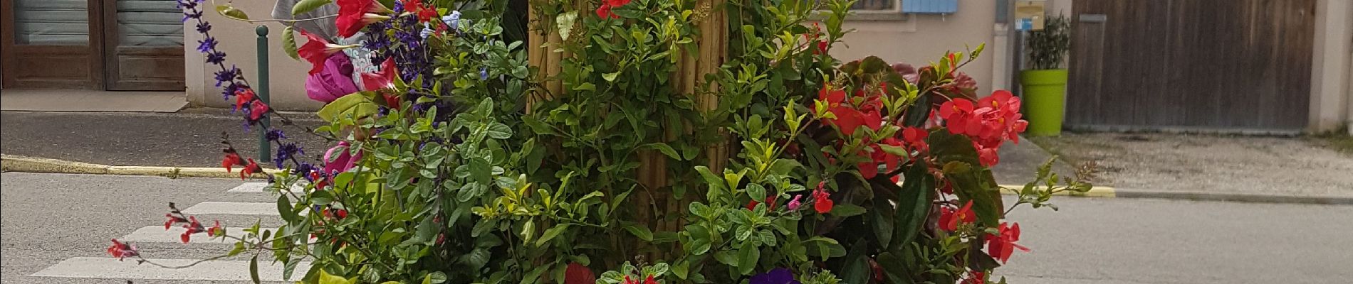
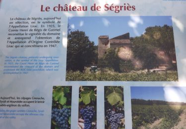
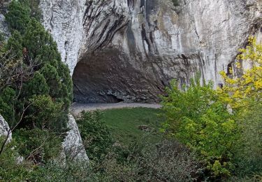
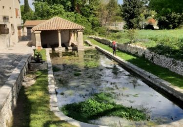
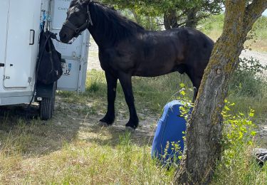
Trail Walking of 8 km to be discovered at Occitania, Gard, Montfaucon. This trail is proposed by poisson1103.

Elevation profile

Photos

37 photos in total. Please click on a photo to see them all in the gallery.

Positioning

Country:
France
Region :
Occitania
Department/Province :
Gard
Municipality :
Montfaucon
Location:
Unknown
Start:(UTM)
640410 ; 4881675 (31T) N.

Trails nearby

Trail Walking Saint-Laurent-des-Arbres - Les Vignobles de Lirac  - Saint Laurent des Arbres - Photo
Walking
tracegps

Walking

Difficult
(1)
Saint-Laurent-des-Arbres, Occitania, Gard, France
15.4 km | 18.6 km-effort
4h 30min
Yes
Trail Walking Orange - le grès - Photo
Walking
legios84

Walking

Very easy
(3)
Orange, Provence-Alpes-Côte d'Azur, Vaucluse, France
10.8 km | 12.4 km-effort
1h 53min
Yes
Trail Walking Saint-Laurent-des-Arbres - St Laurent des Arbres Montagne St Genies - Photo
Walking
Manoune

Walking

Medium
Saint-Laurent-des-Arbres, Occitania, Gard, France
18.8 km | 24 km-effort
6h 36min
Yes
Trail Walking Saint-Geniès-de-Comolas - grotte de Gargantua  - Photo
Walking
Lucien84

Walking

Easy
Saint-Geniès-de-Comolas, Occitania, Gard, France
12.6 km | 16.9 km-effort
4h 50min
Yes
Trail Walking Lirac - lirac - Photo
Walking
fario

Walking

Difficult
Lirac, Occitania, Gard, France
12.6 km | 16.2 km-effort
5h 31min
Yes
Trail Coupling Roquemaure - Lille de Loiselet - Photo
Coupling
Berbezier

Coupling

Roquemaure, Occitania, Gard, France
12.7 km | 13.4 km-effort
1h 32min
No
Trail Walking Châteauneuf-du-Pape - les bords du Rhône  - Photo
Walking
Vero7684

Walking

Easy
(1)
Châteauneuf-du-Pape, Provence-Alpes-Côte d'Azur, Vaucluse, France
13.6 km | 14.8 km-effort
3h 14min
Yes
Trail Walking Lirac - Miracle - Photo
Walking
mijojo

Walking

Difficult
Lirac, Occitania, Gard, France
13.8 km | 16.7 km-effort
4h 57min
No
Trail Mountain bike Saint-Geniès-de-Comolas - Autour de St Genies et Lirac - Photo
Mountain bike
guilloux

Mountain bike

Medium
Saint-Geniès-de-Comolas, Occitania, Gard, France
36 km | 43 km-effort
3h 13min
Yes


Close
My subscriptions