Trail Walking Sainte-Reine - Mont Pelat - Photo
 flip38
flip38

User

© OpenStreetMap contributors
Length
Length
15.5 km
Max alt
Max alt
1535 m
Uphill gradient
Uphill gradient
918 m
Km-Effort
Km-Effort  
28 km
Min alt
Min alt
788 m
Downhill gradient
Downhill gradient
916 m
Boucle
Boucle
Yes
Creation date :
2021-05-28 07:47:36.824
Updated on :
2021-10-31 10:07:52.022

(0 Reviews)

Walking
Walking
4h51
Difficulty : Medium

Scan this QR Code to open this trail in the SityTrail application

FREE GPS app for hiking

Logo SityTrail SityTrail

IGN / Geographical institutes

Download SityTrail from the App Store Download SityTrail from Google Play

Logo SityTrail SityTrail World

The world is yours!

Download SityTrail from the App Store Download SityTrail from Google Play Download SityTrail on Huawei AppGallery

About

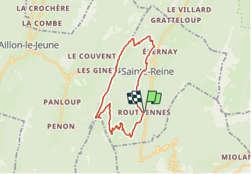
Trail Walking of 15.5 km to be discovered at Auvergne-Rhône-Alpes, Savoy, Sainte-Reine. This trail is proposed by flip38.

Description

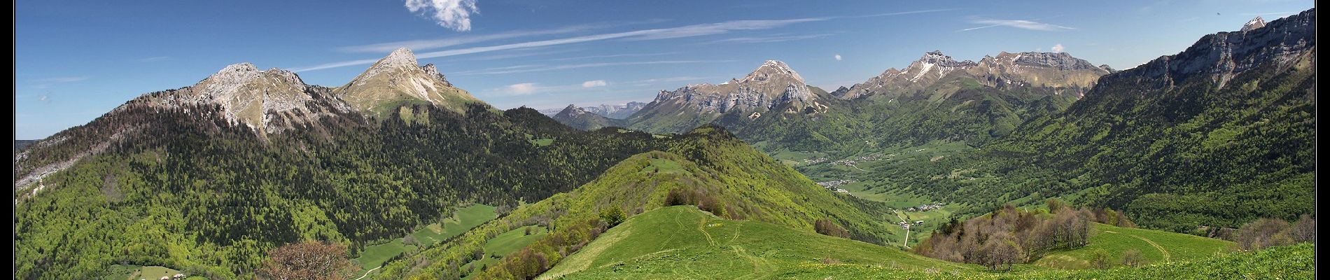
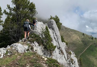
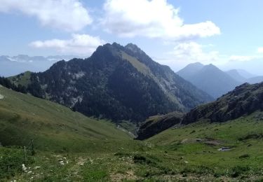
Belle randonnée panoramique vers ce sommet des Bauges.
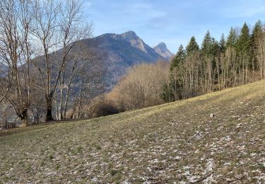
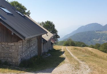
Montée assez raide vers les chalets de la Cha.

D'autres informations sur mon site : http://surlessommets.blog.free.fr/

Elevation profile

Photos

Positioning

Country:
France
Region :
Auvergne-Rhône-Alpes
Department/Province :
Savoy
Municipality :
Sainte-Reine
Location:
Unknown
Start:(UTM)
276758 ; 5053100 (32T) N.

Trails nearby

Trail Walking Saint-Pierre-d'Albigny - La Dent d'Arclusaz, 2041m - Photo
Walking
tracegps

Walking

Difficult
(2)
Saint-Pierre-d'Albigny, Auvergne-Rhône-Alpes, Savoy, France
13.9 km | 29 km-effort
7h 30min
Yes
Trail Walking Aillon-le-Jeune - La Pointe de la Galoppaz 1680m, depuis le Col du Lindar - Photo
Walking
tracegps

Walking

Easy
(1)
Aillon-le-Jeune, Auvergne-Rhône-Alpes, Savoy, France
7.4 km | 14.9 km-effort
3h 45min
No
Trail Walking Aillon-le-Jeune -  Bauges  le Colombier et des crêtes  - Photo
Walking
c.gourme

Walking

Medium
(1)
Aillon-le-Jeune, Auvergne-Rhône-Alpes, Savoy, France
14.2 km | 28 km-effort
5h 35min
Yes
Trail Walking Aillon-le-Jeune - Colombier par rocher de la Bade et Cochette, retour par la Fulie - Photo
Walking
celjean

Walking

Very easy
(2)
Aillon-le-Jeune, Auvergne-Rhône-Alpes, Savoy, France
17.7 km | 35 km-effort
6h 4min
Yes
Trail Walking Aillon-le-Jeune - Petit circuit découverte aillon le jeune - Photo
Walking
choubaka77

Walking

Very easy
Aillon-le-Jeune, Auvergne-Rhône-Alpes, Savoy, France
5.9 km | 8.9 km-effort
1h 59min
Yes
Trail Walking Aillon-le-Jeune - BAUGES: MONT COLOMBIER - Photo
Walking
djeepee74

Walking

Difficult
Aillon-le-Jeune, Auvergne-Rhône-Alpes, Savoy, France
10.8 km | 23 km-effort
4h 19min
Yes
Trail Walking Aillon-le-Jeune - Mont Colombier par les rochers de la Bade et la sente de Rossanaz avec CAF Annecy -R3 - Photo
Walking
sandra_leb

Walking

Very difficult
Aillon-le-Jeune, Auvergne-Rhône-Alpes, Savoy, France
12.2 km | 30 km-effort
6h 42min
Yes
Trail Walking Aillon-le-Jeune - Rochers de  Barde - Photo
Walking
nadd73

Walking

Medium
Aillon-le-Jeune, Auvergne-Rhône-Alpes, Savoy, France
11.7 km | 24 km-effort
6h 25min
Yes
Trail Walking Sainte-Reine - Routhennes - col du potat - Photo
Walking
marsupio

Walking

Medium
Sainte-Reine, Auvergne-Rhône-Alpes, Savoy, France
8.9 km | 16.6 km-effort
3h 42min
Yes


Close
My subscriptions