Trail Walking Baleyssagues - Ballesaygues - Photo
© OpenStreetMap contributors
Length
Length
9.3 km
Max alt
Max alt
106 m
Uphill gradient
Uphill gradient
201 m
Km-Effort
Km-Effort  
12 km
Min alt
Min alt
32 m
Downhill gradient
Downhill gradient
202 m
Boucle
Boucle
Yes
Creation date :
2021-06-11 07:40:44.824
Updated on :
2021-06-12 17:55:57.657

(0 Reviews)

Walking
Walking
3h30
Difficulty : Medium

Scan this QR Code to open this trail in the SityTrail application

FREE GPS app for hiking

Logo SityTrail SityTrail

IGN / Geographical institutes

Download SityTrail from the App Store Download SityTrail from Google Play

Logo SityTrail SityTrail World

The world is yours!

Download SityTrail from the App Store Download SityTrail from Google Play Download SityTrail on Huawei AppGallery

About

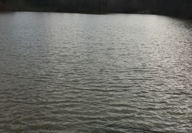
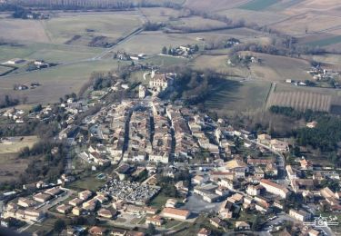
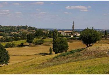
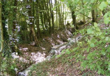
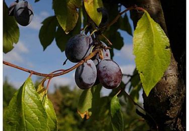
Trail Walking of 9.3 km to be discovered at New Aquitaine, Lot-et-Garonne, Baleyssagues. This trail is proposed by plavengut.

Description

Randonnée sur les coteaux de Duras qui fait bien travailler les mollets et permet de découvrir de belles bâtisses, des vieux puits très particuliers. beaucoup de meules.
Après la rando une visite de Duras et de son château terminé bien la journée

Elevation profile

Positioning

Country:
France
Region :
New Aquitaine
Department/Province :
Lot-et-Garonne
Municipality :
Baleyssagues
Location:
Unknown
Start:(UTM)
274490 ; 4951775 (31T) N.

Trails nearby

Trail Walking Baleyssagues - Balayssagues - Photo
Walking
Briarwood

Walking

Easy
Baleyssagues, New Aquitaine, Lot-et-Garonne, France
5.3 km | 6.4 km-effort
1h 34min
Yes
Trail Walking Saint-Sernin - Lubersac - Photo
Walking
Briarwood

Walking

Easy
Saint-Sernin, New Aquitaine, Lot-et-Garonne, France
5.9 km | 7.3 km-effort
1h 50min
Yes
Trail Mountain bike Duras - Ronde du Pruneau - Duras - Photo
Mountain bike
tracegps

Mountain bike

Difficult
Duras, New Aquitaine, Lot-et-Garonne, France
42 km | 51 km-effort
3h 30min
Yes
Trail Cycle Duras - Circuit Vignes et Vergers en Duraquois - Photo
Cycle
tracegps

Cycle

Difficult
Duras, New Aquitaine, Lot-et-Garonne, France
102 km | 122 km-effort
5h 0min
Yes
Trail Mountain bike Saint-Sernin - Lubersac, une église de Saint-Sernin de Duras - Pays du Dropt - Photo
Mountain bike
tracegps

Mountain bike

Easy
Saint-Sernin, New Aquitaine, Lot-et-Garonne, France
5.4 km | 6.4 km-effort
40min
Yes
Trail Walking Saint-Sernin - Lubersac, une église de Saint-Sernin de Duras - Pays du Dropt - Photo
Walking
tracegps

Walking

Easy
Saint-Sernin, New Aquitaine, Lot-et-Garonne, France
5.4 km | 6.4 km-effort
2h 0min
Yes
Trail Walking Duras - Duras, un château, un vignoble - Pays du Dropt - Photo
Walking
tracegps

Walking

Medium
Duras, New Aquitaine, Lot-et-Garonne, France
6 km | 7.9 km-effort
2h 10min
Yes
Trail Equestrian Baleyssagues - Baleyssagues, la balade des Riquets - Pays du Dropt - Photo
Equestrian
tracegps

Equestrian

Medium
Baleyssagues, New Aquitaine, Lot-et-Garonne, France
8.8 km | 11.5 km-effort
1h 30min
Yes
Trail Mountain bike Baleyssagues - Baleyssagues, la balade des Riquets - Pays du Dropt - Photo
Mountain bike
tracegps

Mountain bike

Medium
Baleyssagues, New Aquitaine, Lot-et-Garonne, France
8.8 km | 11.5 km-effort
1h 10min
Yes


Close
My subscriptions