Trail Walking Sixt-Fer-à-Cheval - Refuge de Vogealle et Bout du monde - Photo

Refuge de Vogealle et Bout du monde

© OpenStreetMap contributors
Length
Length
16 km
Max alt
Max alt
1911 m
Uphill gradient
Uphill gradient
1081 m
Km-Effort
Km-Effort  
30 km
Min alt
Min alt
949 m
Downhill gradient
Downhill gradient
1078 m
Boucle
Boucle
Yes
Creation date :
2021-06-16 07:06:17.523
Updated on :
2021-06-16 16:39:22.72

(0 Reviews)

Walking
Walking
5h50
Difficulty : Very difficult

Scan this QR Code to open this trail in the SityTrail application

FREE GPS app for hiking

Logo SityTrail SityTrail

IGN / Geographical institutes

Download SityTrail from the App Store Download SityTrail from Google Play

Logo SityTrail SityTrail World

The world is yours!

Download SityTrail from the App Store Download SityTrail from Google Play Download SityTrail on Huawei AppGallery

About

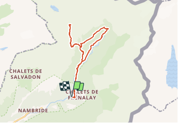
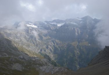
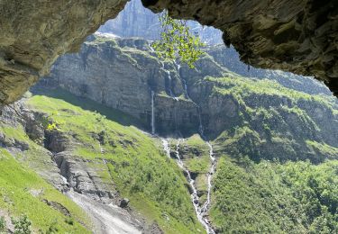
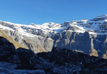
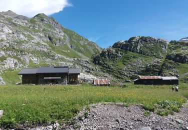
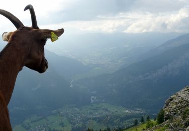
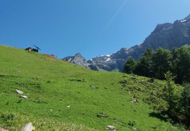
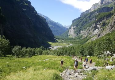
Trail Walking of 16 km to be discovered at Auvergne-Rhône-Alpes, Upper Savoy, Sixt-Fer-à-Cheval. This trail is proposed by GuyVachet.

Description

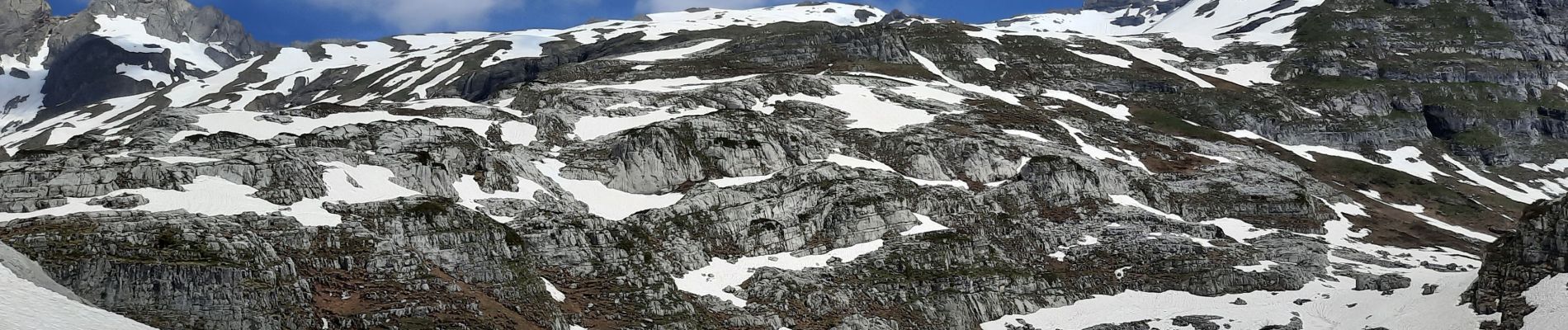
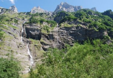
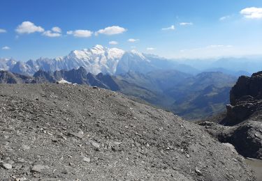
Très belle boucle depuis le site du Fer à Cheval pour le Refuge de Vogealle et retour par le Bout du monde. Démarrage dans le site touristique puis au niveau du Chalet du Prazon, prendre la montée par le Pas du Boret (Attention passage difficile bien qu'équipé mais à éviter si sujet au vertige). Passage par le Chalet du Boret avant de reprendre la montée soutenue passant par la Pierre du Dard et aussi quelques névés pour l'époque avant d'arriver au Refuge (possibilité de poursuivre jusqu'au Lac et au-delà par GRP). Retour par le même itinéraire jusqu'au Chalet du Boret avant de repartir en direction du Bout du Monde et finir par le fond de vallée du Gifre.

Elevation profile

Photos

Positioning

Country:
France
Region :
Auvergne-Rhône-Alpes
Department/Province :
Upper Savoy
Municipality :
Sixt-Fer-à-Cheval
Location:
Unknown
Start:(UTM)
332851 ; 5104942 (32T) N.

Trails nearby

Trail Walking Sixt-Fer-à-Cheval - Sixt Fer à Cheval et cascades - Photo
Walking
tracegps

Walking

Medium
(3)
Sixt-Fer-à-Cheval, Auvergne-Rhône-Alpes, Upper Savoy, France
9.3 km | 14.1 km-effort
3h 0min
Yes
Trail Walking Sixt-Fer-à-Cheval - SIXT PASSY RESERVE: LE BUET MONTEE VIA GRENAIRON - RETOUR PAR LES FONDS - Photo
Walking
djeepee74

Walking

Very difficult
Sixt-Fer-à-Cheval, Auvergne-Rhône-Alpes, Upper Savoy, France
26 km | 56 km-effort
8h 42min
Yes
Trail On foot Sixt-Fer-à-Cheval - GR de Pays Tour des Dents Blanches - Photo
On foot
PRO

On foot

Very difficult
Sixt-Fer-à-Cheval, Auvergne-Rhône-Alpes, Upper Savoy, France
41 km | 87 km-effort
19h 51min
Yes
Trail Walking Sixt-Fer-à-Cheval - Le bout du monde Sixt fer à cheval - Photo
Walking
daniel34

Walking

Medium
Sixt-Fer-à-Cheval, Auvergne-Rhône-Alpes, Upper Savoy, France
11.9 km | 18.7 km-effort
3h 10min
Yes
Trail Walking Sixt-Fer-à-Cheval - lac de la Vogealle par le pas du Boret - Photo
Walking
arianespace

Walking

Difficult
Sixt-Fer-à-Cheval, Auvergne-Rhône-Alpes, Upper Savoy, France
19.2 km | 35 km-effort
8h 0min
Yes
Trail Walking Sixt-Fer-à-Cheval - SIXT-PASSY: PAS DU BORET - VOGEALLE - BOUT DU MONDE - Photo
Walking
djeepee74

Walking

Difficult
Sixt-Fer-à-Cheval, Auvergne-Rhône-Alpes, Upper Savoy, France
15.1 km | 30 km-effort
6h 15min
Yes
Trail Walking Sixt-Fer-à-Cheval - 2020-08-14 Marche Salvagny vers Refuge Grenairon - Photo
Walking
GUIDE
holtzv

Walking

Very easy
Sixt-Fer-à-Cheval, Auvergne-Rhône-Alpes, Upper Savoy, France
6.1 km | 16.3 km-effort
2h 39min
No
Trail Walking Sixt-Fer-à-Cheval - SIXT PASSY: PAS DU BORET - BOUT DU MONDE - Photo
Walking
djeepee74

Walking

Difficult
Sixt-Fer-à-Cheval, Auvergne-Rhône-Alpes, Upper Savoy, France
10.7 km | 18 km-effort
3h 45min
Yes
Trail Fishing Sixt-Fer-à-Cheval - Sixt fer à cheval - Photo
Fishing
jeff2

Fishing

Very easy
Sixt-Fer-à-Cheval, Auvergne-Rhône-Alpes, Upper Savoy, France
12.1 km | 17.9 km-effort
3h 37min
No


Close
My subscriptions