Trail Walking Thiers - Le Chemin de Sainte-Agathe - Photo

Le Chemin de Sainte-Agathe

 arleol63
arleol63

User

© OpenStreetMap contributors
Length
Length
94 km
Max alt
Max alt
1104 m
Uphill gradient
Uphill gradient
3222 m
Km-Effort
Km-Effort  
137 km
Min alt
Min alt
310 m
Downhill gradient
Downhill gradient
3226 m
Boucle
Boucle
Yes
Creation date :
2021-07-05 10:42:46.888
Updated on :
2021-07-05 10:44:32.263

(0 Reviews)

Walking
Walking
31h05
Difficulty : Very difficult

Scan this QR Code to open this trail in the SityTrail application

FREE GPS app for hiking

Logo SityTrail SityTrail

IGN / Geographical institutes

Download SityTrail from the App Store Download SityTrail from Google Play

Logo SityTrail SityTrail World

The world is yours!

Download SityTrail from the App Store Download SityTrail from Google Play Download SityTrail on Huawei AppGallery

About

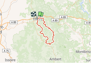
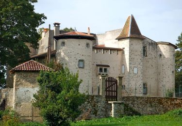
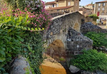
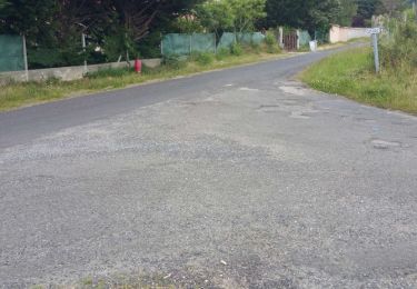
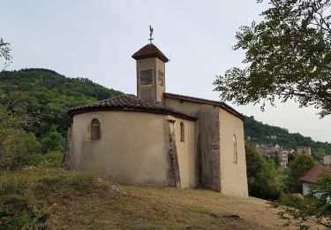
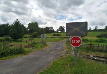
Trail Walking of 94 km to be discovered at Auvergne-Rhône-Alpes, Puy-de-Dôme, Thiers. This trail is proposed by arleol63.

Description

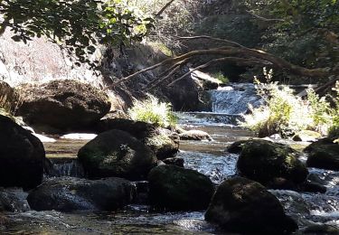
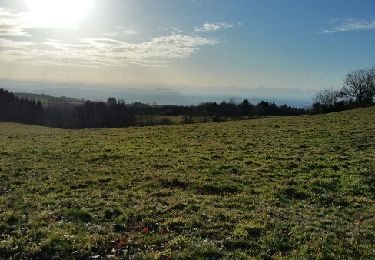
Ballade agréable dans le Forez. Il faut aimer la nature, les forets et les montagnes à vache.

Elevation profile

Points of interest

Point of interest Thiers - Orangerie - Photo
arleol63
THIERS 
Point of interest Thiers - Croisement en T - Photo
arleol63
Point of interest Escoutoux - Prendre le chemin à gauche - Photo
arleol63
Point of interest Escoutoux - Busset, prendre à gauche - Photo
arleol63
Point of interest Escoutoux - D58 - Photo
arleol63
ESCOUTOUX 
Point of interest Vollore-Ville - Croisement en T, prendre en face - Photo
arleol63
Point of interest Vollore-Ville - Le Rouet, carrefour, prendre à gauche - Photo
arleol63
Point of interest Vollore-Ville - Vollore-Ville, tourner à gauche - Photo
arleol63
Point of interest Vollore-Ville - Carrefour de routes, à droite - Photo
arleol63
Point of interest Vollore-Ville - Cote 484 - Photo
arleol63
VOLLORE-VILLE 
Point of interest Aubusson-d'Auvergne - Les Thioulards - Photo
arleol63
AUBUSSON-D'AUVERGNE 
Point of interest Aubusson-d'Auvergne - Gîte des 4 Vents - Photo
arleol63
AUBUSSON-D'AUVERGNE 
Point of interest Courpière - Gîte des Quatre Vents - Photo
arleol63
Point of interest Aubusson-d'Auvergne - Route de la Souche, prendre à gauche - Photo
arleol63
AUBUSSON-D'AUVERGNE 
Point of interest Aubusson-d'Auvergne - Lac d'Aubusson - Photo
arleol63
AUBUSSON-D'AUVERGNE 
Point of interest Augerolles - Augerolles - Photo
arleol63
AUGEROLLES 
Point of interest Augerolles - Scierie, bifurquer à gauche - Photo
arleol63
Point of interest Augerolles - Moulin du Clos - Photo
arleol63
AUGEROLLES 
Point of interest Olmet - Croix de Chamaly - Photo
arleol63
Point of interest Olliergues - Passerelle cote 512 - Photo
arleol63
Point of interest Olliergues - Carrefour en T - Photo
arleol63
OLLIERGUES 
Point of interest Olliergues - Prendre chemin à droite - Photo
arleol63
Point of interest Olliergues - Olliergues - Photo
arleol63
OLLIERGUES 
Point of interest Marat - Passerelle - Photo
arleol63
MARAT 
Point of interest Saint-Pierre-la-Bourlhonne - Bauchaud - Photo
arleol63
SAINT-PIERRE-LA-BOURLHONNE 
Point of interest La Renaudie - Le Clef, prendre à gauche - Photo
arleol63
Point of interest La Renaudie - Croix de Sainte-Agathe - Photo
arleol63
Point of interest La Renaudie - La Renaudie - Photo
arleol63
LA RENAUDIE 
Point of interest La Renaudie - Gîte communal de la Renaudie - Photo
arleol63
Point of interest La Renaudie - La Coudairie - Photo
arleol63
LA RENAUDIE 
Point of interest Vollore-Montagne - D317 - Photo
arleol63
VOLLORE-MONTAGNE 
Point of interest Vollore-Montagne - Rossias, scierie, prendre sentier à droite - Photo
arleol63
Point of interest Vollore-Montagne - Montchoisy, bifurquer à droite - Photo
arleol63
Point of interest Vollore-Montagne - Bellevue - Photo
arleol63
VOLLORE-MONTAGNE 
Point of interest Vollore-Montagne - Croix de Sainte-Agathe - Photo
arleol63
VOLLORE-MONTAGNE 
Point of interest Vollore-Montagne - Croix des Tuiles - Photo
arleol63
VOLLORE-MONTAGNE 
Point of interest Vollore-Ville - Croisement en triangle, prendre à droite - Photo
arleol63
Point of interest Vollore-Ville - Croisée de chemins - Photo
arleol63
VOLLORE-VILLE 
Point of interest Sainte-Agathe - Rochemulet - Photo
arleol63
SAINTE-AGATHE 
Point of interest Sainte-Agathe - Raffy, prendre chemin à gauche - Photo
arleol63
Point of interest Sainte-Agathe - D7 - Photo
arleol63
SAINTE-AGATHE 
Point of interest Sainte-Agathe - Sainte Agathe - Photo
arleol63
SAINTE-AGATHE 
Point of interest Sainte-Agathe - Sainte-Agathe - Photo
arleol63
SAINTE-AGATHE 
Point of interest Sainte-Agathe - Carrefour de sentiers, prendre à droite - Photo
arleol63
Point of interest Sainte-Agathe - Route d'accès à Vaulx, prendre à gauche - Photo
arleol63
Point of interest Sainte-Agathe - Croix des Quatre Chemins - Photo
arleol63
Point of interest Celles-sur-Durolle - Croix de fer, continuer en face - Photo
arleol63
CELLES-SUR-DUROLLE 
Point of interest Celles-sur-Durolle - Ruisseau du Bouchet - Photo
arleol63
CELLES-SUR-DUROLLE 
Point of interest Thiers - Membrun - Photo
arleol63
THIERS 
Point of interest Thiers - Passerelle - Photo
arleol63
THIERS 
Point of interest Thiers - Passerelle - Photo
arleol63
THIERS 
Point of interest Thiers - Conduite forcée - Photo
arleol63
Point of interest Thiers - Eglise Saint-Jean - Photo
arleol63
Point of interest Thiers - Orangerie - Photo
arleol63
THIERS 

Positioning

Country:
France
Region :
Auvergne-Rhône-Alpes
Department/Province :
Puy-de-Dôme
Municipality :
Thiers
Location:
Unknown
Start:(UTM)
542278 ; 5077625 (31T) N.

Trails nearby

Trail Walking Thiers - Thiers_Enfer_Rouets - Photo
Walking
GUIDE
jagarnier

Walking

Medium
(1)
Thiers, Auvergne-Rhône-Alpes, Puy-de-Dôme, France
11.4 km | 18.3 km-effort
3h 30min
Yes
Trail Walking Thiers - Thiers_Horts - Photo
Walking
GUIDE
jagarnier

Walking

Medium
(1)
Thiers, Auvergne-Rhône-Alpes, Puy-de-Dôme, France
11 km | 16.1 km-effort
3h 15min
Yes
Trail Walking Saint-Rémy-sur-Durolle - 2016-1-26- Chabrol  - Photo
Walking
claudef

Walking

Medium
(2)
Saint-Rémy-sur-Durolle, Auvergne-Rhône-Alpes, Puy-de-Dôme, France
8.6 km | 12 km-effort
2h 32min
Yes
Trail On foot Thiers - Thiers - Château de Vaulx - Photo
On foot
PRO

On foot

Medium
Thiers, Auvergne-Rhône-Alpes, Puy-de-Dôme, France
16 km | 25 km-effort
5h 37min
No
Trail On foot Thiers - Château de Vaulx - Thiers - Photo
On foot
PRO

On foot

Medium
Thiers, Auvergne-Rhône-Alpes, Puy-de-Dôme, France
12.6 km | 20 km-effort
4h 39min
No
Trail On foot Dorat - Le sentier de Néron - Photo
On foot
PRO

On foot

Easy
Dorat, Auvergne-Rhône-Alpes, Puy-de-Dôme, France
5.9 km | 7.6 km-effort
1h 42min
Yes
Trail On foot Thiers - De l'Enfer aux Rouets - Photo
On foot
PRO

On foot

Easy
Thiers, Auvergne-Rhône-Alpes, Puy-de-Dôme, France
7.6 km | 12.2 km-effort
2h 46min
Yes
Trail On foot Escoutoux - Les Terrasses de la Dore - Photo
On foot
PRO

On foot

Easy
(1)
Escoutoux, Auvergne-Rhône-Alpes, Puy-de-Dôme, France
13.3 km | 16.1 km-effort
3h 39min
Yes
Trail Walking Thiers - Thiers_Couteliere_3 - Photo
Walking
GUIDE
jagarnier

Walking

Difficult
Thiers, Auvergne-Rhône-Alpes, Puy-de-Dôme, France
21 km | 31 km-effort
7h 0min
Yes


Close
My subscriptions