Trail Walking Bilhères - Le Pic d'Escurets en partant du col de Marie Blanque - Photo

Le Pic d'Escurets en partant du col de Marie Blanque

© OpenStreetMap contributors
Length
Length
5.8 km
Max alt
Max alt
1423 m
Uphill gradient
Uphill gradient
379 m
Km-Effort
Km-Effort  
10.9 km
Min alt
Min alt
1035 m
Downhill gradient
Downhill gradient
393 m
Boucle
Boucle
Yes
Creation date :
2021-07-29 07:10:00.155
Updated on :
2021-07-29 17:59:33.124

(0 Reviews)

Walking
Walking
3h10
Difficulty : Difficult

Scan this QR Code to open this trail in the SityTrail application

FREE GPS app for hiking

Logo SityTrail SityTrail

IGN / Geographical institutes

Download SityTrail from the App Store Download SityTrail from Google Play

Logo SityTrail SityTrail World

The world is yours!

Download SityTrail from the App Store Download SityTrail from Google Play Download SityTrail on Huawei AppGallery

About

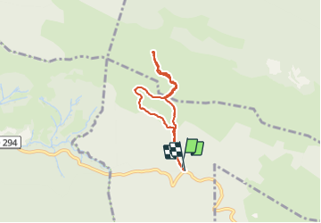
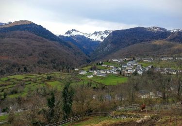
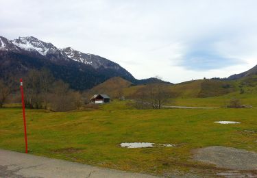
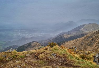
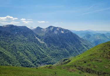
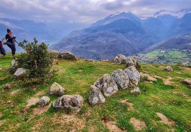
Trail Walking of 5.8 km to be discovered at New Aquitaine, Pyrénées-Atlantiques, Bilhères. This trail is proposed by rogerpoirier.

Description

Une superbe vue mais au dessus de la mer de nuage qui nous permet d'identifier une quantité de sommes jusqu'au Pic de Midi de Bigorre, en passant par le ¨Pic de Ger au dessus de Gourette. Comme il avait plu, la montée, dans le brouillard, la croupe herbeuse, bien redressée,  était assez glissante, nous sommes descendus par le sentier en pointillés sur la carte, un peu moins bien balisé,  mais il y a parfois des poteaux.

Elevation profile

Positioning

Country:
France
Region :
New Aquitaine
Department/Province :
Pyrénées-Atlantiques
Municipality :
Bilhères
Location:
Unknown
Start:(UTM)
702875 ; 4771727 (30T) N.

Trails nearby

Trail Walking Bielle - Pics de Cambeilh et petit Gerbe  - Photo
Walking
DuMarsan

Walking

Easy
(1)
Bielle, New Aquitaine, Pyrénées-Atlantiques, France
13.7 km | 27 km-effort
5h 24min
Yes
Trail On foot Bilhères - Les cercles de pierre (Bilhères) - Photo
On foot
PRO

On foot

Easy
Bilhères, New Aquitaine, Pyrénées-Atlantiques, France
7.2 km | 11.6 km-effort
2h 37min
Yes
Trail On foot Bilhères - Les cabanes de Lasbordes - Photo
On foot
PRO

On foot

Easy
Bilhères, New Aquitaine, Pyrénées-Atlantiques, France
11.2 km | 19.7 km-effort
4h 28min
Yes
Trail On foot Bilhères - Le Turon de Técouère - Photo
On foot
PRO

On foot

Easy
Bilhères, New Aquitaine, Pyrénées-Atlantiques, France
6.3 km | 7.9 km-effort
1h 47min
Yes
Trail On foot Bilhères - Les cercles de pierre - Photo
On foot
PRO

On foot

Easy
Bilhères, New Aquitaine, Pyrénées-Atlantiques, France
3.5 km | 5.5 km-effort
1h 15min
Yes
Trail On foot Bilhères - Le Plateau de Benou et les Cromlechs de Lous Couraus - Photo
On foot
PRO

On foot

Easy
Bilhères, New Aquitaine, Pyrénées-Atlantiques, France
6.3 km | 11.2 km-effort
2h 33min
Yes
Trail Walking Bilhères - Pic des escurets 1440m en Aller-Retour - Photo
Walking
HaschKnight

Walking

Easy
Bilhères, New Aquitaine, Pyrénées-Atlantiques, France
4.8 km | 9.9 km-effort
2h 12min
Yes
Trail Walking Bilhères - Trace-Gps-Tour-du-Benou: 05-03-2019 - Photo
Walking
HaschKnight

Walking

Difficult
(1)
Bilhères, New Aquitaine, Pyrénées-Atlantiques, France
17.8 km | 28 km-effort
5h 30min
Yes
Trail Walking Bilhères - Cromlechs von Lou Couraus - 974m - Photo
Walking
HaschKnight

Walking

Easy
Bilhères, New Aquitaine, Pyrénées-Atlantiques, France
5 km | 7 km-effort
1h 35min
Yes


Close
My subscriptions