Trail On foot Castres - Entre Canal et étangs - Photo

Entre Canal et étangs

© OpenStreetMap contributors
Length
Length
9.4 km
Max alt
Max alt
85 m
Uphill gradient
Uphill gradient
65 m
Km-Effort
Km-Effort  
10.2 km
Min alt
Min alt
67 m
Downhill gradient
Downhill gradient
65 m
Boucle
Boucle
Yes
Creation date :
2021-08-03 11:33:20.396
Updated on :
2021-08-03 12:04:52.911

(0 Reviews)

On foot
On foot
2h19
Difficulty : Easy
Nordic walking
Nordic walking
--
Difficulty : Very easy
Running
Running
1h00
Difficulty : Easy
Cycle
Cycle
--
Difficulty : Very easy

Scan this QR Code to open this trail in the SityTrail application

FREE GPS app for hiking

Logo SityTrail SityTrail

IGN / Geographical institutes

Download SityTrail from the App Store Download SityTrail from Google Play

Logo SityTrail SityTrail World

The world is yours!

Download SityTrail from the App Store Download SityTrail from Google Play Download SityTrail on Huawei AppGallery

About

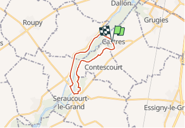
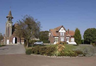
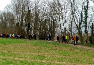
Trail On foot of 9.4 km to be discovered at Hauts-de-France, Aisne, Castres. This trail is proposed by Odette21..

Description

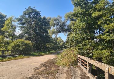
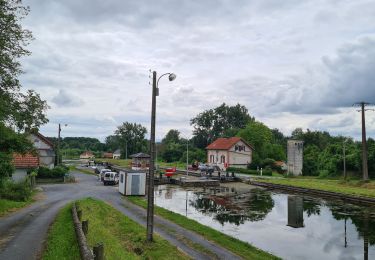
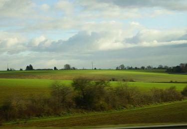
Départ de l'église de Castres par un petit chemin à travers la campagne puis arrivée sur la droite un agréable endroit pour piqueniquer au bord d'étangs très reposant puis après être  passé devant le camping remonter vers le Hamel (avec arrêt au restaurant au bord de l'eau ?). Reprendre le long de la halte nautique et retrouver Castres au prochain pont en suivant le canal.

Elevation profile

Positioning

Country:
France
Region :
Hauts-de-France
Department/Province :
Aisne
Municipality :
Castres
Location:
Unknown
Start:(UTM)
517085 ; 5516875 (31U) N.

Trails nearby

Trail Mountain bike Castres - Parcours fontaines les clercs - Photo
Mountain bike
alainwald

Mountain bike

Easy
Castres, Hauts-de-France, Aisne, France
52 km | 57 km-effort
4h 14min
Yes
Trail Mountain bike Dallon - pays de ham - Photo
Mountain bike
alainwald

Mountain bike

Very easy
Dallon, Hauts-de-France, Aisne, France
56 km | 61 km-effort
4h 21min
Yes
Trail Walking Saint-Quentin - Le marais d'Isle - Photo
Walking

Walking

Very easy
Saint-Quentin, Hauts-de-France, Aisne, France
5.4 km | 6 km-effort
Unknown
Yes
Trail Walking Saint-Quentin - Du canal au chemin de fer - Saint-Quentin - Photo
Walking
tracegps

Walking

Medium
Saint-Quentin, Hauts-de-France, Aisne, France
7.2 km | 8.3 km-effort
2h 0min
Yes
Trail Walking Seraucourt-le-Grand - Fontaine - Photo
Walking
tracegps

Walking

Medium
Seraucourt-le-Grand, Hauts-de-France, Aisne, France
9.1 km | 9.9 km-effort
2h 30min
Yes
Trail Walking Saint-Quentin - La pâturelle - Photo
Walking
tracegps

Walking

Very difficult
Saint-Quentin, Hauts-de-France, Aisne, France
14.6 km | 16.4 km-effort
4h 0min
Yes
Trail Walking Saint-Quentin - Le marais d'Isle - Photo
Walking
tracegps

Walking

Easy
Saint-Quentin, Hauts-de-France, Aisne, France
5.4 km | 6 km-effort
1h 30min
Yes
Trail Walking Saint-Quentin - Du canal au chemin de fer - Photo
Walking
tracegps

Walking

Medium
Saint-Quentin, Hauts-de-France, Aisne, France
7.2 km | 8.3 km-effort
2h 0min
Yes
Trail Walking Castres - Castres du 02-04-2023 après midi  - Photo
Walking
VANDERPUTTENMi

Walking

Medium
Castres, Hauts-de-France, Aisne, France
8.7 km | 9.9 km-effort
1h 58min
Yes


Close
My subscriptions